Yosemite National Park
Sheer granite walls, thundering waterfalls and giant sequoias in one of the world's great national parks.
- Best time to go
- May to June for waterfalls; September to October for fewer crowds
- Local time
- –
- Currency
- US Dollar (USD)
- Reading time
- 4 min
- Language
- English
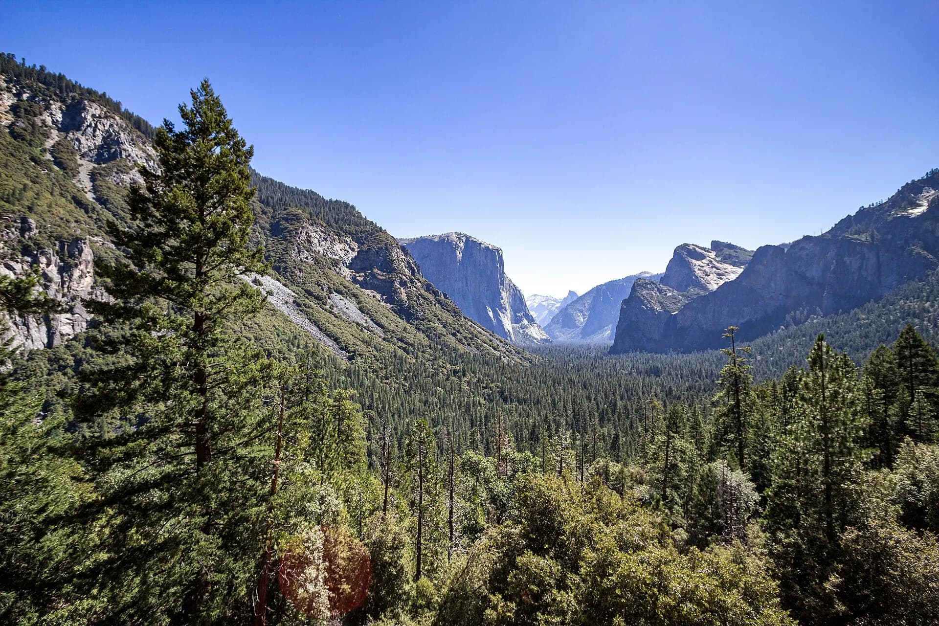
Yosemite, in California's Sierra Nevada, is a landscape of extraordinary scale: a glacier-carved valley walled by granite cliffs nearly a kilometre high, waterfalls among the tallest in North America, high alpine meadows and groves of giant sequoias, some of the largest living things on earth. It's the ancestral home of the Ahwahneechee people, and its protection in 1864 helped give birth to the idea of national parks. It's a World Heritage Site.
It's also one of the busiest national parks in the United States, with most visitors concentrated in Yosemite Valley. Plan ahead, start early each day, and venture beyond the valley floor to find quieter trails and views.
The top 8 in Yosemite National Park
- 1
Tunnel View
Photo: Dllu, CC BY-SA 4.0, via Wikimedia Commons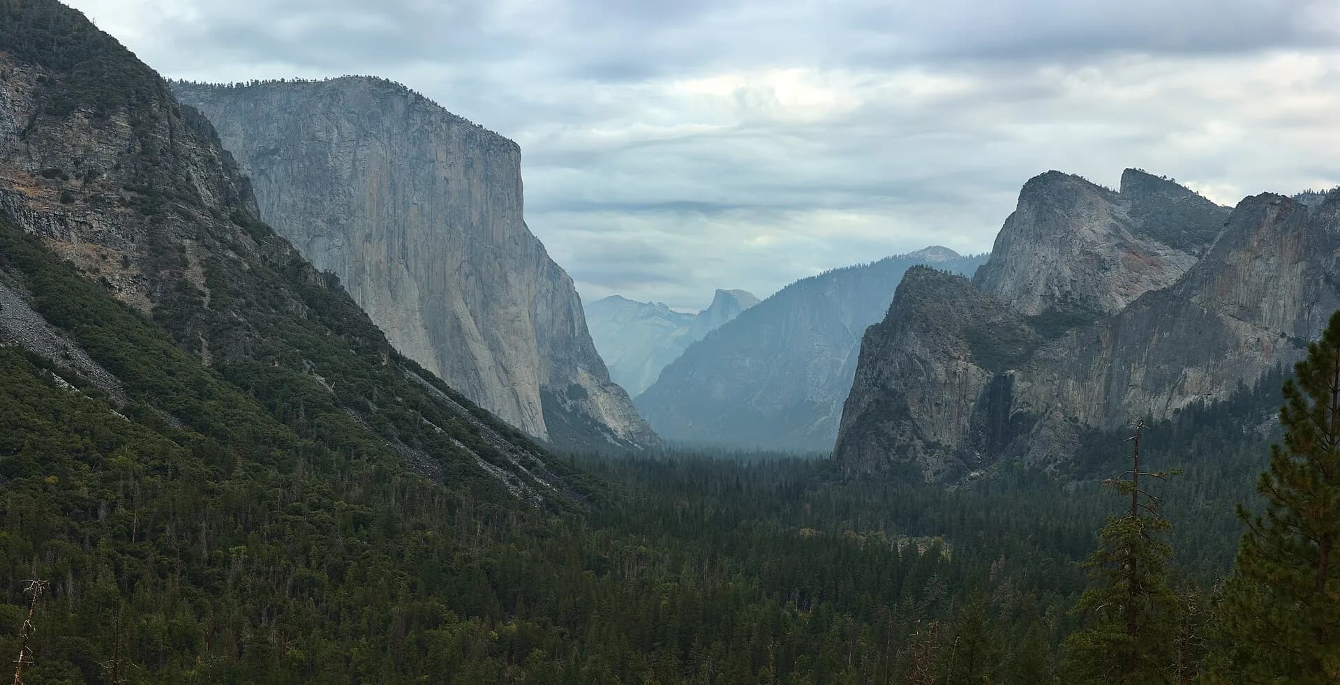
A roadside viewpoint at the western entrance to the valley, with the classic panorama of El Capitan, Bridalveil Fall and Half Dome rising above the forested valley floor. It's spectacular at sunset and after storms.
- 2
El Capitan
Photo: King of Hearts, CC BY-SA 3.0, via Wikimedia Commons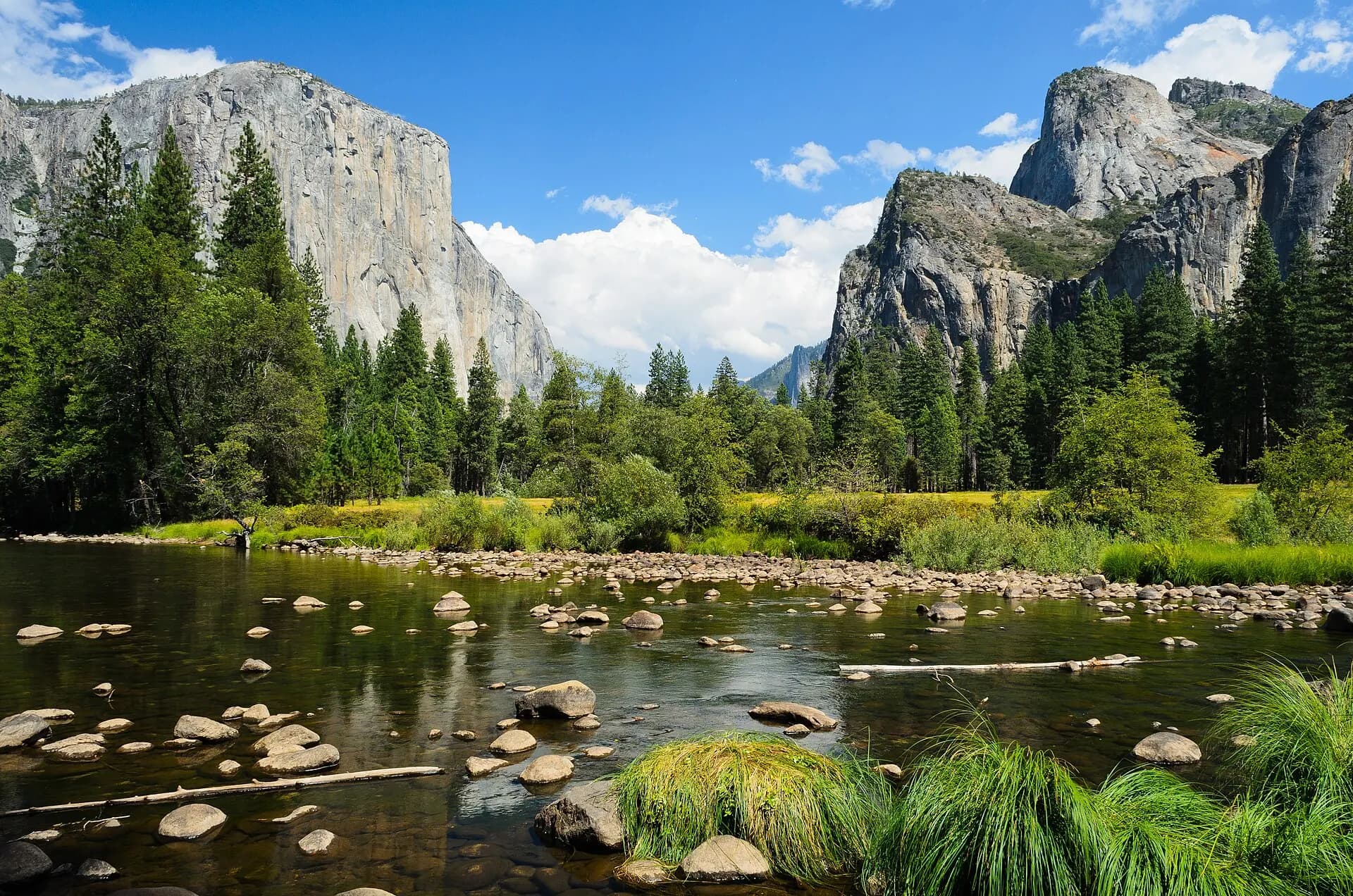
A sheer granite monolith rising about 900 metres from the valley floor, one of the most famous big walls in the world for rock climbers. From the meadow below, you can watch climbers inching up its face, often over several days.
- 3
Yosemite Falls
Photo: Diliff, CC BY-SA 3.0, via Wikimedia Commons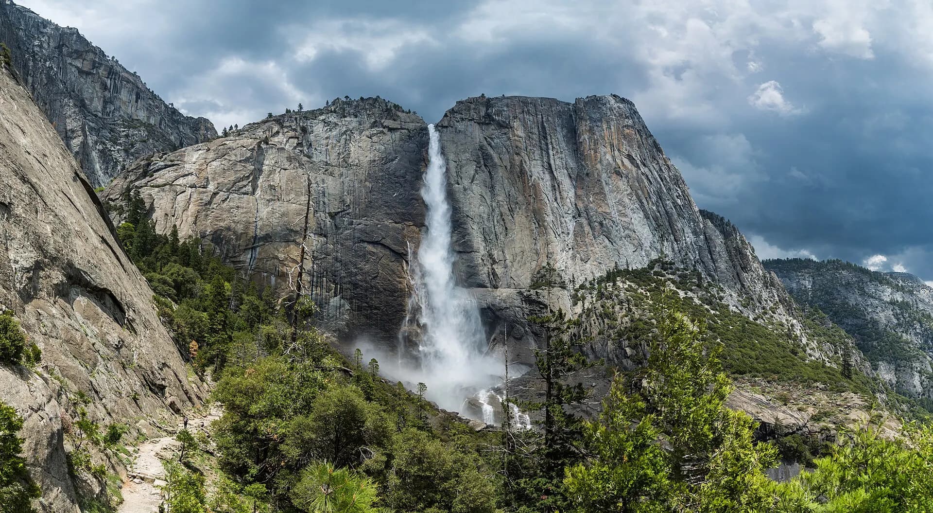
One of the tallest waterfalls in North America, dropping a total of around 740 metres in three sections. An easy loop leads to the base of Lower Yosemite Fall, and a strenuous trail climbs to the top.
TipThe falls are fullest in spring and early summer; by late summer they can dry to a trickle.
- 4
Half Dome
Photo: Tuxyso, CC BY-SA 3.0, via Wikimedia Commons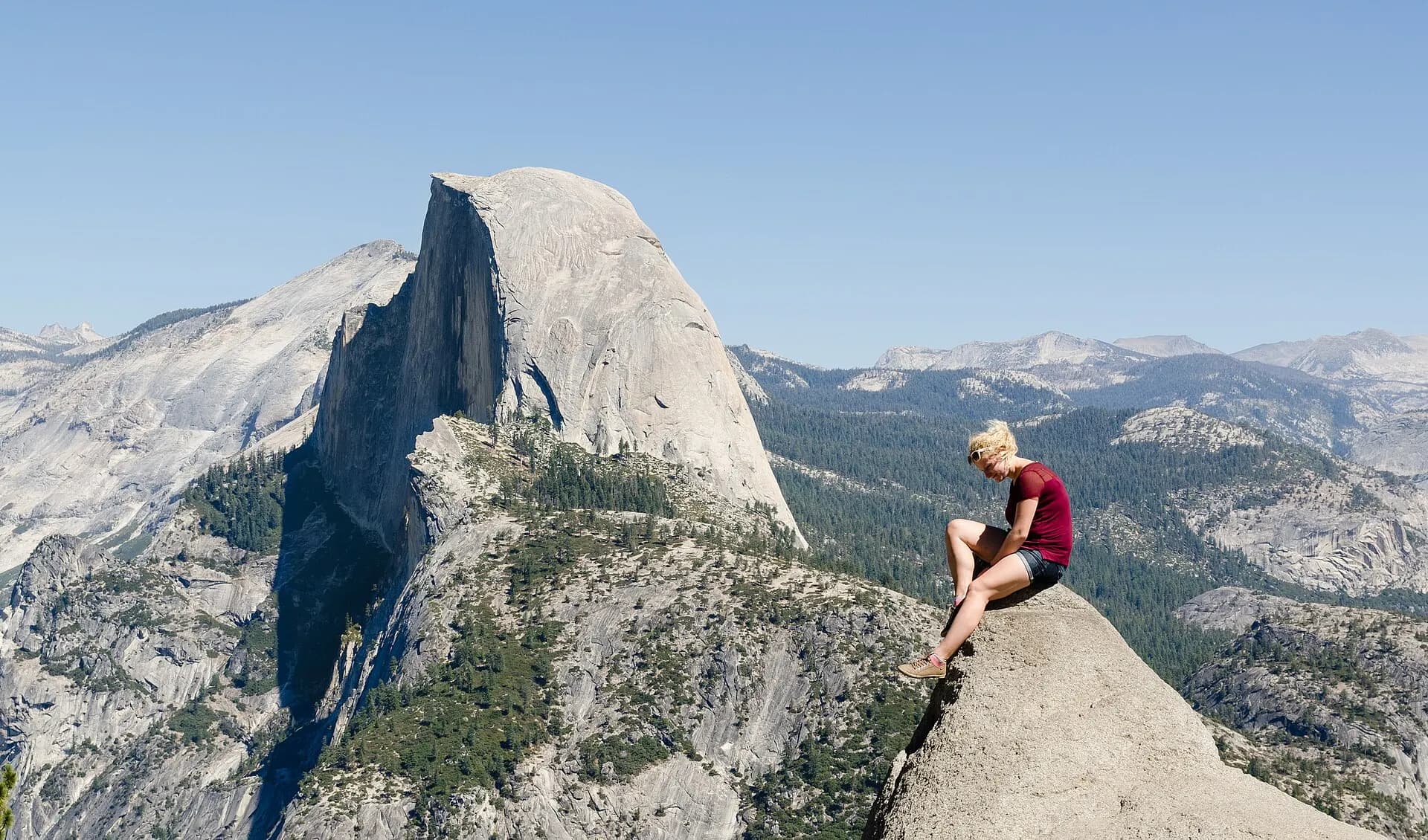
The park's iconic granite dome, seen from across the valley, sliced as if by a knife on one side. The long, demanding hike to its summit ends with a climb up steel cables, and requires a permit allocated by lottery.
- 5
The Mist Trail
Photo: JCRPannie, CC BY-SA 4.0, via Wikimedia Commons
A trail climbing beside the Merced River to Vernal Fall and Nevada Fall, with granite steps soaked by spray in spring. It's one of the most popular hikes in the park.
TipWear shoes with good grip and a rain jacket; the steps are slippery and the spray heavy in spring.
- 6
Glacier Point
Photo: Tuxyso, CC BY-SA 3.0, via Wikimedia Commons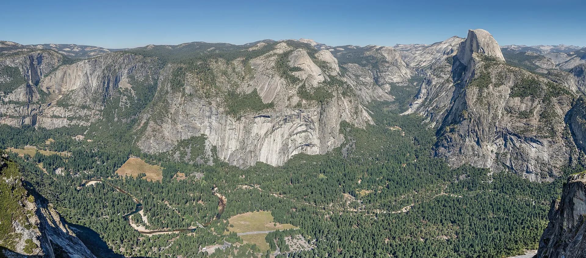
A viewpoint more than nine hundred metres above the valley floor, with a sweeping view of Half Dome, Vernal and Nevada falls and the high Sierra. It's reached by road in summer and autumn, or by the steep Four Mile Trail from the valley.
- 7
Mariposa Grove of Giant Sequoias
Photo: Dietmar Rabich, CC BY-SA 4.0, via Wikimedia Commons
The largest grove of giant sequoias in the park, near the southern entrance, with more than five hundred mature trees, including the Grizzly Giant, estimated to be around 3,000 years old. Trails wind among the trees.
- 8
Tuolumne Meadows and Tioga Road
Photo: Jarek Tuszyński, CC BY 4.0, via Wikimedia Commons
High in the park, Tioga Road crosses alpine country of granite domes, lakes and wide meadows, and Tuolumne Meadows is a base for hikes to lakes and peaks. The road is closed in winter and usually opens in late spring or early summer.
When to go
Spring brings the waterfalls at their peak, with wildflowers in the valley. Summer is warm and the busiest season, with all roads open. Autumn is quieter, with golden colours and fewer crowds, though many waterfalls are dry. Winter brings snow to the high country, and Tioga and Glacier Point roads close, but the valley is peaceful and beautiful. In mid to late February, if conditions are right, the setting sun can make Horsetail Fall glow like fire.
Getting around
Most visitors drive into the park. A free shuttle bus runs in Yosemite Valley, where parking is limited; leave your car and use the shuttle, walk or cycle on the paved paths. Regional buses connect the park with nearby towns. The nearest airports are Fresno, about two hours away, and the San Francisco Bay Area, about four hours.
Local tips
- Check the National Park Service website for any entry reservation requirements during your dates.
- Store all food and scented items in the bear-proof lockers provided; never leave food in your car.
- Start hikes early to find parking and avoid heat.
- Carry plenty of water and layers; temperatures vary greatly with altitude.
- Check road conditions and chain requirements in winter.
- Stay well back from rivers and waterfalls; currents are deadly.
- Petrol is limited inside the park; fill up before you enter.
- Mobile signal is patchy; download maps in advance.
- Wildfire smoke can affect air quality in late summer; check forecasts.
Eat and drink
Food in the park ranges from cafeterias and pizza decks to the grand dining room of the historic Ahwahnee hotel, beneath its timber-beamed ceiling. Groceries are sold in Yosemite Village, but bringing supplies from outside the park is cheaper. Picnics with a view are part of the experience. Nearby gateway towns such as Mariposa and Groveland have Gold Rush-era saloons and family restaurants.
Where to stay
Lodging inside the park, from tent cabins to historic hotels, and campgrounds book up months in advance. Towns just outside the park, such as El Portal, Mariposa, Oakhurst and Groveland, offer more choice, though they add driving time each day.
Beyond the valley
Hetch Hetchy, in the park's north-western corner, is a reservoir in a granite valley once compared to Yosemite Valley itself, with quiet trails to waterfalls. Wawona, near the southern entrance, has a historic hotel and a pioneer history centre. The high country around Tuolumne Meadows offers hikes to alpine lakes such as Cathedral Lakes and Elizabeth Lake, and the view from Olmsted Point looks down Tenaya Canyon to Half Dome. Rock climbing, rafting on the Merced River in summer and cross-country skiing at Badger Pass in winter add to the options.