Grand Canyon
A mile-deep gorge carved by the Colorado River through almost two billion years of rock, seen from viewpoints, trails and the river itself.
- Best time to go
- March to May and September to November, avoiding summer heat in the canyon
- Local time
- –
- Currency
- US Dollar (USD)
- Reading time
- 9 min
- Language
- English
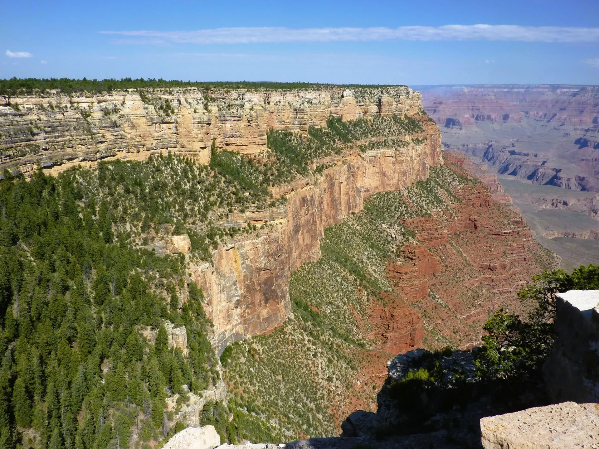
The Grand Canyon, in northern Arizona, is one of the great sights of the world: a gorge around 446 kilometres long, up to 29 kilometres wide and more than 1.6 kilometres deep, cut by the Colorado River through layer upon layer of coloured rock. Most of it is protected as Grand Canyon National Park, a World Heritage Site, and the lands around it belong to Native American nations, including the Havasupai and Hualapai, whose ancestors have lived here for centuries.
Most visitors come to the South Rim, open all year, with its village, shuttle buses and a chain of viewpoints along the edge. The North Rim, higher, cooler and far quieter, is a four-to-five-hour drive away and opens only in the warmer months. 2025 and 2026 have been hard years for the park: a wildfire burned much of the North Rim, and a flash flood in August 2026 damaged the pipeline that supplies the South Rim with water, closing hotels and parts of the inner canyon. Day visits continue, but check the park's alerts before you plan anything below the rim or overnight.
The top 14 in Grand Canyon
- 1
Mather Point
Photo: Tuxyso, CC BY-SA 3.0, via Wikimedia Commons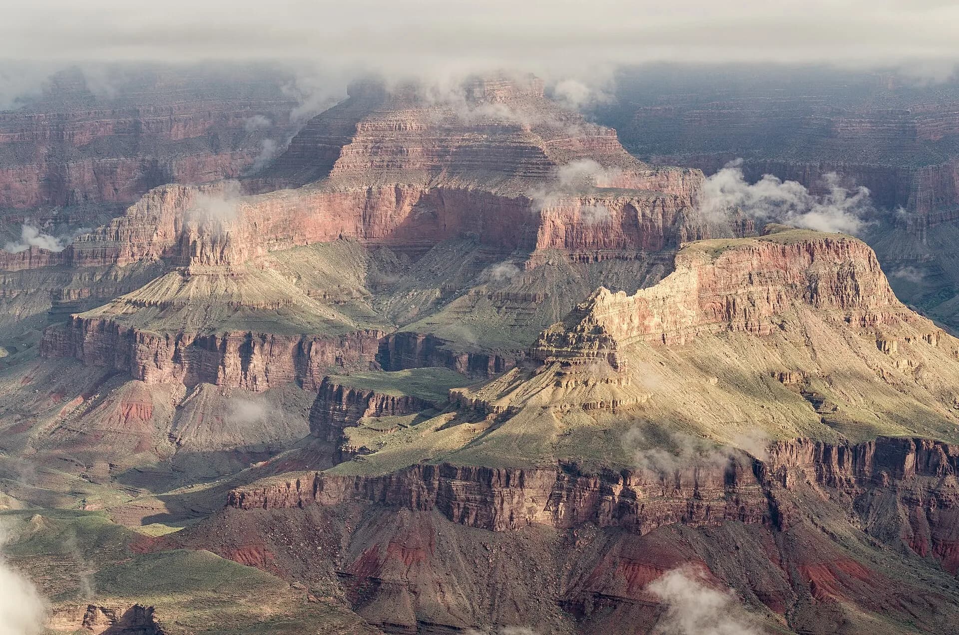
The first viewpoint most people reach, a short walk from the main visitor centre, with a wide view across the canyon to the North Rim. It's the busiest spot in the park, so walk a few minutes along the Rim Trail in either direction for more space.
- 2
Yavapai Point and Geology Museum
Photo: Tuxyso, CC BY-SA 3.0, via Wikimedia Commons
A short walk west along the rim, the stone museum has panoramic windows and exhibits that explain how the canyon formed and what the rock layers mean. The view takes in long stretches of the canyon floor and glimpses of the river.
- 3
Grand Canyon Village
Photo: Marine 69-71, CC BY-SA 4.0, via Wikimedia Commons
The historic heart of the South Rim, with the El Tovar Hotel of 1905, Mary Colter's Hopi House and Bright Angel Lodge, and the Kolb Studio, built by two pioneering photographer brothers on the very edge of the rim. The paved Rim Trail links it all with the viewpoints to the east.
- 4
Bright Angel Trail
Photo: Grand Canyon National Park, Public domain, via Wikimedia Commons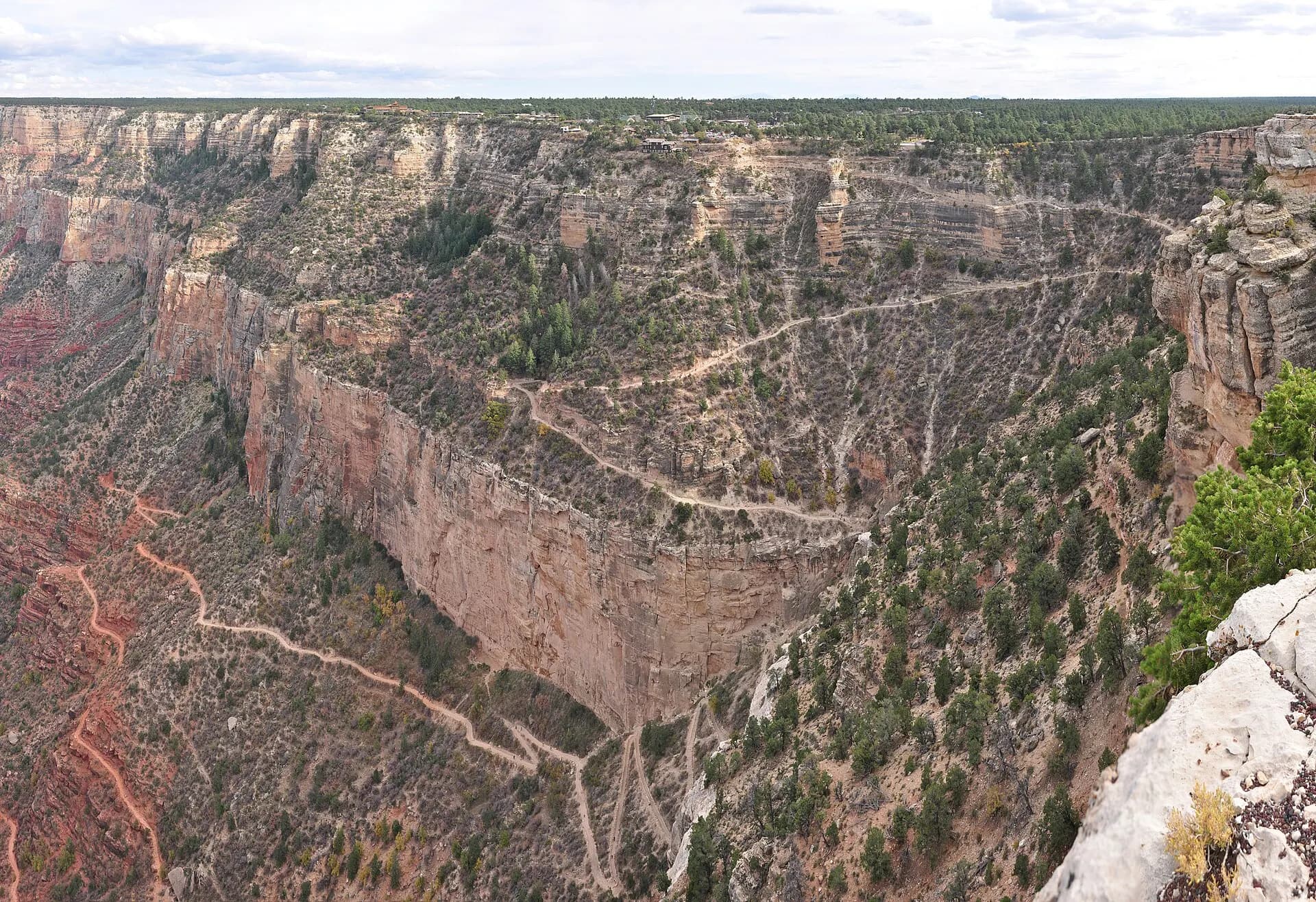
The canyon's best-known trail zigzags down a natural break in the cliffs from the village, following an ancient route used by the Havasupai. In autumn 2026, flood damage has closed it below the Mile-and-a-Half Resthouse, and water is off at the resthouses; even the short walk down is a real climb back up.
TipAllow twice as long to hike up as you took to go down.
- 5
Hopi Point
Photo: Alexander Migl, CC BY-SA 4.0, via Wikimedia Commons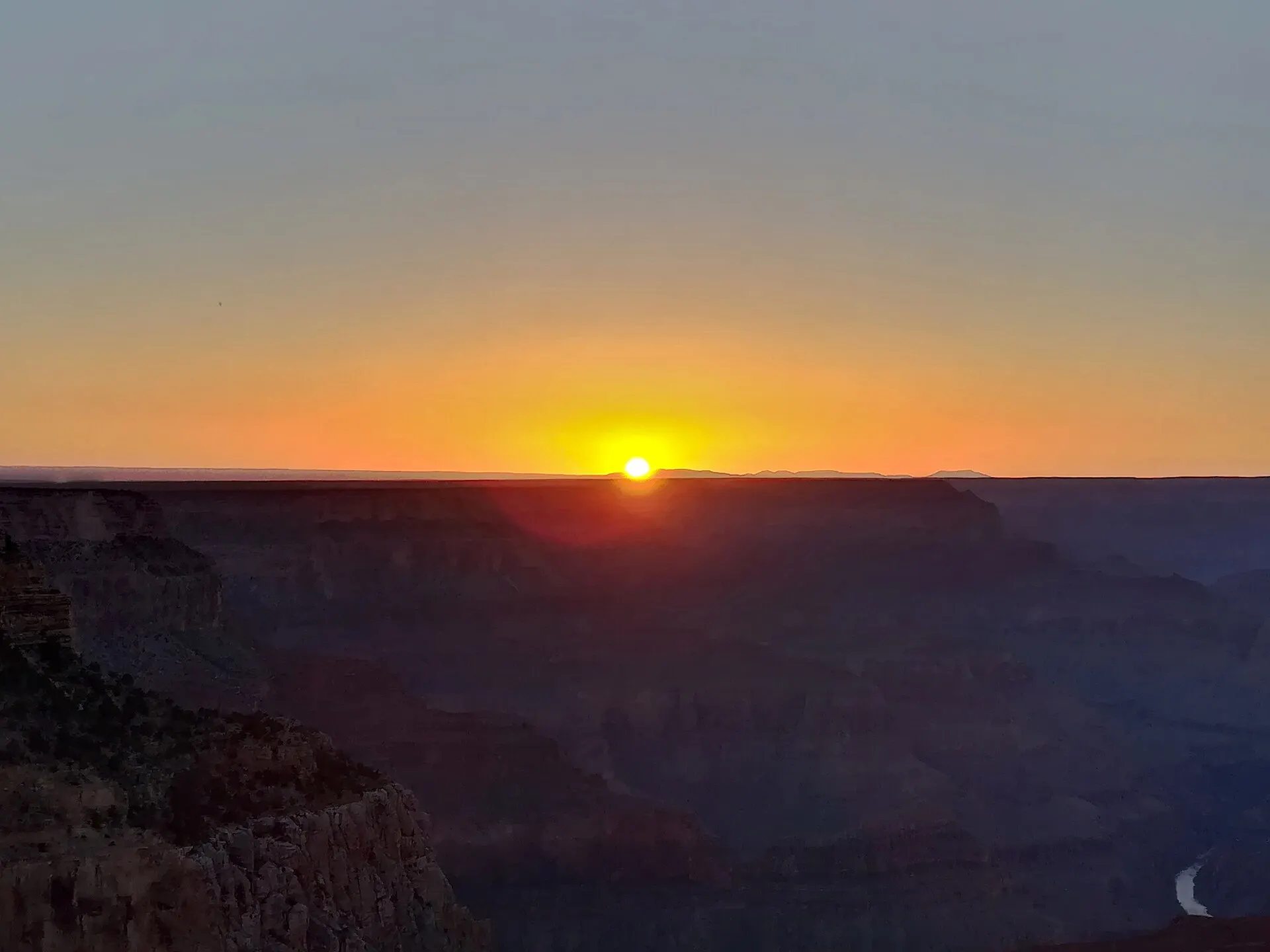
The first major stop on Hermit Road and one of the classic places for sunset, jutting out far enough to give views up and down the canyon. Neighbouring Mohave Point looks down on the Colorado River and its rapids.
- 6
Pima Point
Photo: Eric Kilby, CC BY-SA 2.0, via Wikimedia Commons
A quieter viewpoint near the end of Hermit Road, where on still days you can sometimes hear the river far below. The path between the shuttle stops along this stretch makes a fine rim walk.
- 7
Hermits Rest
Photo: NPS Photo by Michael Quinn, Public domain, via Wikimedia Commons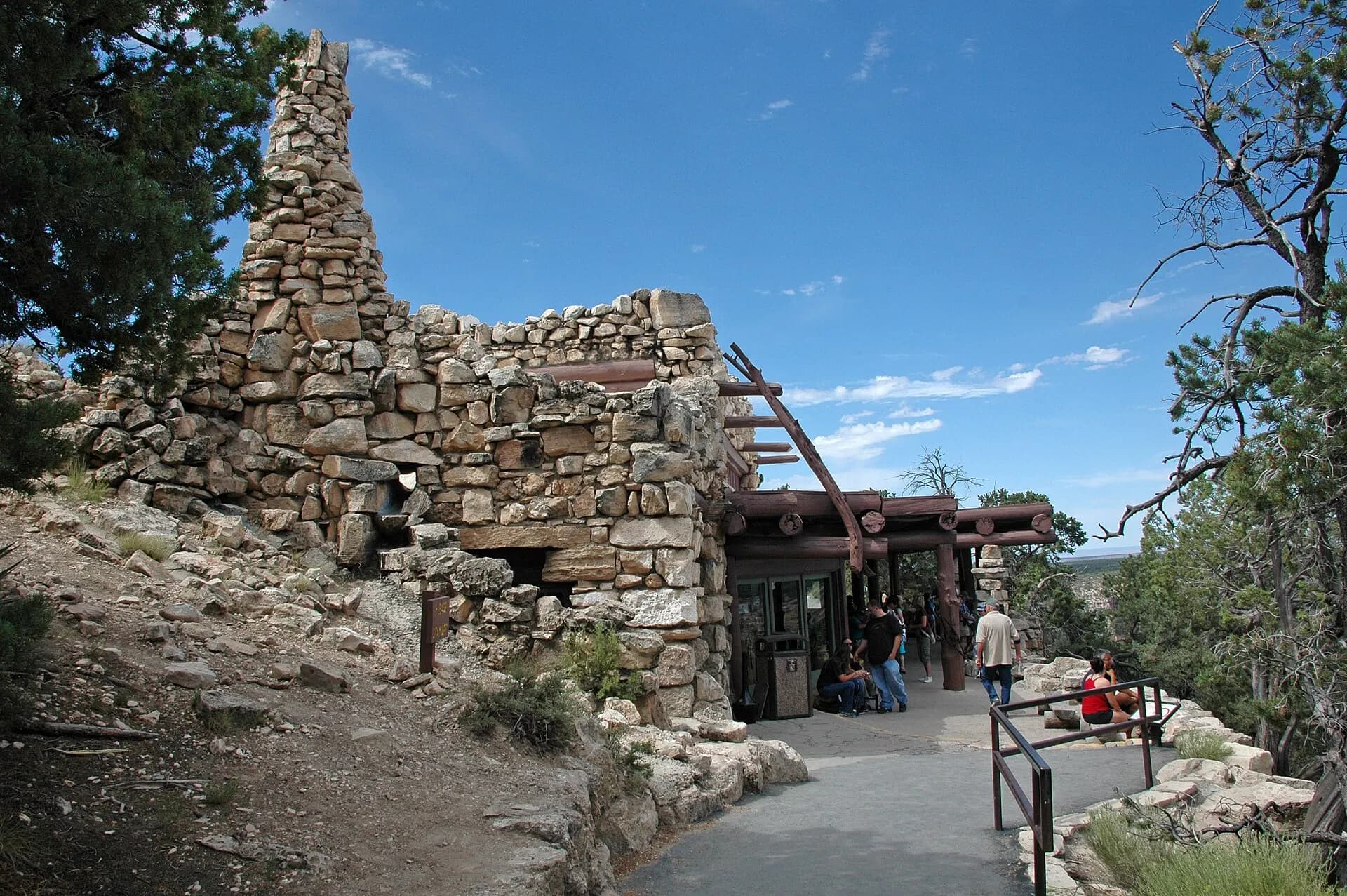
The western end of Hermit Road, with a rustic stone building designed by Mary Colter in 1914 and the start of the steep, unmaintained Hermit Trail. From March to November, the road is closed to private cars and reached by the free red-route shuttle.
- 8
South Kaibab Trail and Yaki Point
Photo: Vulturesong, CC0, via Wikimedia Commons
East of the village, the South Kaibab Trail follows a ridge with open views from the first steps. Ooh Aah Point, about 1.4 kilometres down, and Cedar Ridge, about 2.4 kilometres, are popular turnaround points. There's no shade and no water on the trail, and in autumn 2026 it was closed below Tip-Off Point. Neighbouring Yaki Point is a peaceful viewpoint for sunrise.
TipThe trailhead is reached by the orange-route shuttle or the early-morning Hikers' Express.
- 9
Grandview Point
Photo: Pierre André, CC BY-SA 4.0, via Wikimedia Commons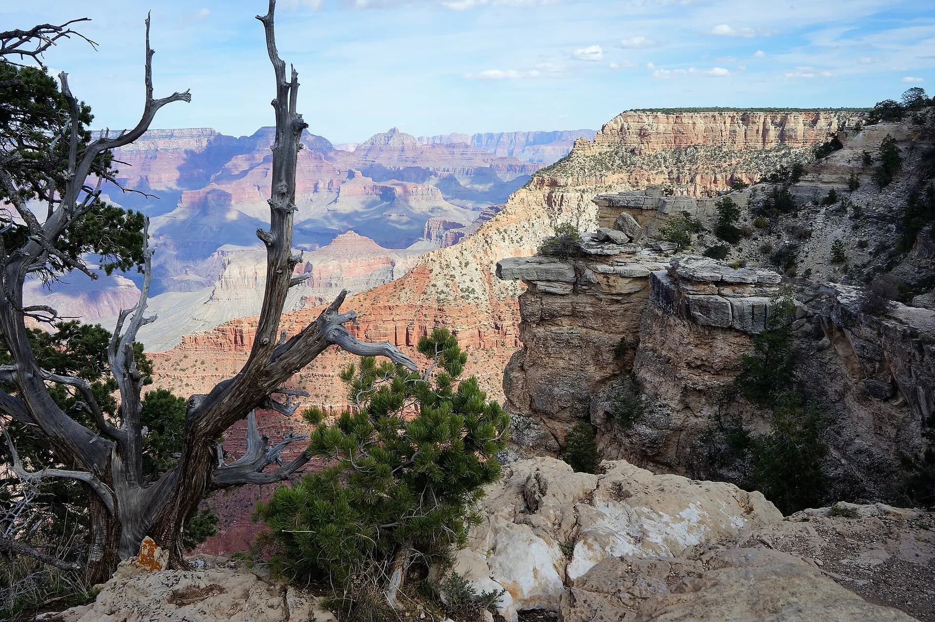
On Desert View Drive, a high viewpoint with a sweeping, forested outlook, at the head of a steep historic trail built by miners in the 1890s.
- 10
Lipan Point
Photo: Mariordo (Mario Roberto Durán Ortiz), CC BY-SA 4.0, via Wikimedia Commons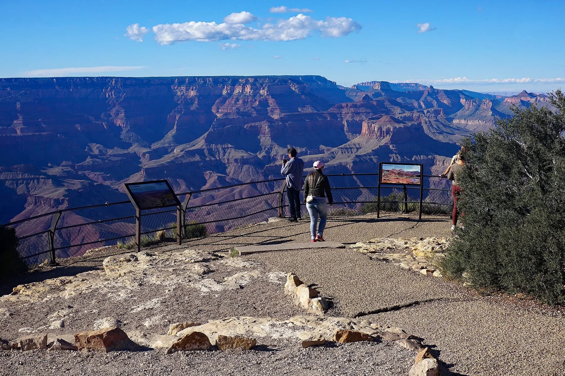
One of the best views on the South Rim, with a long stretch of the Colorado River in sight and the canyon's oldest rock layers exposed below. Lipan and nearby Moran Point are also good for stargazing.
- 11
Desert View Watchtower
Photo: DXR, CC BY-SA 4.0, via Wikimedia Commons
A 21-metre stone tower designed by Mary Colter and completed in 1932, at the eastern edge of the park, 37 kilometres from the village. The ground-floor View Room is open, and the upper floors, with murals by the Hopi artist Fred Kabotie, open when staffing allows, with free timed tickets.
TipThe small Tusayan Ruin, an ancestral Puebloan village, lies just west on the same road.
- 12
The North Rim
Photo: Tuxyso, CC BY-SA 3.0, via Wikimedia Commons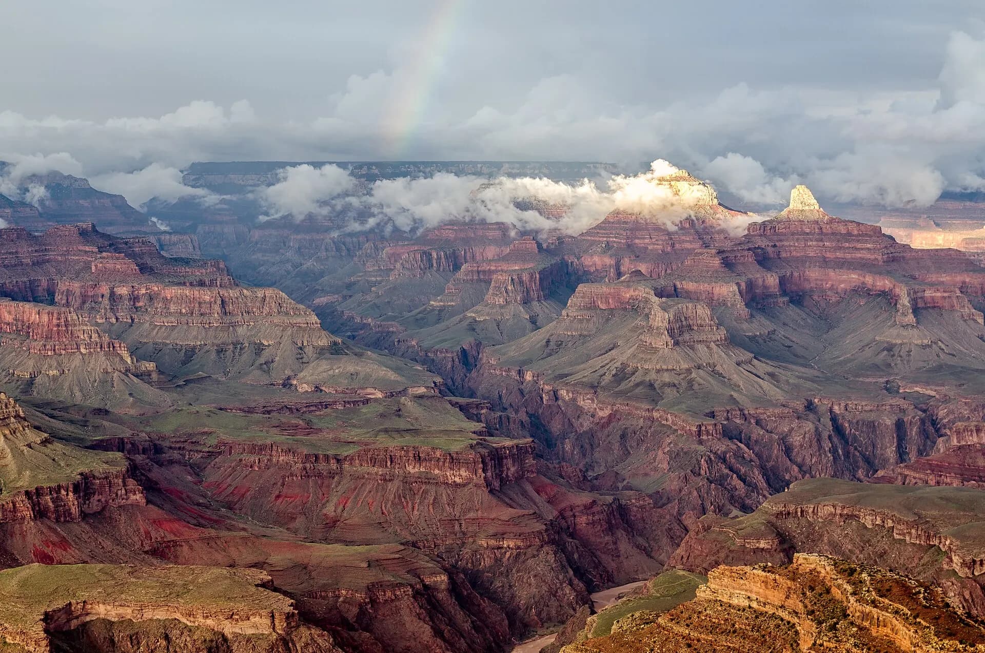
About 300 metres higher than the South Rim, with spruce and aspen forest and far fewer visitors. The 2025 Dragon Bravo Fire destroyed the historic Grand Canyon Lodge, and the 2026 season has been very limited, with trails at Bright Angel Point, Point Imperial and Cape Royal closed, no lodging in the park and all water off. See the section below for details.
- 13
Havasu Falls
Photo: Manderson164 (talk) (Uploads), Public domain, via Wikimedia Commons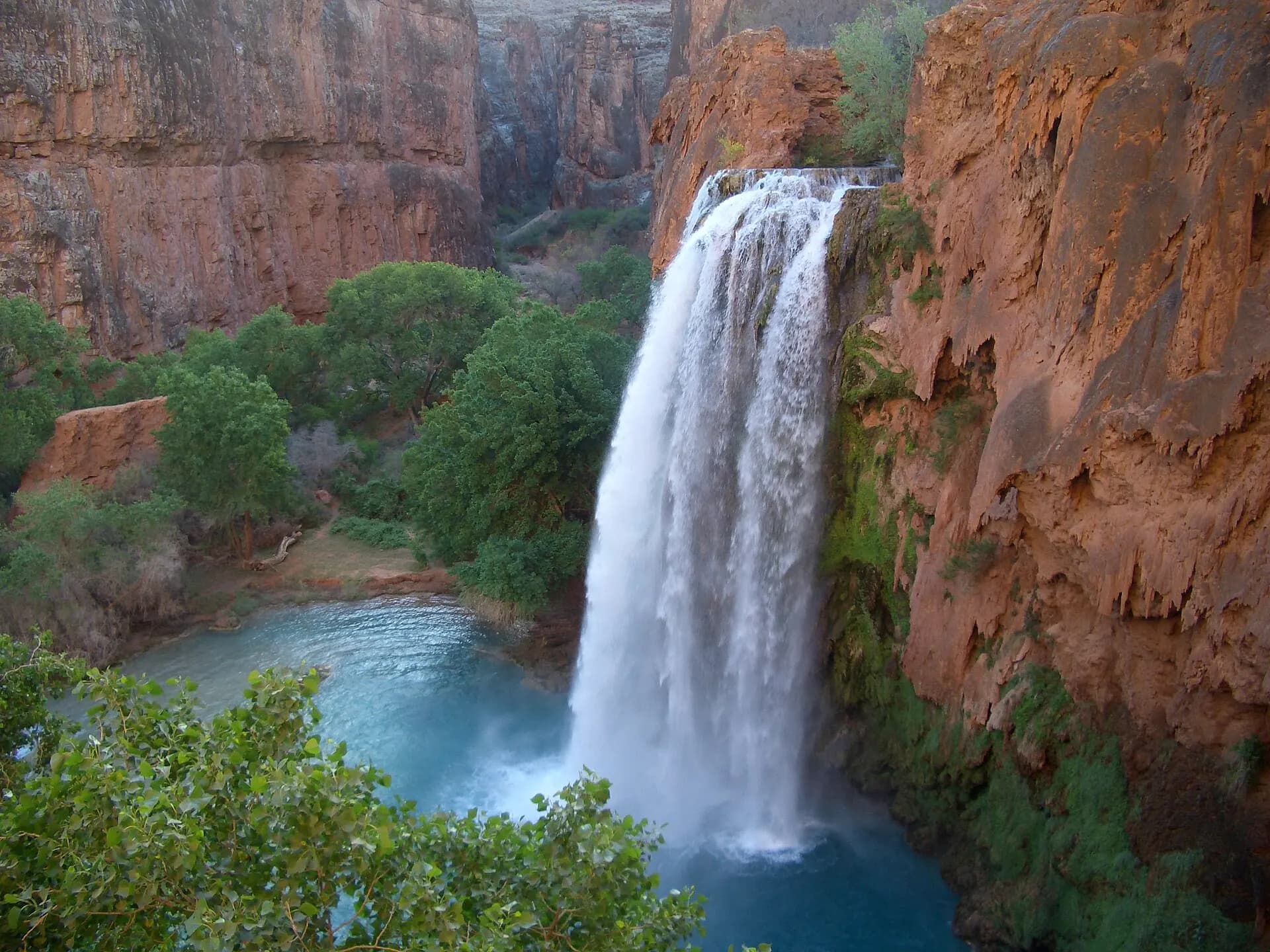
A turquoise waterfall on the Havasupai Reservation, deep in a side canyon west of the national park and reached only on foot, by mule or by helicopter. Visits require a reservation from the Havasupai Tribe for a 3-night stay, booked well in advance; the trail from Hilltop to Supai Village is about 13 kilometres, with the campground and falls beyond.
TipDay hikes without a booking aren't possible; arriving without a permit counts as trespassing.
- 14
Grand Canyon West and the Skywalk
Photo: Boris Dzhingarov, CC BY 2.0, via Wikimedia Commons
Run by the Hualapai Tribe on its own land, far to the west and closer to Las Vegas than to the national park. The Skywalk, a glass-floored bridge at Eagle Point, projects out over the canyon, and Guano Point has wide river views. Entry is by paid pass, separate from the national park.
When to go
Spring, from March to May, and autumn, from September to November, are the best seasons, with mild days on the rim and bearable temperatures for hiking. Summer brings the biggest crowds and dangerous heat inside the canyon, where temperatures often pass 40°C, while the South Rim, at about 2,100 metres, stays warmer than pleasant but rarely extreme. July to September is monsoon season, with afternoon thunderstorms, lightning and flash floods. Winter is quiet and often snowy on the South Rim, with cold nights and icy trails. The North Rim is closed in winter and in 2026 is open until 30 November or the first major snowstorm.
Getting around
The South Rim is about an hour and a half by road from Flagstaff, and the Grand Canyon Railway runs from Williams to the village, a trip of a little over two hours each way. Las Vegas and Phoenix are each roughly four hours or more away by car. The free shuttle buses are the easiest way to get around the South Rim: the blue route loops around the village, the orange route serves Mather Point, Yaki Point and the South Kaibab Trailhead, and the red route follows Hermit Road, closed to private vehicles from March to November. A summer-only purple route links Tusayan, just outside the South Entrance. Desert View Drive, to the east, is open to cars all year. The North Rim is about 340 kilometres by road from the South Rim.
Local tips
- Entrance costs US$35 per private vehicle for seven days, and the park takes cards only, not cash.
- Non-US residents aged 16 and over pay an extra US$100 each on top of the entrance fee, unless they have an America the Beautiful pass; the non-resident annual pass costs US$250.
- Carry plenty of water and refill at the trailhead tanks; water is off at many points below the rim.
- Don't feed squirrels or other wildlife; rock squirrels bite and can carry disease.
- Stay behind railings and well back from the edge, especially when taking photos.
- Arrive early or late in the day to avoid parking queues at the South Entrance in busy months.
- Check the park's "Key Hiking Messages" page before any hike below the rim.
Eat and drink
Food on the South Rim is mostly simple, from cafeterias and grab-and-go counters to a few sit-down restaurants, including the historic El Tovar Dining Room. Water restrictions in autumn 2026 have reduced hours and options, so check what's open on the day and consider bringing a picnic. Tusayan, just outside the South Entrance, has more restaurants, and Flagstaff and Williams have a wider choice.
Where to stay
The in-park lodges, from the grand El Tovar and Bright Angel Lodge on the rim to Maswik, Yavapai, Kachina and Thunderbird lodges, are the most atmospheric places to stay and book up months ahead. After the August 2026 flood, they were closed to overnight guests; in mid-October the concessioner expected to welcome guests again from 20 November 2026, but check before you book. Tusayan, a few minutes from the South Entrance, has several hotels unaffected by the closure, and Williams and Flagstaff are further options. Mather Campground in the village and the seasonal Desert View Campground are booked through Recreation.gov. On the North Rim, there is no lodging inside the park in 2026; the nearest is outside the boundary, towards Jacob Lake.
Hiking below the rim safely
Walking into the canyon is the best way to understand its scale, but it's the reverse of climbing a mountain: the easy part comes first, and the hard part is the climb back out, at altitude and often in the heat. The park service is clear: don't attempt to hike from the rim to the river and back in one day. From the South Rim it's a round trip of roughly 22 to 30 kilometres, with around 1,400 metres or more of descent and climb, and every year rangers rescue hikers suffering from heat exhaustion, dehydration and low sodium. In summer, avoid hiking in the hottest part of the day, turn around when you've used a third of your water and energy, and eat salty snacks as well as drinking. Overnight trips below the rim need a backcountry permit, and in late 2026 the river corridor, including Phantom Ranch, its campground and the bridges over the Colorado, was closed with no reopening date.
The North Rim after the Dragon Bravo Fire
In July 2025, a lightning strike started the Dragon Bravo Fire, which burned around 145,000 acres of the Kaibab Plateau and destroyed the Grand Canyon Lodge, a 1930s landmark perched on the rim at Bright Angel Point, along with many other buildings and the water system. The rim reopened in May 2026 for a limited season with almost no services: no lodging, no drinking water and strict fire restrictions. Flooding in August then closed the North Kaibab Trail. Long-term plans for rebuilding are under public consultation, and visitors should expect a remote, self-sufficient trip until new facilities are built. The North Rim Country Store and Jacob Lake, outside the park, sell fuel and supplies.
Rafting the Colorado River
The classic way to see the canyon from below is a river trip from Lees Ferry, near Page, downstream through the national park. Guided commercial trips, with motor rafts, oar boats or paddle rafts, last from three to eighteen days and are often booked a year or two ahead, while private trips for experienced boaters are allocated by a weighted lottery. Shorter options include half-day and full-day smooth-water floats near Lees Ferry and one-day whitewater trips through the Hualapai lands at the western end. The river is cold all year, released from the bottom of the Glen Canyon Dam.
Rock, river and people
The canyon's walls are a cross-section of the Earth's history. The dark rock in the inner gorge, the Vishnu Schist, is around 1.7 billion years old, while the cream Kaibab Limestone at the rim formed in a shallow sea around 270 million years ago. The canyon itself is young by comparison, carved mostly in the last five to six million years as the Colorado cut down through the rising plateau. People have lived in and around it for thousands of years, and the park recognises eleven traditionally associated tribes, including the Havasupai, Hualapai, Hopi, Navajo and several bands of Southern Paiute. Their lands, histories and sacred places remain part of the canyon today.
Responsible travel
Water is precious here, and in 2026 more than ever: take short showers in Tusayan, refill rather than buy bottles, and follow any conservation rules. Stay on trails, carry out all rubbish, and never throw anything into the canyon. Leave rocks, plants and artefacts where they are. Havasupai and Hualapai lands are sovereign tribal nations with their own rules, so book through their official sites, respect closures and photography rules, and keep to the areas open to visitors. Watch out for California condors, reintroduced here and still endangered, and never approach them.