Hawaiʻi Island (the Big Island)
A living volcano, snow-capped summits, coffee farms, black and green sand and the sacred places of old Hawaiʻi.
- Best time to go
- April to May and September to November; December to March for whales
- Local time
- –
- Currency
- US Dollar (USD)
- Reading time
- 12 min
- Language
- English
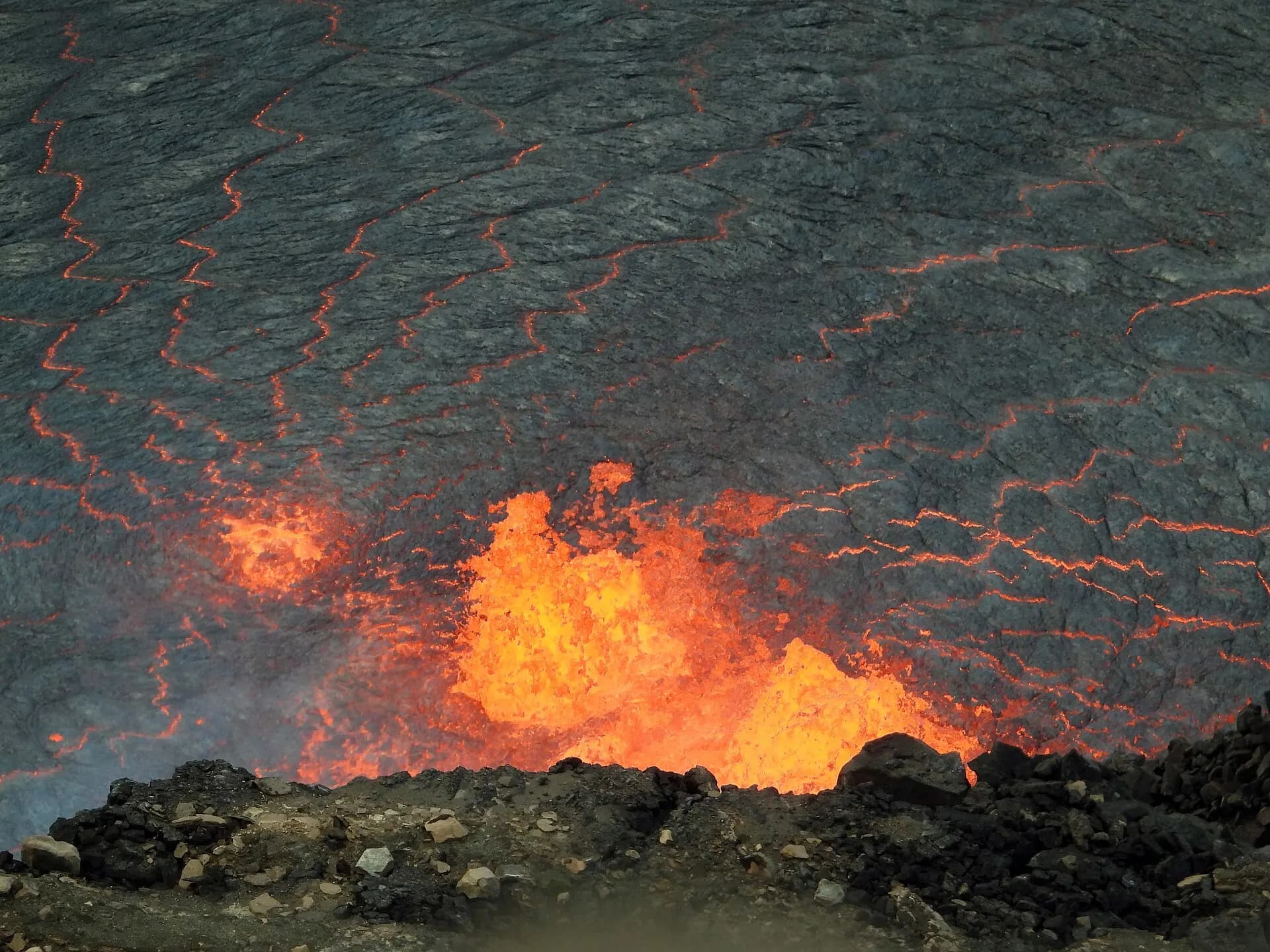
Hawaiʻi Island, usually called the Big Island to avoid confusion with the state, is larger than all the other Hawaiian Islands put together, and it's still growing. Five volcanoes built it. Maunakea and Mauna Loa both rise more than 4,000 metres above the sea, and Kīlauea, on the south-eastern flank, is one of the most active volcanoes on Earth. Its summit has been erupting in short, spectacular episodes of lava fountaining since December 2024.
The island packs in an astonishing range of climates. The sunny Kona and Kohala coasts on the dry west side have coffee farms, coral reefs and lava fields. The wet east side around Hilo has rainforest, waterfalls and orchids. In the south, Kaʻū is remote and windswept, and on the summits it can snow in winter. Distances are real here: it's about two and a half hours' drive from Kona to the volcano, so most visitors split their stay between the two sides.
The top 18 in Hawaiʻi Island (the Big Island)
- 1
Kailua-Kona
Photo: Ken Lund from Reno, Nevada, USA, CC BY-SA 2.0, via Wikimedia Commons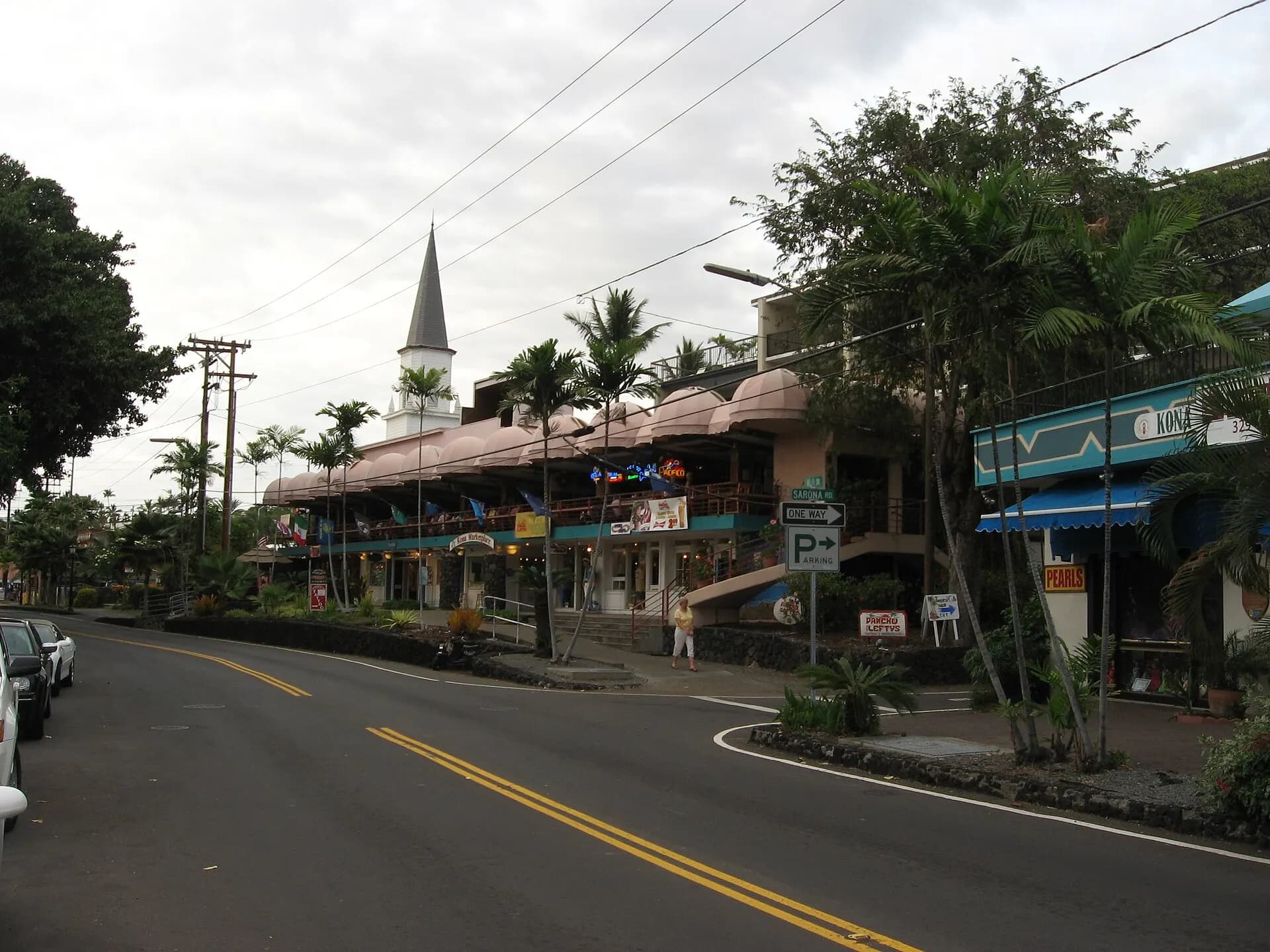
The main town of the west coast, with a seafront lined with shops and restaurants. Huliheʻe Palace, a nineteenth-century royal summer home, and Mokuʻaikaua Church face each other across Aliʻi Drive, and nearby Kamakahonu, beside the pier, was where Kamehameha the Great spent his last years.
- 2
Kona coffee farms
Photo: Ekrem Canli, CC BY-SA 4.0, via Wikimedia Commons
On the cool, cloudy slopes above Kailua, a narrow belt of small family farms grows Kona coffee, one of the few coffees grown in the United States. The village of Hōlualoa makes a pleasant base, with galleries along the main road, and many farms offer tours and tastings from the tree to the roaster.
TipCheck the label: only coffee labelled "100% Kona" is entirely from the region; "Kona blend" may contain as little as a tenth.
- 3
Keauhou Bay and the manta night snorkel
Reef manta rays, with wingspans of up to four metres, gather off the Kona coast at night to feed on plankton drawn by lights. Boat trips from Keauhou Bay and Honokōhau Harbor take snorkellers and divers to watch them loop and somersault just below the surface. It's one of the most memorable wildlife encounters in Hawaiʻi.
TipFloat flat on the surface, keep your hands to yourself and never touch a manta; touching damages the protective coating on their skin. Choose an operator that follows the responsible manta-viewing guidelines.
- 4
Kealakekua Bay
Photo: Robert Linsdell from St. Andrews, Canada, CC BY 2.0, via Wikimedia Commons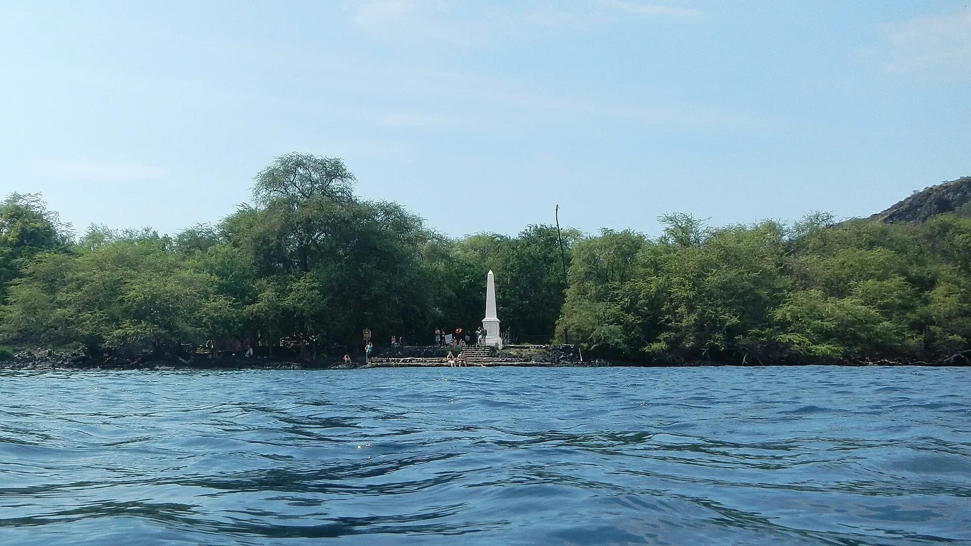
A deep, sheltered bay and Marine Life Conservation District with some of the clearest water and best snorkelling on the island, and frequent spinner dolphins. In 1779, Captain James Cook was killed here at Kaʻawaloa, on the bay's northern shore, where a white obelisk now stands. Hikiau Heiau, a sacred temple platform, rises behind the beach at Nāpōʻopoʻo.
TipReach the monument by the steep Kaʻawaloa Trail (bring water; there are no facilities) or a guided kayak tour with a State Parks permitted company. Every vessel, even a rented kayak, needs a transit permit, and landing at Kaʻawaloa is not allowed for permitted vessels. Don't walk onto the heiau.
- 5
Puʻuhonua o Hōnaunau National Historical Park
Photo: Robert Linsdell from St. Andrews, Canada, CC BY 2.0, via Wikimedia Commons
A place of refuge, where those who had broken a kapu (sacred law) could escape death if they reached its walls. A great stone wall separates the puʻuhonua from the royal grounds, and the reconstructed Hale o Keawe temple, guarded by carved kiʻi, once held the bones of chiefs. Palm-fringed lava shoreline, tide pools and green sea turtles complete the scene.
TipNext door, the boat ramp area known as Two Step is a popular snorkelling entry; it's outside the park and gets busy, so go early.
- 6
Papakōlea Green Sand Beach
Photo: Pushkr from , United States, CC BY 2.0, via Wikimedia Commons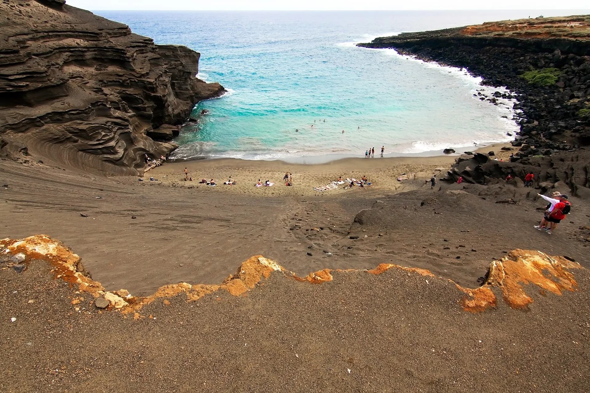
One of very few green-sand beaches in the world, tucked inside the eroded cone of a cinder hill near Ka Lae (South Point), the southern tip of the United States. The colour comes from olivine crystals weathered out of the lava. The land is Hawaiian Home Lands, and the only legitimate way in is a hot, exposed hike of about 4 kilometres each way along the coast.
TipThe paid truck rides offered at the car park are not authorised and have scarred the land with ruts; walk instead. Bring plenty of water and sun protection, take no sand, and be very careful in the water, as currents here are strong.
- 7
Punaluʻu Black Sand Beach
Photo: Frank Schulenburg, CC BY-SA 3.0, via Wikimedia Commons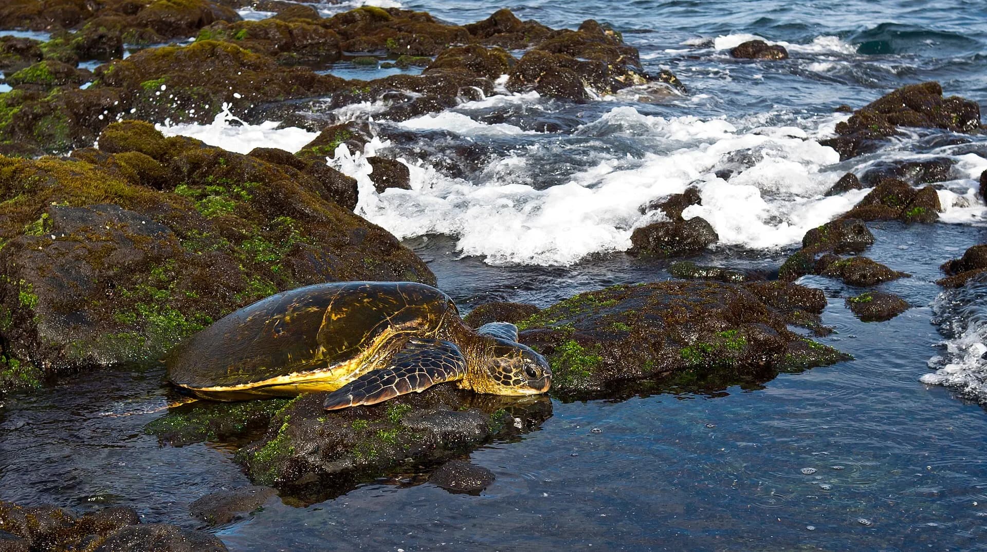
A crescent of jet-black sand, formed when lava shattered on meeting the sea, fringed with coconut palms. Hawaiian green sea turtles often haul out to rest on the sand, and endangered hawksbill turtles nest here. Cold freshwater springs bubble up near the shore.
TipKeep at least 3 metres from turtles, and never take black sand or stones; removing them is illegal and they are being lost.
- 8
Kīlauea summit, Hawaiʻi Volcanoes National Park
Photo: Brocken Inaglory, CC BY-SA 3.0, via Wikimedia Commons
The heart of the national park, a UNESCO World Heritage Site, and home of Pele, the Hawaiian goddess of volcanoes. Crater Rim Drive and its overlooks look into the vast caldera and Halemaʻumaʻu crater, where episodic lava fountaining has been taking place since December 2024. Between episodes there may be little to see but steam; during one, fountains can rise hundreds of metres, and at night the glow lights the sky. The renovated Kīlauea Visitor Center is due to reopen in late 2026.
TipCheck the USGS Hawaiian Volcano Observatory for the latest activity and the park's alerts page for closures before you go. Overlooks close temporarily when tephra and Pele's hair fall downwind, and in October 2026 the Halemaʻumaʻu Trail and part of Byron Ledge Trail closed because of summit inflation and earthquakes. Parking can be full by mid-morning.
- 9
Kīlauea Iki and Nāhuku
Photo: Netherzone, CC BY-SA 4.0, via Wikimedia Commons
Kīlauea Iki, "little Kīlauea", is a crater whose floor was a lava lake in 1959. A classic loop trail of about 6 kilometres descends through rainforest and crosses the steaming, cracked crater floor. Close by, Nāhuku (Thurston Lava Tube) is a walk-through lava cave reached by a short rainforest trail, reopened in August 2026 after its entrance bridge was replaced.
TipNāhuku is lit from 8am to 8pm; go early or after dark to avoid the crowds, and bring a torch outside those hours.
- 10
Chain of Craters Road
Photo: Robert Linsdell from St. Andrews, Canada, CC BY 2.0, via Wikimedia Commons
The road drops about 1,000 metres in 30 kilometres from the summit to the sea, past pit craters, lava flows from different decades and the Puʻu Loa petroglyph field, one of the largest in Hawaiʻi. It ends at the coast, where lava flows cut it off. The Hōlei Sea Arch, long the road's final sight, collapsed into the ocean in September 2026.
TipThere's no fuel, food or water beyond the summit. Stay well back from the sea cliffs, which can collapse without warning.
- 11
Hilo
Photo: Robert Linsdell from St. Andrews, Canada, CC BY 2.0, via Wikimedia Commons
The island's largest town has a relaxed, old-fashioned feel, with wooden plantation-era shopfronts, a busy farmers market, Japanese-style Liliʻuokalani Gardens and the Pacific Tsunami Museum, which tells the story of the waves that struck the town in 1946 and 1960. ʻImiloa Astronomy Center explains Maunakea's science and Hawaiian voyaging traditions.
- 12
Rainbow Falls
Photo: Robert Linsdell from St. Andrews, Canada, CC BY 2.0, via Wikimedia Commons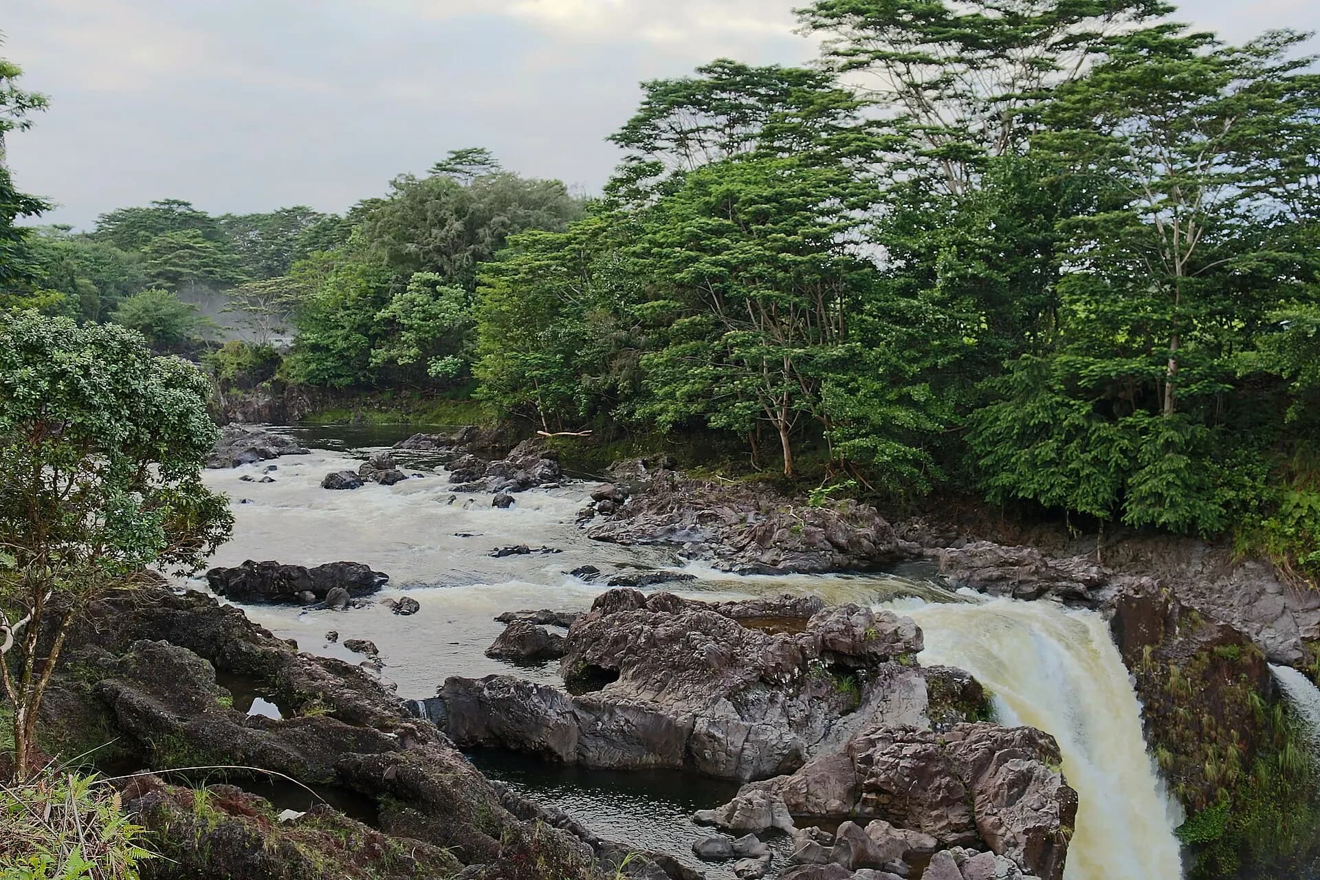
Waiānuenue, as it's known in Hawaiian, is a broad waterfall on the Wailuku River on the edge of Hilo, pouring over a lava cave said to be the home of the goddess Hina. Rainbows form in the spray on sunny mornings. It's an easy stop, a short walk from the car park.
- 13
ʻAkaka Falls State Park
Photo: Robert Linsdell from St. Andrews, Canada, CC BY 2.0, via Wikimedia Commons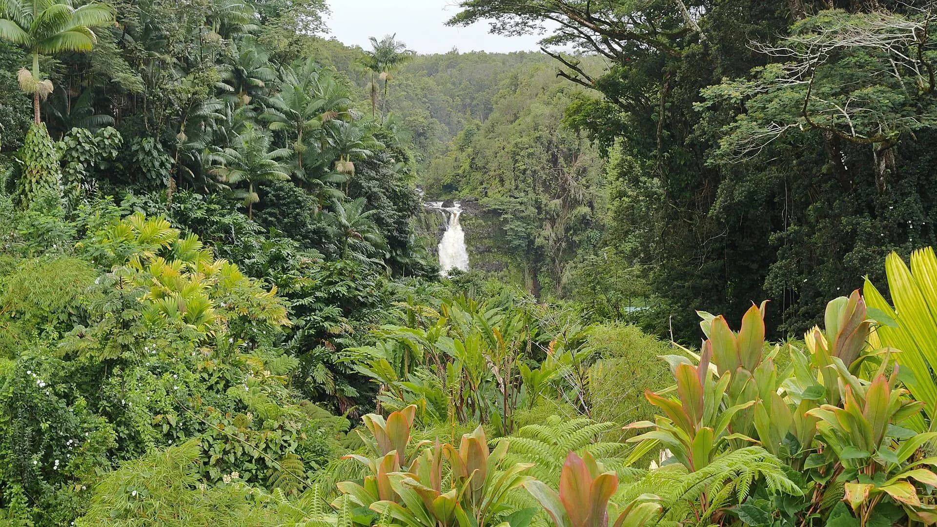
A short, paved loop through rainforest of ginger, orchids and bamboo leads to ʻAkaka Falls, plunging 135 metres into a mossy gorge, one of the highest waterfalls in Hawaiʻi that's easy to reach. The park opens daily from 8.30am to 5pm.
TipNon-residents pay per person and for parking, by card only; pay online before you arrive, as mobile signal is weak. Check park notices, as part of the trail has been closed by fallen trees.
- 14
Waipiʻo Valley Lookout
Photo: Vamsi, CC BY-SA 3.0, via Wikimedia Commons
At the end of the road through the old sugar town of Honokaʻa, the lookout gazes into Waipiʻo, the "valley of curved water", walled by cliffs nearly 600 metres high, with a black-sand beach at its mouth. It was home to Hawaiian royalty and is still farmed for taro. The lookout is the place for visitors to enjoy it.
TipThe steep road into the valley is closed to visitors under county emergency rules, because of rockfall risk, and is open only to residents in 4WD vehicles; it's also closed to walkers. Visiting the valley floor is possible only on a permitted guided tour; check the current county rules.
- 15
North Kohala: Hāwī and Pololū
Photo: zak11527, CC BY-SA 3.0, via Wikimedia Commons
The island's northern tip is green ranch country with the small towns of Hāwī and Kapaʻau, full of cafés and galleries in old plantation buildings. Kapaʻau has the original statue of Kamehameha the Great, who was born in this district. The road ends at the Pololū Valley Lookout, with a dramatic view along the sea cliffs; a steep, often muddy trail descends to a boulder beach.
TipParking at Pololū is very limited; the ocean below is dangerous, so don't swim.
- 16
Puʻukoholā Heiau National Historic Site
Photo: Bamse, CC BY-SA 4.0, via Wikimedia Commons
A massive stone temple built by Kamehameha in 1790 to 1791, after a prophecy that he would unite the islands if he built a heiau for his war god. It's one of the last major temples built in old Hawaiʻi. A short trail leads past it to the shore, where sharks are sometimes seen cruising offshore.
TipVisitors may not enter the heiau; view it from the trail.
- 17
Hāpuna Beach
Photo: Larry D. Moore, CC BY 4.0, via Wikimedia Commons
A long, wide beach of white sand on the Kohala Coast, often ranked among the best in the state, with calm water for swimming in summer and good bodyboarding on gentle days. It's the place to rest between sightseeing days on the west side.
TipWinter swells can bring powerful waves and currents; check with the lifeguards.
- 18
Maunakea
Photo: NOIRLab/AURA/NSF, CC BY 4.0, via Wikimedia Commons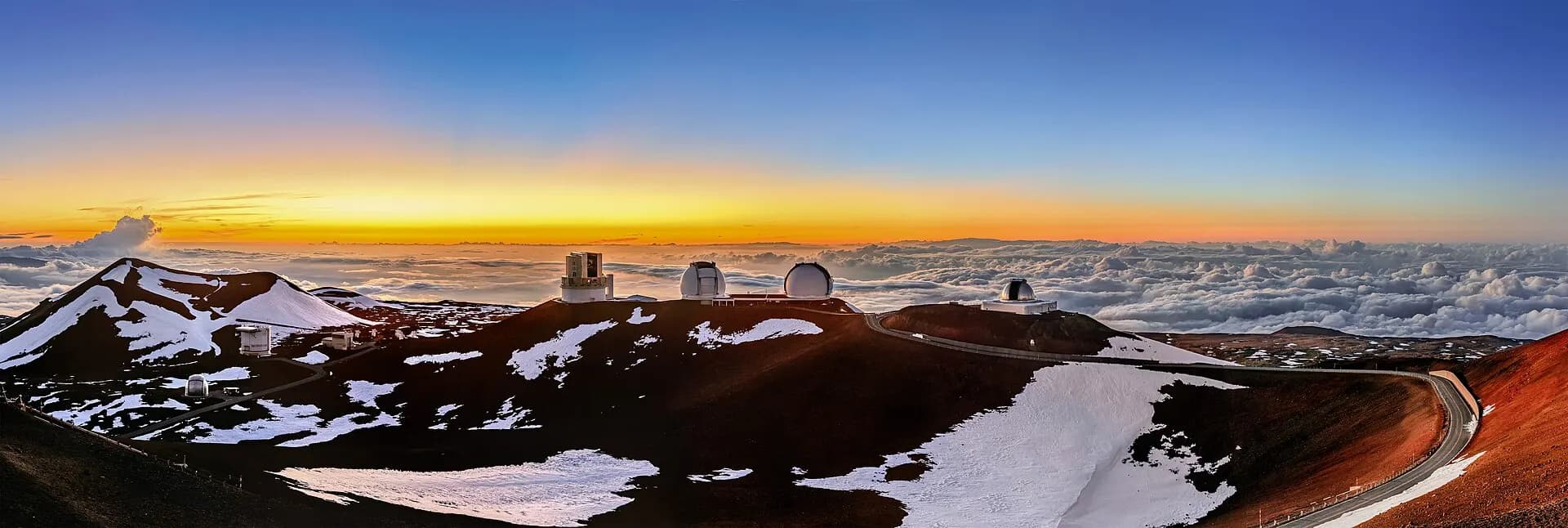
At 4,207 metres, Maunakea is Hawaiʻi's highest peak, and measured from its base on the ocean floor, the tallest mountain on Earth. It's the most sacred mountain in Hawaiian tradition, and its summit, above the clouds, hosts some of the world's leading astronomical observatories. The Visitor Information Station at 2,800 metres, open daily from 9am to 9pm, is the place to stop, acclimatise and look at the stars.
TipAbove the visitor station, the road is steep and partly unpaved, and only 4WD vehicles are allowed; use low range on the way down. The summit is open from 30 minutes before sunrise to 30 minutes after sunset. Children under 13, pregnant women and people in poor health shouldn't go above the visitor station. Most hire-car contracts don't allow the summit road; join a tour if in doubt.
When to go
The Big Island is warm all year at sea level, with the Kona and Kohala coasts far sunnier and drier than Hilo, one of the wettest towns in the United States. April to May and September to November bring good weather and fewer crowds. Winter, from December to March, brings humpback whales offshore, higher surf on north- and west-facing shores, and sometimes snow on the summits of Maunakea and Mauna Loa. Summer is busy, and the hurricane season runs from June to November; storms in August and September 2026 temporarily closed much of the national park. Volcano activity follows no calendar.
Getting around
Most visitors fly into Ellison Onizuka Kona International Airport (KOA) on the west coast; Hilo International Airport (ITO) has inter-island flights and is due to gain direct flights from the mainland. A hire car is essential for most visitors: the island-wide Hele-On bus is cheap but infrequent. The Daniel K. Inouye Highway, the Saddle Road, crosses between Maunakea and Mauna Loa and is the quickest route between Kona and Hilo. Allow at least a full day for the volcano from Kona, and ideally stay a night or two in Volcano or Hilo.
Local tips
- Check USGS HVO and the park's alerts page on the morning of your visit; eruptive episodes can begin and end within hours.
- Vog, volcanic smog, can affect people with asthma or heart conditions; check air quality when the summit is erupting.
- Bring layers: it can be cold and wet at the volcano, which sits at about 1,200 metres.
- Use only mineral sunscreen; Hawaiʻi law bans the sale of sunscreens with oxybenzone and octinoxate.
- Pay park fees by card, and buy reservations and day-use fees for state parks online before you arrive.
- Never leave valuables in the car at trailheads and beaches.
- Fill up with fuel before long drives through Kaʻū, the Saddle Road or Chain of Craters.
Eat and drink
Look for plate lunches, loco moco (said to have been invented in Hilo), poke, kālua pork and laulau, as well as malasadas, Portuguese doughnuts, from bakeries in Honokaʻa and Hilo. Kona coffee and Kaʻū coffee are both worth tasting at the farm, and macadamia nuts, lilikoʻi (passion fruit) and vanilla are grown on the island. Hilo's farmers market sells tropical fruit you won't see elsewhere, and fresh ʻahi and ono turn up on menus up and down the Kona coast.
Where to stay
Kailua-Kona has the widest choice of hotels and condos, at all prices, with easy access to snorkelling and the coffee farms. The Kohala Coast to the north is a string of upmarket resorts and golf courses beside the best white-sand beaches. On the east side, Hilo has simple hotels and guesthouses, and the rainforest village of Volcano, right by the national park, has cottages and bed-and-breakfasts that let you see the eruption glow at night. Splitting your stay between the west and east sides saves many hours of driving.
Kīlauea's eruption
Kīlauea's summit eruption, which began on 23 December 2024, has unfolded as a series of dozens of separate episodes, each typically lasting hours to a day or so, with lava fountains, sometimes more than 300 metres high, spraying from vents on the south-western wall of Halemaʻumaʻu, separated by quiet pauses of days or weeks. The lava has stayed within a closed area of the caldera, but the fountains rain down tephra and strands of volcanic glass called Pele's hair on overlooks and roads downwind, which close temporarily for safety. In October 2026, the park warned that the summit remained highly pressurised, with earthquakes, new cracks and sporadic activity from the north vent, and closed some trails. Forecasts aren't possible, so treat viewing as a bonus: check the USGS webcams and updates, which often estimate when the next episode may begin, follow the rangers' advice and keep out of closed areas.
Maunakea and Hawaiian culture
In Hawaiian tradition, Maunakea is the realm of the gods and an ancestor of the Hawaiian people, the place where the sky father Wākea and the earth mother Papahānaumoku meet, and home of the snow goddess Poliʻahu. Its upper slopes hold shrines, burials and Lake Waiau, one of the highest lakes in the United States. The building of telescopes on the summit has long been contested, and protests in 2019 against a new observatory drew thousands. Today, a state authority with a strong Native Hawaiian voice is taking over stewardship of the mountain from the University of Hawaiʻi. Visit with respect: stay on roads and trails, don't build or disturb stone stacks, and take nothing away.
Elsewhere, sacred places such as heiau and puʻuhonua carry deep meaning. Don't climb on stone walls, move rocks or leave offerings. The ʻokina (ʻ) and kahakō (the macron over a vowel) change how place names are pronounced and what they mean, so it's worth noticing them on signs.
Ocean safety
Many of the island's shores are rocky lava coastlines with no reef protection, and conditions can change quickly. Swim at beaches with lifeguards where you can, and ask about the day's currents and surf. Never turn your back on the sea, snorkel with a buddy and in the calm morning hours, and if caught in a current, swim parallel to the shore. Stay out of rivers and pools when it's raining upstream, especially on the wet Hāmākua and Hilo side, as flash floods can rise very fast.
Responsible travel
Visitors are welcome, but the island's culture, reefs and wildlife need care. Stay on marked trails, park only in legal spaces and respect "kapu" and no-trespassing signs, which mark private or sacred land. Keep at least 3 metres from sea turtles and 45 metres from Hawaiian monk seals, don't touch or stand on coral and never feed fish. Use mineral sunscreen, take your rubbish home and never take lava rock or sand. Support locally owned farms, restaurants and Hawaiian-led cultural experiences, and choose tour operators who hold the right permits.