Puerto Rico
A mountainous Caribbean island where Spanish forts, a rainforest, glowing bays and surf beaches all lie within a few hours' drive of San Juan.
- Best time to go
- Mid-December to April for drier weather and calm seas; May, June and November are quieter and cheaper; hurricane season peaks August to October
- Local time
- –
- Currency
- US Dollar (USD)
- Reading time
- 16 min
- Language
- Spanish and English
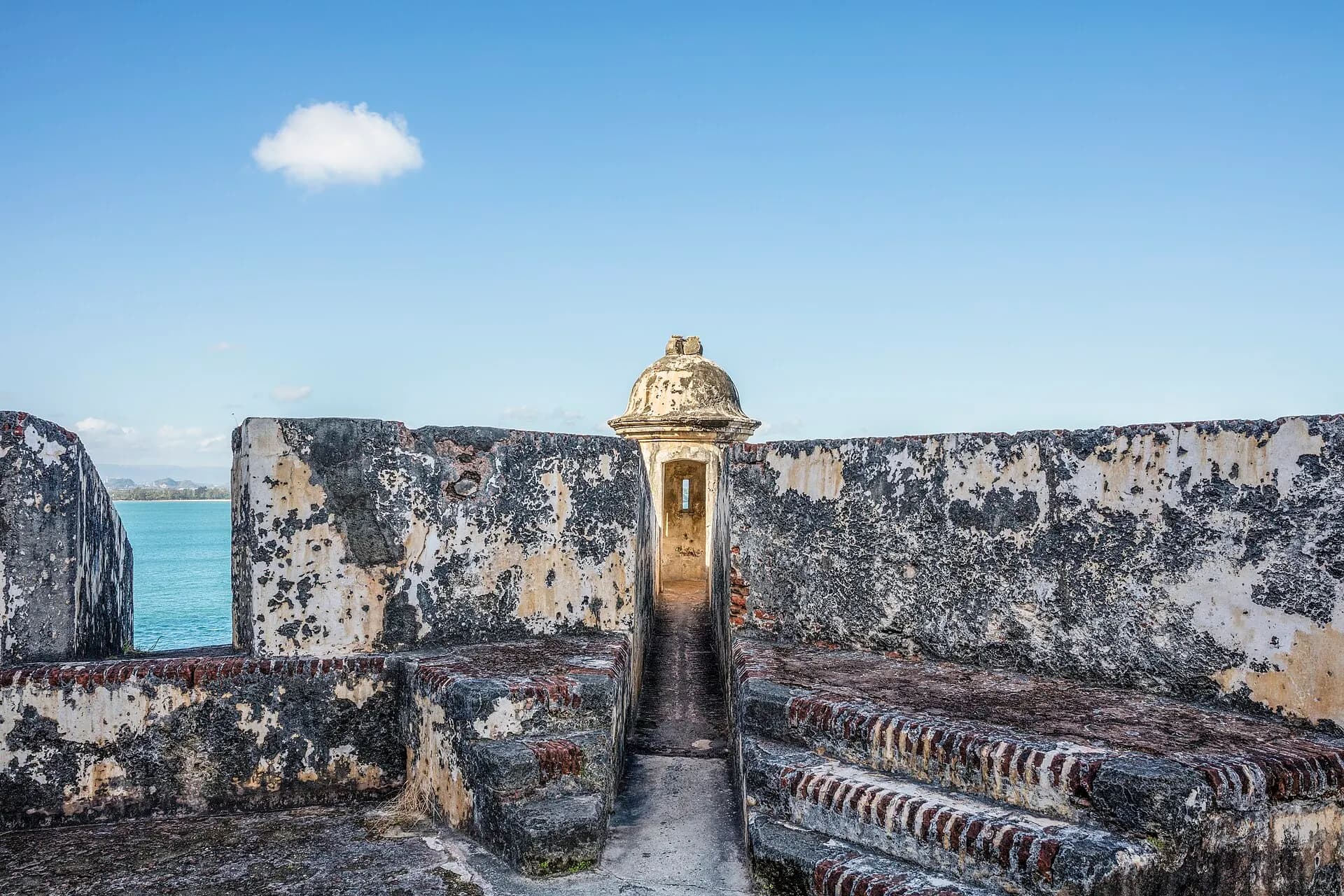
Puerto Rico is the smallest and most easterly of the Greater Antilles, an island roughly 160 kilometres long and 55 wide, with a spine of forested mountains, a lush, rainy north and east, and a dry, sunny south-west of cactus scrub and salt flats. It has been a territory of the United States since 1898, so visitors from the mainland need no passport and pay in US dollars, yet the island's language, music, food and sense of identity are unmistakably Puerto Rican: Spanish-speaking, Caribbean and proud of a history that runs from the Taíno people through four centuries of Spanish rule.
That variety packs into a small space. Within a week you can walk the ramparts of a sixteenth-century fortress, hike to waterfalls in the only tropical rainforest in the US National Forest System, paddle through a lagoon that glows blue at night, and lie on one of the Caribbean's finest beaches. The stops below follow a loop of ten days to two weeks: Old San Juan and the capital's beaches first, then east to El Yunque, Luquillo and Fajardo, across by ferry to Culebra and Vieques, back to the main island and south over the mountains to Ponce, round the south-west corner by Guánica and Cabo Rojo, up the west coast to Rincón and finally east along the north coast through the karst country to San Juan. With five days or less, base yourself in San Juan and pick day trips to the east.
The top 18 in Puerto Rico
- 1
Castillo San Felipe del Morro
Photo: P. Hughes, CC BY-SA 4.0, via Wikimedia Commons
El Morro, as everyone calls it, guards the headland at the north-western tip of Old San Juan, where its six levels of walls, ramps and gun batteries step down from a grassy hill to the mouth of the bay. The Spanish began it in the 1530s and kept enlarging it for more than two centuries, and it saw off attacks by the English and the Dutch. Inside, tunnels, barracks, a chapel and the lighthouse are open to explore, and the views along the coast are superb. The great lawn in front, the Campo del Morro, is where families fly kites on breezy afternoons.
TipEntry is run by the National Park Service. In 2026 a pass costs $10 for visitors aged 16 and over, covers both El Morro and San Cristóbal for 24 hours, and is paid by card only; children under 16 go free.
- 2
Old San Juan's streets
Photo: P. Hughes, CC BY-SA 4.0, via Wikimedia Commons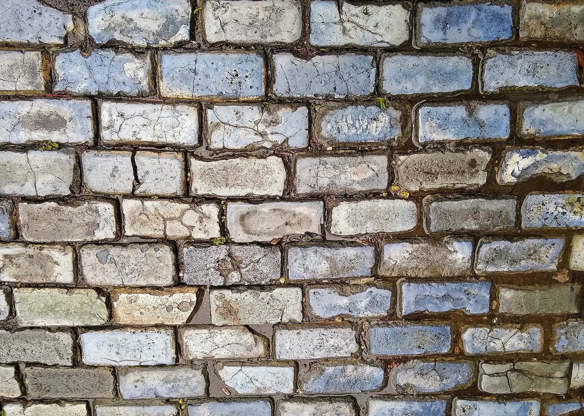
The walled old city, founded in 1521 and the oldest city under the US flag, fills a small island at the mouth of San Juan Bay. Its grid of streets, paved with blue-tinged adoquines, blocks cast from iron-furnace slag and brought as ballast on Spanish ships, climbs between houses painted in pinks, yellows, turquoise and ochre, with wooden shutters and iron balconies dripping with plants. Calle del Cristo leads down past the Cathedral of San Juan Bautista, where the explorer Juan Ponce de León is buried, to the little Capilla del Cristo. Calle San Sebastián comes alive at night with bars and music, and plazas such as Plaza de Armas and Plaza Colón are ideal for a rest in the shade.
TipThe city's free trolleys loop through the old town, which helps on the steep streets. Wear shoes with grip, as the adoquines are slippery after rain.
- 3
La Fortaleza and Paseo de la Princesa
Photo: vxla, CC BY 2.0, via Wikimedia Commons
La Fortaleza, built in the 1530s as the city's first fortification, is now the oldest executive mansion in continuous use in the Western Hemisphere, the official residence of Puerto Rico's governor. Together with the forts and city walls, it was listed by UNESCO in 1983. Its whitewashed and pastel façade closes the end of Calle Fortaleza, a street often decorated overhead with umbrellas or other art installations. Below the walls, the Paseo de la Princesa is a broad promenade along the bay, with a fountain, food stalls at weekends and a gate through the city wall, the Puerta de San Juan, through which arriving officials once entered.
TipGuided visits to La Fortaleza's gardens and rooms have been offered at times, but they depend on the governor's office; check locally rather than counting on one.
- 4
Castillo San Cristóbal
The largest fortification the Spanish built in the Americas protected the old city from attack by land, sprawling across about eleven hectares at the eastern edge of Old San Juan. A system of moats, ramparts, outworks and tunnels was designed so that each part could defend the next. Its sentry boxes, the garitas, have become a symbol of Puerto Rico, and the Garita del Diablo, the "devil's sentry box" perched over the sea, comes with a ghost story. San Cristóbal is usually quieter than El Morro, and its upper walls give a fine view over the old city's rooftops.
- 5
Condado
Photo: P. Hughes, CC BY-SA 4.0, via Wikimedia Commons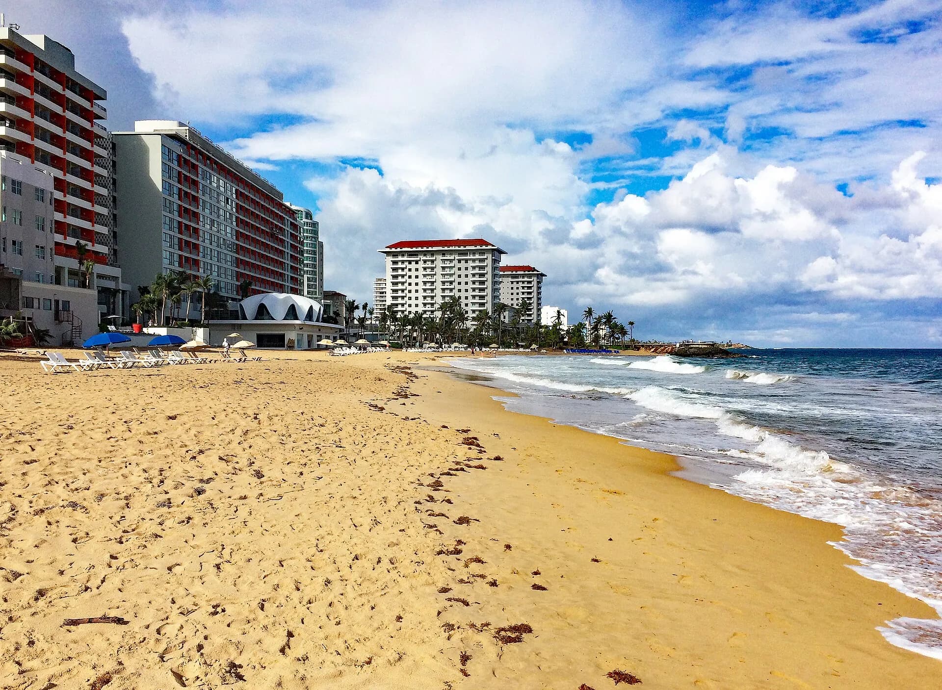
East of the old city, past the green lagoon and the Puente Dos Hermanos bridge, the Condado district is San Juan's glamorous hotel strip, a narrow neighbourhood between the Atlantic and the Condado lagoon. Ashford Avenue is lined with towers, restaurants and boutiques, and the beaches, though sometimes rough, are a short walk from almost every hotel. Further east, Ocean Park and Isla Verde have broader, calmer sands, and in Santurce, the inland neighbourhood behind Condado, La Placita market turns into a big outdoor party on weekend nights, while the streets around Calle Cerra are covered in large-scale murals.
TipThe Condado lagoon is calmer than the sea and popular for paddleboarding and kayaking, often with manatees in sight.
- 6
Piñones
Photo: Edgar Torres, CC BY 3.0, via Wikimedia Commons
Just beyond the airport, the road leaves the city behind and runs through palm groves and mangroves along the coast of Loíza, a town that is the heart of Afro-Puerto Rican culture. Roadside kiosks fry up bacalaítos, salt-cod fritters, alcapurrias of plantain and yautía stuffed with crab or meat, and piononos, all washed down with coconut water drunk straight from the shell. A paved boardwalk and cycle path follows the coast through the Piñones State Forest, with mangrove lagoons and quiet beaches.
TipWeekend afternoons are lively and fun; on weekdays the kiosks are calmer but some are closed. In late July, Loíza celebrates the Fiestas de Santiago Apóstol with vejigante masks.
- 7
El Yunque National Forest
Photo: Gordon Tarpley, CC BY 2.0, via Wikimedia Commons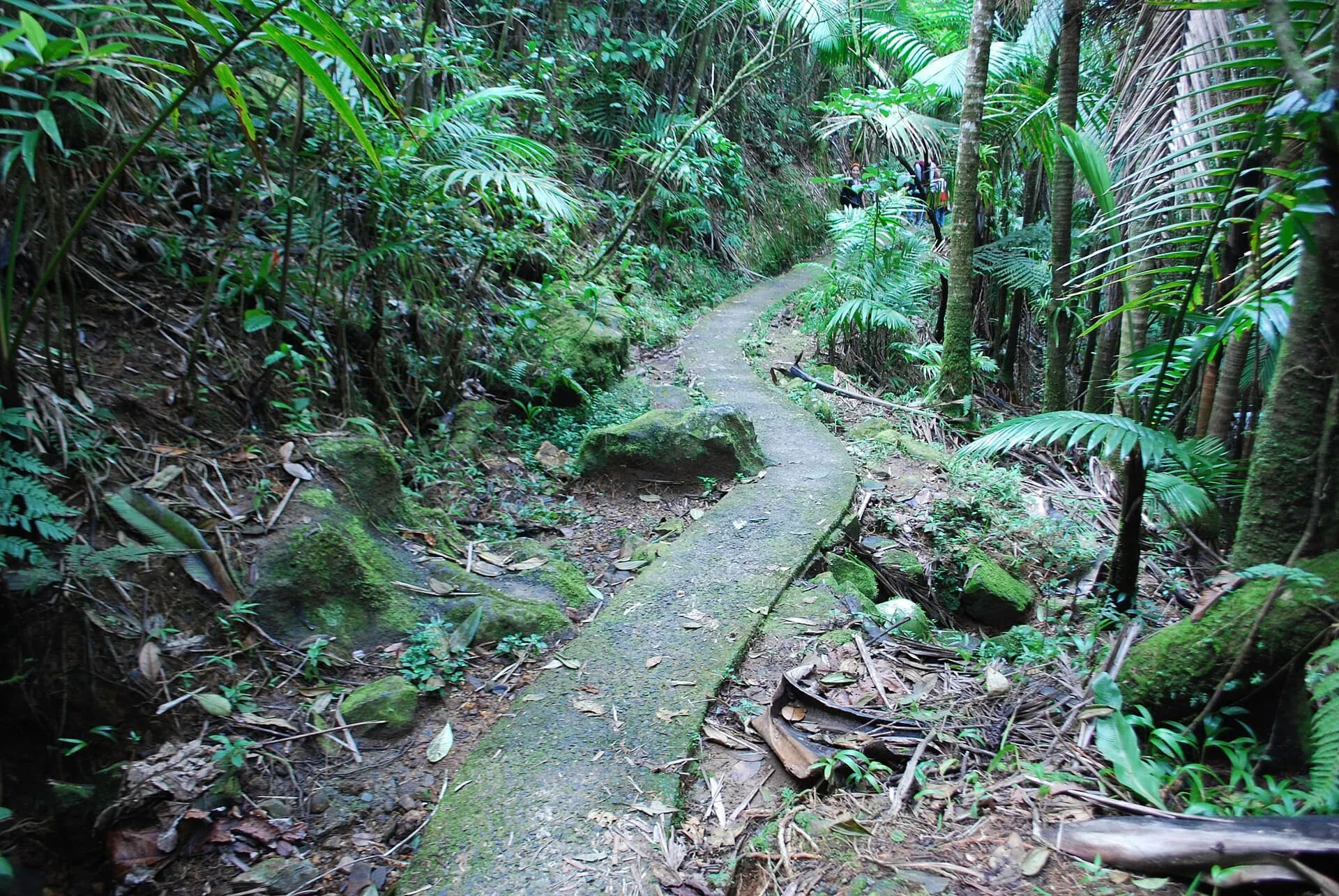
Rising to over 1,000 metres in the Luquillo Mountains, El Yunque catches the trade winds and with them a deluge of rain: the upper slopes receive several metres a year. The result is a dense forest of tabonuco and palo colorado trees, giant tree ferns, sierra palms and bromeliads, alive with the chirp of the tiny coquí frog and home to the critically endangered Puerto Rican parrot. El Portal, the visitor centre near the entrance on PR-191, has exhibits on the forest's ecology, and the road climbs past waterfalls, viewpoints and the stone Yokahú Tower to trailheads higher up.
TipThe reservation system once required for PR-191 was suspended in 2023 and had not returned by late 2026. Entry to the recreation corridor is free and first come, first served from 8am to 5pm, with the gate closing temporarily when the car parks fill, so arrive early, especially at weekends. Several trails, including La Mina and the upper section to El Yunque peak, have been closed for long periods since the hurricanes; check the Forest Service alerts page. El Portal closes for maintenance for about two weeks each September.
- 8
La Coca Falls
Photo: Jami430, CC BY-SA 4.0, via Wikimedia Commons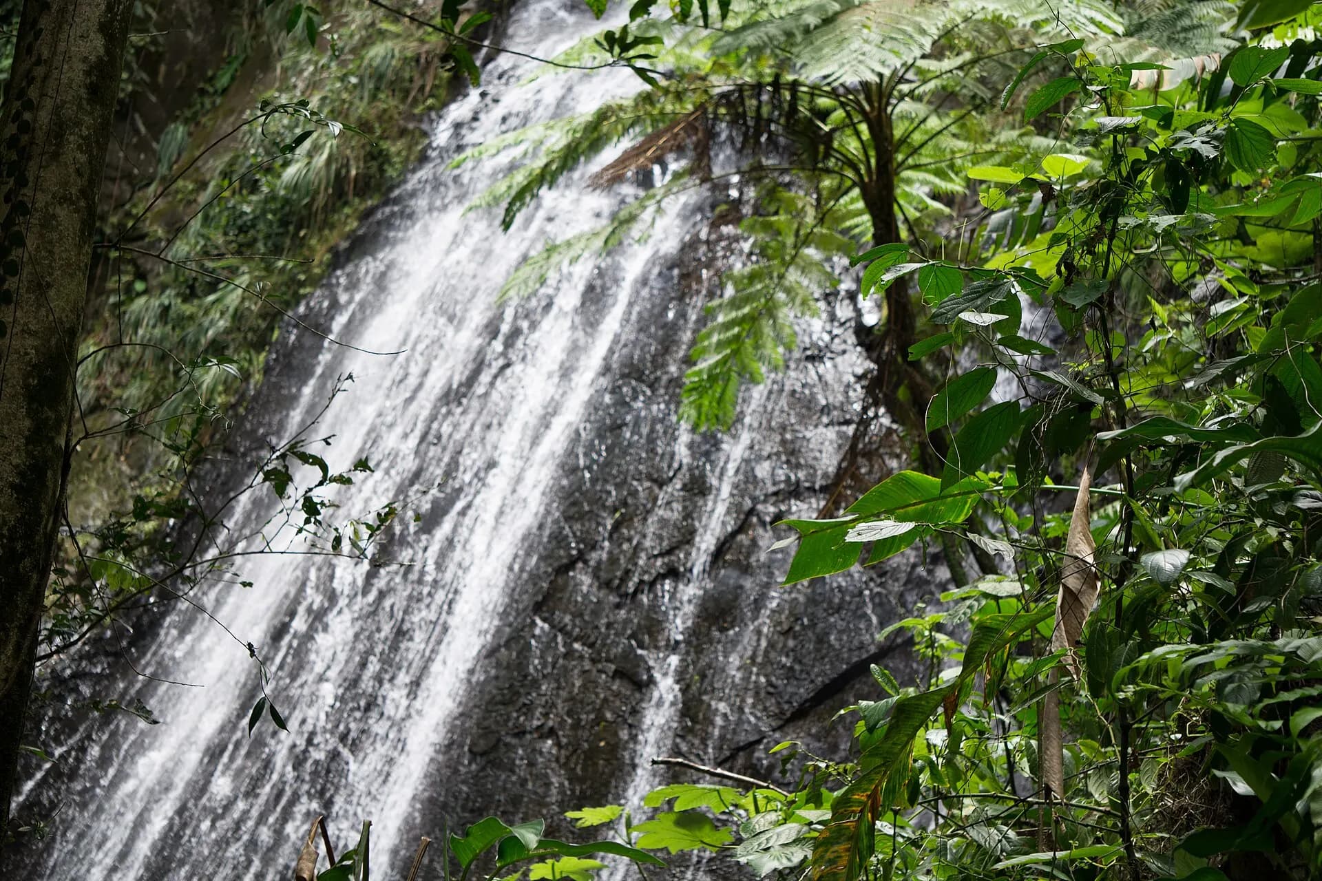
The first big waterfall along PR-191, La Coca tumbles some 25 metres down a rock face right beside the road, so it's visible without a hike. It's at its most impressive after rain. Nearby, the La Coca trail drops steeply into the forest to cross streams; it's muddy and slippery, and best left to hikers with good footwear. Further up, the Yokahú Tower and short paved paths such as the Baño Grande trail, past a pool built in the 1930s, offer easier walks.
TipParking at La Coca is limited to a few roadside bays. Never cross streams or swim in the forest's pools when rain is falling upstream, as flash floods can rise quickly.
- 9
Luquillo kiosks
Photo: Güldem Üstün, CC BY 2.0, via Wikimedia Commons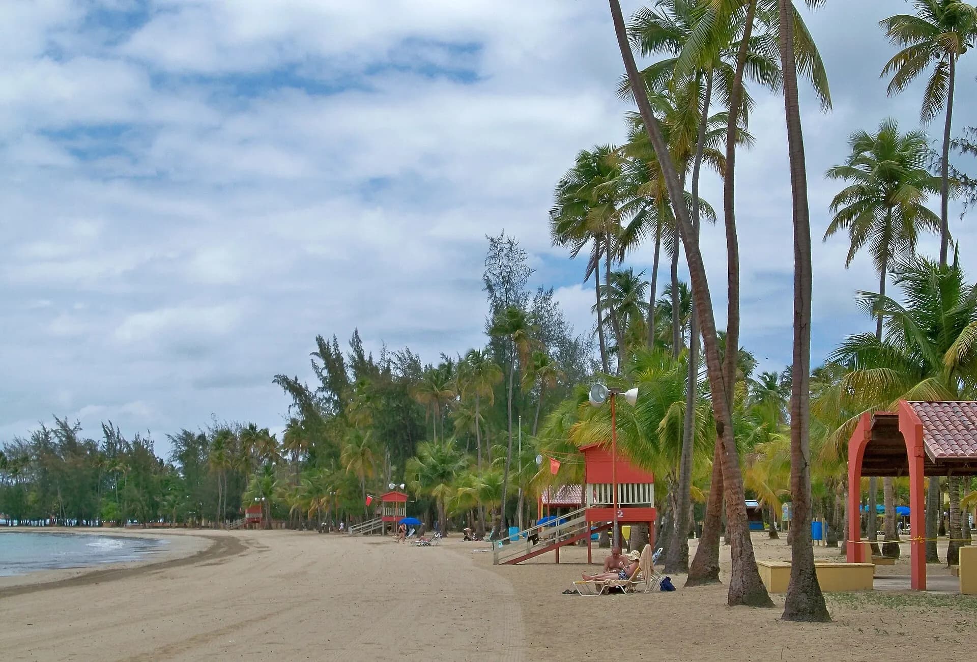
Luquillo's balneario, a public beach backed by coconut palms and protected by an offshore reef, is one of the calmest and prettiest beaches near San Juan, with El Yunque's peaks behind it. Beside it, along Route 3, a long row of numbered kioskos, more than fifty small restaurants and bars, serves everything from mofongo and seafood empanadillas to tacos, burgers and piña coladas. It's the classic stop for lunch or an early dinner after a morning in the rainforest.
TipPublic balnearios charge a small parking fee and have lifeguards, toilets and showers. Lifeguard hours are limited, and swimming outside them is at your own risk.
- 10
Laguna Grande, Fajardo
Photo: Bjoertvedt, CC BY-SA 4.0, via Wikimedia Commons
Puerto Rico has three of the world's few bioluminescent bays, and Laguna Grande is the easiest to reach from San Juan. The lagoon lies in Las Cabezas de San Juan, a nature reserve on the island's north-eastern tip, and is fed by a narrow channel through the mangroves. At night, tiny organisms called dinoflagellates light up blue-green when disturbed, so every paddle stroke and trailing hand leaves a glowing streak. Guided kayak tours set off from Las Croabas, paddling through the dark mangrove channel to the open lagoon.
TipSwimming in Laguna Grande is not allowed. The glow is far brighter on dark, moonless nights; avoid the days around the full moon. Skip insect repellent and sunscreen just before the tour to protect the water.
- 11
Flamenco Beach, Culebra
Photo: Carolyn Sugg, CC BY-SA 2.0, via Wikimedia Commons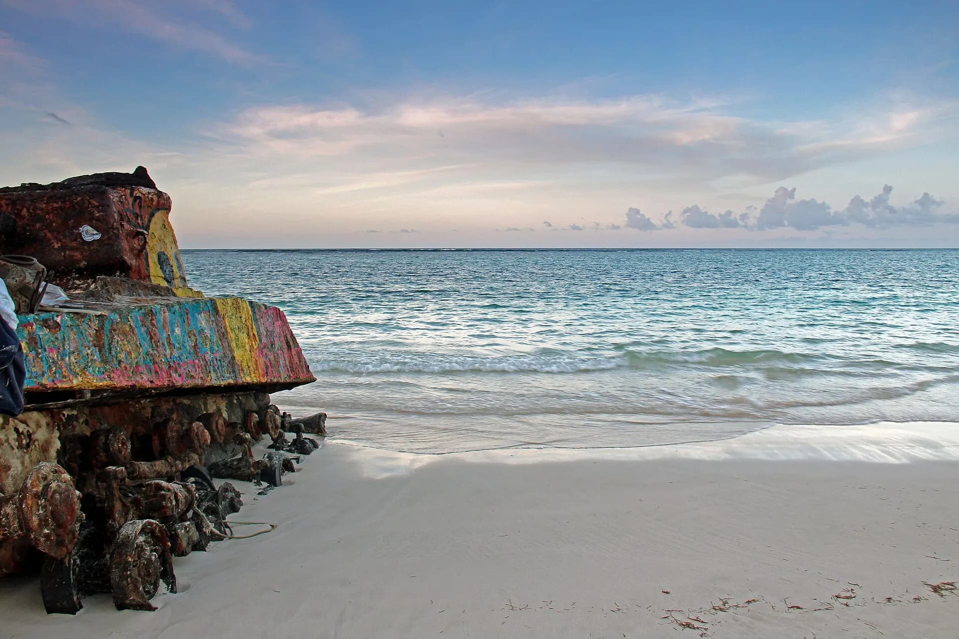
Culebra is a small, sleepy island off the east coast, between the main island and the Virgin Islands, with no big resorts and a laid-back village, Dewey, by the ferry dock. Its star is Flamenco Beach, a horseshoe of fine white sand and clear, turquoise water that regularly appears on lists of the world's best beaches. Rusting tanks left from the US Navy's bombing range, which closed in 1975, sit at one end, now painted with graffiti. Snorkellers head to Tamarindo and Carlos Rosario beaches, or take a water taxi to the uninhabited cay of Culebrita.
TipFerries from Ceiba sell out on weekends and holidays; book well ahead or fly from San Juan on a small plane. Non-residents pay higher fares than islanders since a fare change in May 2026. Golf carts and jeeps are the usual transport on the island and are limited, so reserve before you go.
- 12
Mosquito Bay, Vieques
Photo: Edgar Torres, CC BY 3.0, via Wikimedia Commons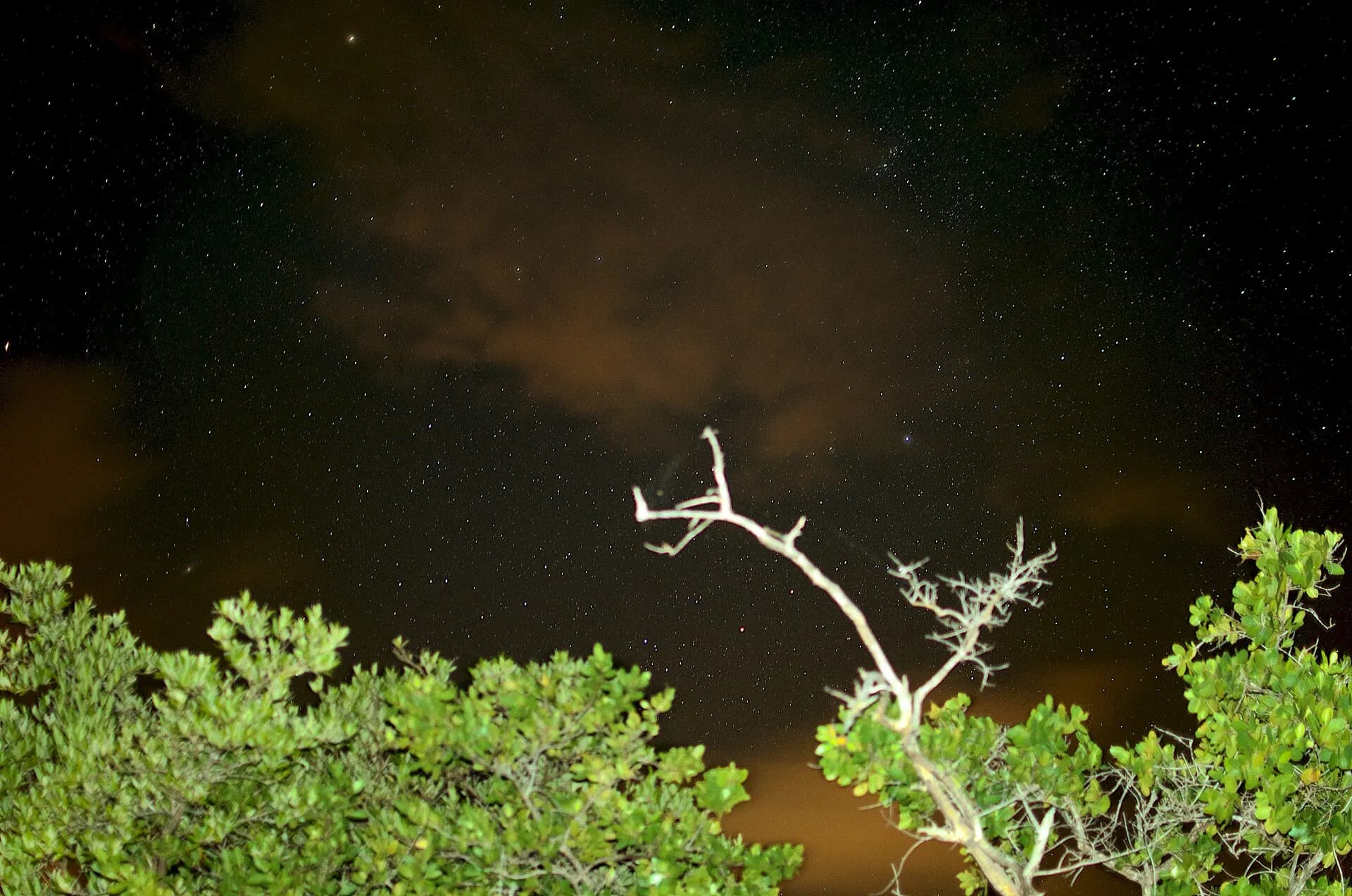
Vieques, larger and greener than Culebra, has wild horses wandering its roads, a string of empty beaches in the former Navy lands that now form a national wildlife refuge, and two small towns: Isabel Segunda on the north coast and the waterfront village of Esperanza on the south. Its great attraction is Mosquito Bay, often described as the brightest bioluminescent bay in the world. A narrow mouth keeps the organisms concentrated, and on a dark night the water shimmers with almost unbelievable intensity. Tours by kayak or electric boat leave from Esperanza in the evenings.
TipSwimming is not permitted, and only licensed operators can take visitors into the bay. Book with an established operator, and plan your trip around the moon: on full-moon nights, tours may not run.
- 13
Ponce
Photo: Ian Poellet, CC BY-SA 4.0, via Wikimedia Commons
Puerto Rico's second historic city, on the Caribbean coast south of the mountains, grew rich on sugar, rum and coffee in the nineteenth century and has a grand, slightly faded charm. The Plaza Las Delicias has fountains, the cathedral of Our Lady of Guadalupe, and the Parque de Bombas, a red-and-black striped wooden firehouse of 1882 that is the city's emblem. The Museo de Arte de Ponce, in a building by Edward Durell Stone, has one of the finest art collections in the Caribbean, including Frederic Leighton's Flaming June. On a hill above the town, the Castillo Serrallés, the mansion of a rum dynasty, looks out over the city and the sea.
TipThe drive from San Juan on the PR-52 toll motorway takes around an hour and a half. Ponce's seafront boardwalk, La Guancha, is a good place to watch the sunset.
- 14
Guánica Dry Forest
Photo: Oquendo from Freeport, NY, CC BY 2.0, via Wikimedia Commons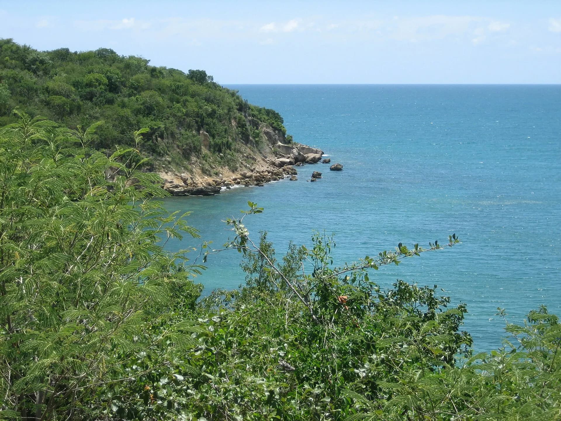
A world away from El Yunque, the Guánica State Forest on the south-west coast is one of the best-preserved subtropical dry forests in the world and a UNESCO biosphere reserve. Trails wind through cactus, gumbo-limbo and twisted lignum vitae trees, home to many endemic birds, and drop to quiet coves and the coastline of Ballena Bay. Off the coast, Gilligan's Island, a mangrove cay reached by a short boat ride, has shallow water good for snorkelling.
TipIt is hot and shadeless out here; walk in the early morning and carry plenty of water. Ferries to Gilligan's Island run from the Guánica waterfront and are reduced or suspended at times, so check before you go.
- 15
Los Morrillos Lighthouse, Cabo Rojo
Photo: Jerjes Medina Albino, CC BY-SA 3.0, via Wikimedia Commons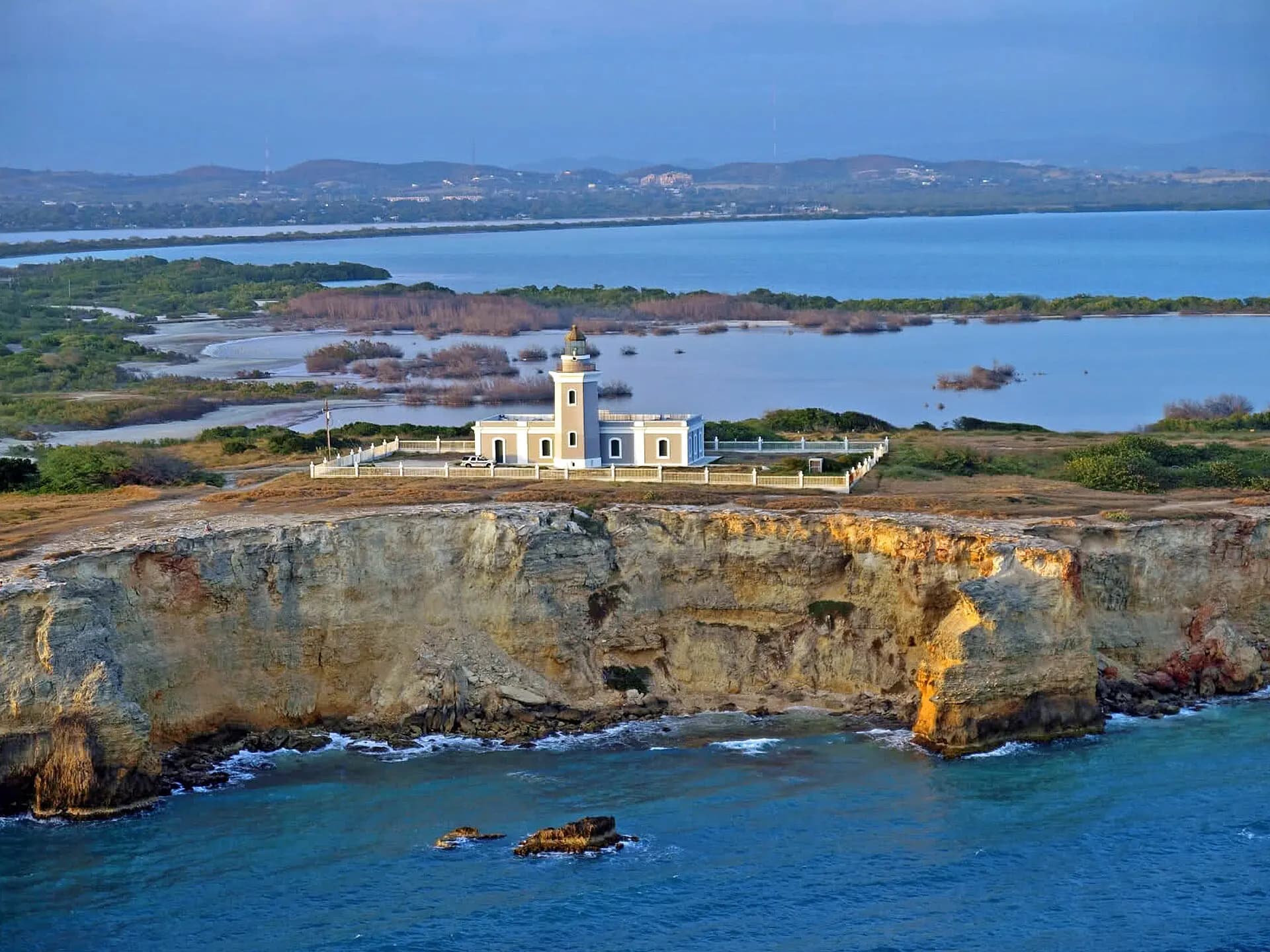
At the island's south-western corner, the Faro Los Morrillos stands on limestone cliffs that glow pinkish-red at sunset, giving the cape its name. Built in 1882, the lighthouse looks down on a natural arch, a sheer drop to the sea, and the crescent of Playa Sucia, a beautiful beach despite its name. On the way in, the road crosses the Cabo Rojo salt flats, where salt has been harvested for centuries and pink-tinged pools attract shorebirds. Nearby, the fishing village of La Parguera has its own small bioluminescent bay and a maze of mangrove cays.
TipThe cliff edges have no railings; stay well back, especially in wind. Bring water and sun protection, as there's little shade and few facilities.
- 16
Rincón
Photo: M S, CC BY-SA 2.0, via Wikimedia Commons
On the island's westernmost point, Rincón became Puerto Rico's surf town after it hosted the world surfing championships in 1968, and it keeps a relaxed, international feel. From roughly November to March, big swells roll into breaks such as Domes, Maria's and Tres Palmas, while in summer the sea is calm enough for snorkelling at Steps Beach. Humpback whales pass close to the shore in winter, often visible from the lighthouse park at Punta Higüero, and the sunsets over the Mona Passage are legendary.
TipWinter surf is powerful and best left to experienced surfers; beginners will find gentler waves and surf schools at beaches such as Sandy Beach and Pools.
- 17
Arecibo Observatory
Photo: Mariordo (Mario Roberto Durán Ortiz), CC BY-SA 4.0, via Wikimedia Commons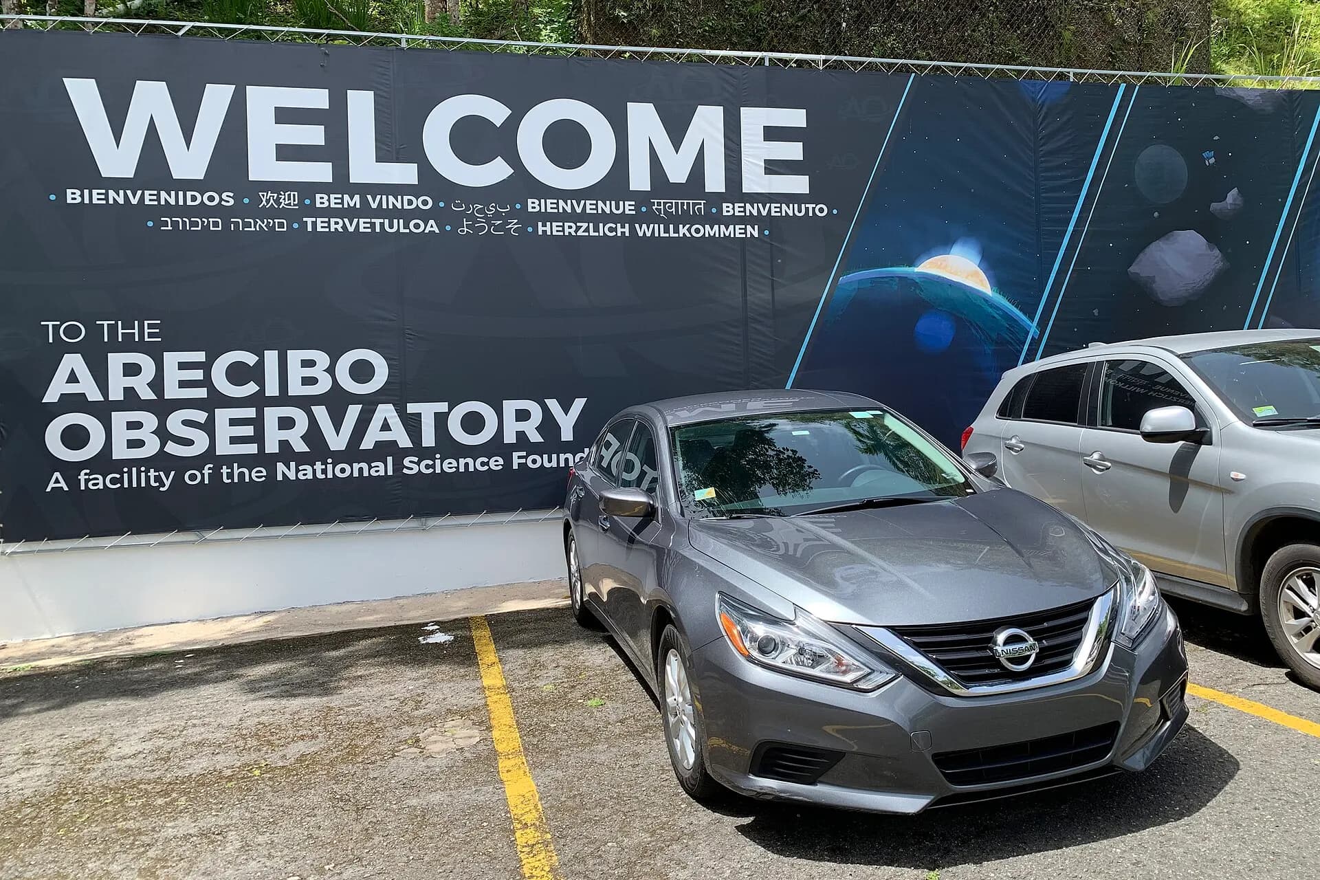
For more than half a century, the 305-metre radio dish set into a sinkhole near Arecibo was the largest single-aperture telescope in the world, famous for the 1974 Arecibo message and for its appearances in films. It collapsed in 2020, and research using the big dish has ended, but the site has been reborn as the Arecibo C3 science and visitor centre, focused on science education. In 2026 it was reopening in phases, with a preview of a new exhibition and historic tours.
TipTickets must be bought online at least a day ahead, with no sales at the gate. The nearby Río Camuy Cave Park, once one of the island's top attractions, has been closed since 2023, with no confirmed reopening date as of late 2026; check before planning around it.
- 18
Cueva Ventana
Photo: J & E, CC BY 2.0, via Wikimedia Commons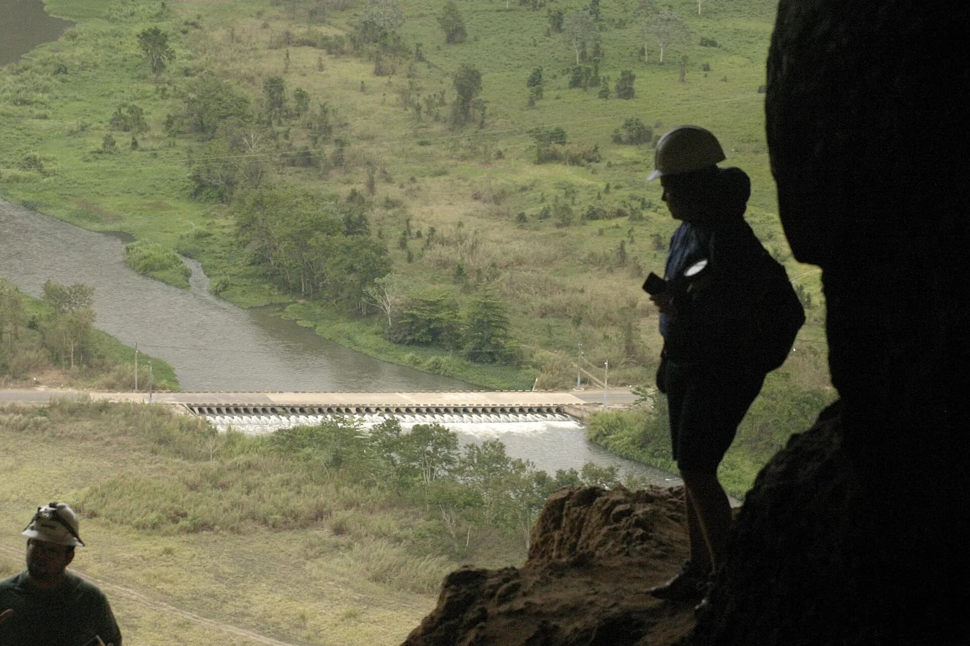
In the karst hills between Arecibo and Utuado, a short guided walk leads through a cave full of stalactites and bats to its "window": a wide opening in the cliff face that frames a sweeping view over the green Río Grande de Arecibo valley. The surrounding karst country, of haystack hills, sinkholes and underground rivers, is one of the island's most distinctive landscapes, and the inland roads through it, though slow and winding, pass coffee farms and roadside lechoneras.
TipVisits are by guided tour from the site on the PR-10, and the walk is short but uneven; wear closed shoes.
When to go
Puerto Rico is warm all year, with daytime temperatures around 27 to 32°C on the coasts and cooler air in the mountains. The driest and most popular season runs from mid-December to April, when hotels are fullest and prices highest, especially over Christmas, which in Puerto Rico stretches all the way to the San Sebastián street festival in Old San Juan in mid-January. This is also the season for whale watching and big surf in Rincón.
The Atlantic hurricane season lasts from June to November, peaking from August to October. Hurricanes Irma and Maria in 2017 and Fiona in 2022 caused immense damage, and power and water cuts can follow even milder storms. Travel in this season is cheaper and usually fine, but buy flexible bookings and insurance. May, June and November make a good compromise. Rain falls in short, heavy bursts year-round in the north and east, and El Yunque is wet in every month.
Getting around
Most visitors fly into Luis Muñoz Marín International Airport in Carolina, east of San Juan; there are also smaller international airports at Aguadilla, in the north-west, and Ponce. In San Juan, the old town and Condado are walkable, taxis and ride-hailing apps are easy to find, and buses link the main districts, but beyond the capital public transport is scarce.
To explore the island, rent a car. Driving is on the right, distances are in kilometres while speed limits are in miles per hour, and the main motorways, such as PR-22 to Arecibo and PR-52 to Ponce, are tolled electronically, so make sure your hire car has an AutoExpreso tag. Mountain roads are narrow and winding, and traffic around San Juan is heavy at rush hour.
For Culebra and Vieques, the government ferry service runs passenger boats from Ceiba, on the east coast about an hour from San Juan. Fares are very low for residents, higher for visitors since May 2026, and boats fill up fast at weekends and holidays, so buy tickets online in advance. Schedules change and crossings are cancelled in rough weather, so leave a buffer before any flight home. Small planes also fly to both islands from San Juan and Ceiba. Most hire companies don't allow their cars on the ferry, so rent a jeep or golf cart on the islands.
Local tips
- US citizens need no passport to visit from the mainland; other visitors follow US entry rules, including an ESTA or visa.
- Spanish is the main language, though English is widely spoken in tourist areas. A few words of Spanish go a long way outside San Juan.
- Tip as on the mainland, around 15 to 20 per cent in restaurants; check bills, as some add a service charge.
- Tap water is generally safe, but after storms boil notices can be issued; follow local advice.
- Swim only at beaches with lifeguards where possible. The north coast faces the open Atlantic, and rip currents cause drownings every year.
- Don't leave valuables in parked cars, especially at beach car parks and trailheads.
- Mosquitoes can carry dengue, which has seen outbreaks in recent years; use repellent, especially around dawn and dusk.
Eat and drink
Puerto Rican cooking, cocina criolla, blends Taíno, Spanish and African traditions. The signature dish is mofongo, green plantains mashed with garlic and pork crackling, often stuffed with shrimp or served in a garlicky broth. Arroz con gandules, rice with pigeon peas, is the national side dish, and pernil, slow-roasted pork shoulder, is the centrepiece of any celebration. On the road south of San Juan, the town of Cayey's Guavate district is lined with lechoneras roasting whole pigs on spits, busy with music and families at weekends.
Snacks include alcapurrias, bacalaítos and empanadillas from beach kiosks, and the tripleta, a sandwich of three meats. Sweet treats include tembleque, a coconut pudding, and quesitos, cream-cheese pastries from the bakery. Rum is everywhere: the Bacardí distillery in Cataño, across the bay from Old San Juan, runs tours, and the piña colada is said to have been invented in San Juan in the 1950s. At Christmas, look for coquito, a coconut and rum eggnog. Local coffee from the central mountains is excellent and well worth seeking out.
Where to stay
Old San Juan has boutique hotels and guesthouses in restored colonial buildings and puts the forts and nightlife on your doorstep; Condado, Ocean Park and Isla Verde offer beach hotels and resorts within a short taxi ride. For the east, Fajardo or Luquillo make a good base for El Yunque, Laguna Grande and the ferries. On Culebra and Vieques, accommodation is small-scale, mostly guesthouses and rentals, and Esperanza is the obvious base for Mosquito Bay. In the south-west, Ponce has historic hotels in the old centre, while Cabo Rojo and La Parguera have relaxed inns and seafood restaurants. Rincón is full of surf lodges, cabins and holiday rentals, and makes the best base for the west coast.
A short history
Before Columbus arrived in 1493, the island was home to the Taíno, who called it Borikén; the name survives in the word Boricua, which Puerto Ricans use for themselves. The ceremonial ball courts at Caguana, in the mountains near Utuado, are among the most important Taíno sites in the Caribbean. Spanish colonisation, starting in 1508 under Juan Ponce de León, devastated the Taíno population, and enslaved Africans were brought to work the sugar plantations, shaping the island's culture and music, from bomba to plena.
San Juan's forts made it the military key to the Spanish Caribbean, much as in Havana and Cartagena; see our Havana and Cartagena guides for its sister cities. After the Spanish-American War of 1898, Puerto Rico passed to the United States. Its people became US citizens in 1917, and since 1952 it has been a self-governing commonwealth, though questions of status, whether statehood, independence or the present arrangement, remain a lively political debate.
Responsible travel
The bioluminescent bays are fragile ecosystems: follow the guides' instructions, don't wear repellent or sunscreen in the water, and choose licensed operators. Reef-safe sunscreen helps protect the coral off Culebra, Vieques and Guánica, and you should never stand on or touch coral. In El Yunque, keep to marked trails and never feed wildlife. Leatherback and hawksbill turtles nest on some beaches between spring and summer, so keep lights and distance at night if you see marked nests. Hurricane recovery is still going on in places, and tourism is an important part of it: eat at family kiosks and lechoneras, buy local crafts, coffee and rum, and spend time beyond San Juan, where your money goes furthest. For another Caribbean escape further west, see our Cancún guide.