Belize
A small, English-speaking country where the second-longest barrier reef on Earth runs offshore and jungle-wrapped Maya temples rise just inland.
- Best time to go
- Late November to April for the dry season and calm seas; March to June for whale sharks off Placencia; June to November is hurricane season
- Local time
- –
- Currency
- Belize Dollar (BZD)
- Reading time
- 17 min
- Language
- English and Spanish
Belize is a sliver of a country on the Caribbean side of Central America, wedged between Mexico's Yucatán and Guatemala, with fewer people than many European cities and a landscape that packs a remarkable amount into a small space. Offshore, the Belize Barrier Reef runs for roughly 300 kilometres, the longest in the northern hemisphere, scattered with more than a hundred low sandy cayes and three of the Caribbean's four true coral atolls. Inland, rainforest, pine savannah and limestone hills hide the ruins of Maya cities that once held tens of thousands of people, along with caves the Maya treated as gateways to the underworld.
It is also the only country in Central America where English is the official language, a legacy of its time as British Honduras, which ended with independence in 1981. On the street you'll hear Belizean Kriol, Spanish, Garifuna, Q'eqchi' and Mopan Maya, and Plautdietsch among the Mennonite farming communities. The mix shows up in the food, the music and the easy-going pace.
The stops below follow a loop of about two weeks: from Belize City north to the Maya sites of Altun Ha and Lamanai, out to the islands of Ambergris Caye and Caye Caulker and the atoll of Lighthouse Reef, then west through the Cayo District for caves, ruins and waterfalls, and finally south-east to the jaguar reserve at Cockscomb and the beaches of Hopkins and Placencia. With a week, most people pair one island with Cayo. Many travellers arrive overland from Mexico's Riviera Maya, covered in our Tulum guide, or continue west into Guatemala to Tikal and on to Antigua Guatemala.
The top 19 in Belize
- 1
Belize City
Photo: Kreuzschnabel, CC BY-SA 3.0, via Wikimedia Commons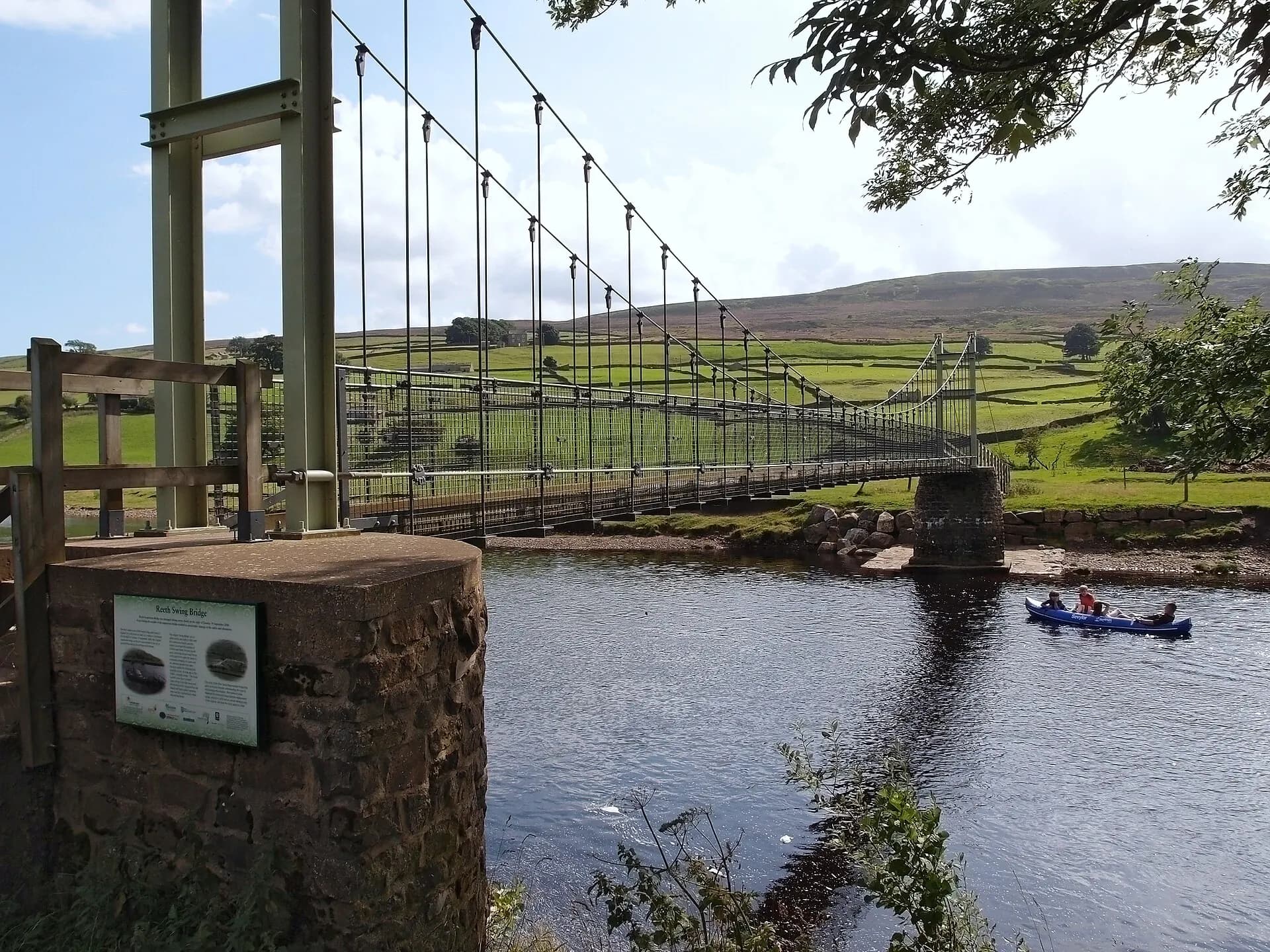
The former capital, still the largest town and the country's transport hub, is somewhere most visitors pass through rather than linger in. The government moved inland to purpose-built Belmopan in 1970, after Hurricane Hattie flooded the low-lying city in 1961. A few hours are enough to see the hand-operated Swing Bridge over Haulover Creek, one of the last of its kind still in use; St John's Cathedral, begun in 1812 and the oldest Anglican church in Central America; and the Museum of Belize, in a former colonial prison, with good displays of Maya jade, pottery and coins. The Fort George waterfront has the water-taxi terminals for the cayes.
TipBelize City has a reputation for petty and occasionally violent crime in some neighbourhoods. Stick to the centre and the Fort George area by day, and take a taxi after dark.
- 2
Altun Ha
Photo: Denis Barthel, CC BY-SA 4.0, via Wikimedia Commons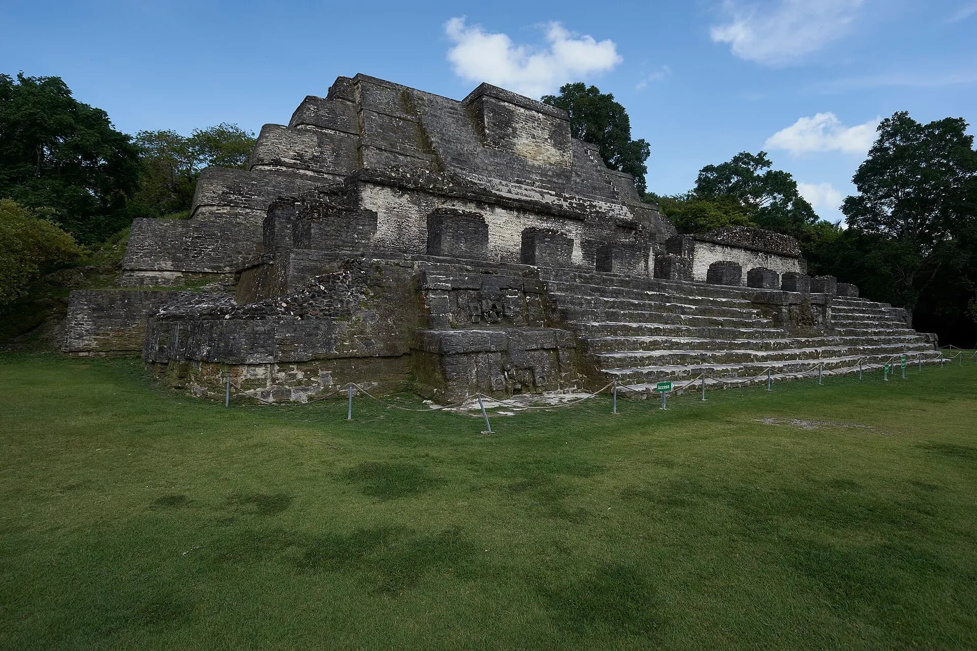
About an hour north of Belize City, Altun Ha was a wealthy trading and ceremonial centre in the Classic period, close enough to the coast to deal in jade, obsidian and marine shell. Its two main plazas are compact and easy to explore, framed by restored pyramids. The tallest, the Temple of the Masonry Altars, is the one you'll see on the label of Belikin, the national beer, and in a tomb deep inside it archaeologists found a carved jade head of the sun god, the largest worked jade object known from the Maya world, which now appears on Belizean banknotes.
TipAltun Ha is the easiest Maya site to reach from Belize City and a popular cruise excursion; arrive early or late to avoid the groups.
- 3
Lamanai
Photo: Martin Falbisoner, CC BY-SA 4.0, via Wikimedia Commons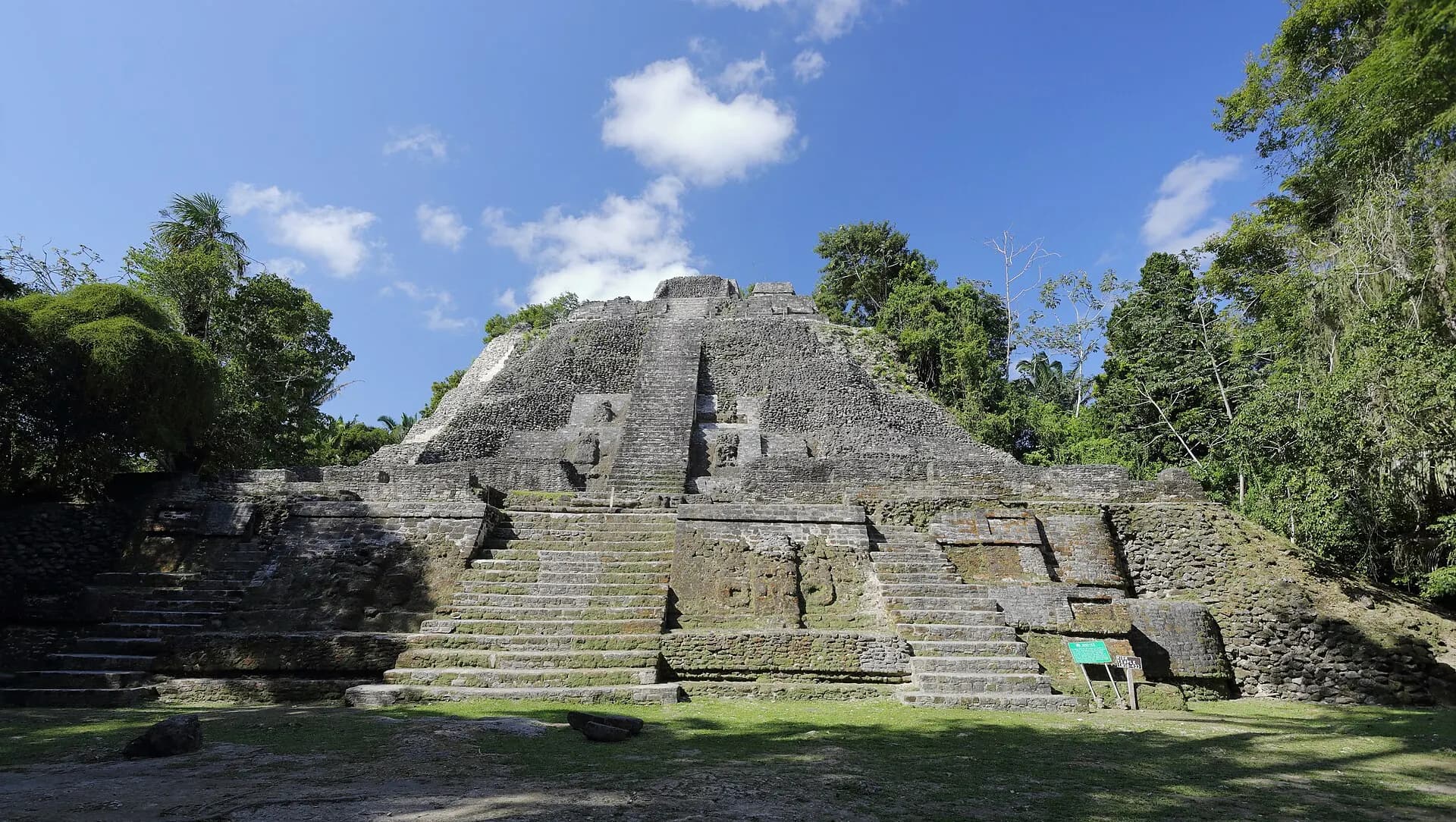
Lamanai is reached in the most memorable way: by a fast boat ride of about an hour and a half up the New River from near Orange Walk Town, past mangroves, Mennonite farms and, if you're lucky, crocodiles, iguanas and herons on the banks. The name is usually translated as "submerged crocodile", and the site was lived in for longer than almost any other Maya city, from well before 1000 BC until after the Spanish arrived, when friars built churches here whose ruins still stand. In the forest are the Mask Temple, with huge stucco faces on its façade, the Jaguar Temple, and the High Temple, whose steep steps lead to a view over the canopy and the river lagoon.
TipHowler monkeys live around the site and are noisiest early in the day. Tours from Orange Walk usually include lunch and the boat ride; bring insect repellent.
- 4
Ambergris Caye and San Pedro
Photo: Psubhashish, CC BY-SA 4.0, via Wikimedia Commons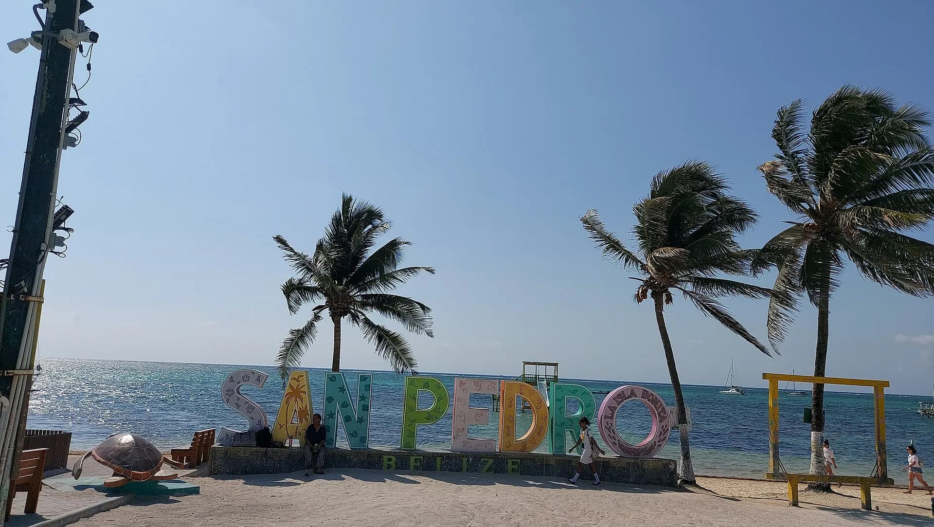
The largest of Belize's islands is a long, narrow strip of mangrove and sand stretching up towards Mexico, with the reef running just offshore, close enough to hear the surf breaking on it. San Pedro, the island's only town, grew from a fishing village into the country's busiest resort, and its sandy streets are full of golf carts, beach bars, dive shops and restaurants. Resorts spread north and south along the coast. There are few broad beaches, as the calm lagoon behind the reef keeps seagrass close to shore, so most life happens on docks and in the water: snorkelling, diving, sailing, kayaking and fly fishing for bonefish and tarpon on the flats.
TipGolf carts are the main transport; they're easy to rent, but drive carefully on the busy roads at night.
- 5
Hol Chan Marine Reserve
Photo: Nikdahl, CC BY-SA 3.0, via Wikimedia Commons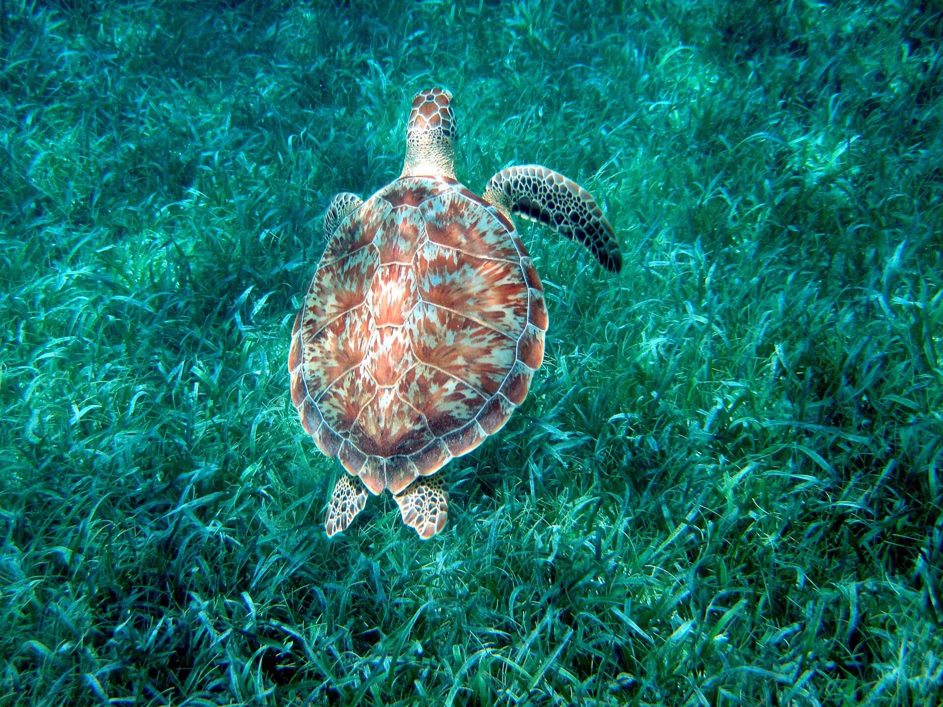
Set up in 1987 as Belize's first marine reserve, Hol Chan, "little channel" in Maya, protects a natural cut through the reef at the southern tip of Ambergris Caye, along with seagrass beds and mangroves behind it. Because fishing has been banned here for decades, the cut is crowded with life: snapper, grunts and parrotfish in shoals, moray eels, green turtles, spotted eagle rays and the occasional nurse shark, all a short boat ride from San Pedro. Strong currents run through the channel, so snorkellers go with licensed guides.
TipA reserve fee is charged on top of the tour price; it's usually collected by the boat operator. Ask whether it's included when booking.
- 6
Shark Ray Alley
Photo: Bernard DUPONT from FRANCE, CC BY-SA 2.0, via Wikimedia Commons
A shallow sandy patch just south of Hol Chan, inside the same reserve, where fishermen once cleaned their catch and nurse sharks and southern stingrays learnt to gather round the boats. The habit has stuck, and dozens of the harmless sharks and rays still glide in when a boat arrives, in water only two or three metres deep, so even nervous swimmers can watch them from the surface. Most Hol Chan snorkel trips combine the two sites.
TipDon't touch or feed the animals. Choose operators who follow the reserve rules, which aim to reduce the feeding that changed their behaviour in the first place.
- 7
Caye Caulker
Photo: James Willamor, CC BY-SA 2.0, via Wikimedia Commons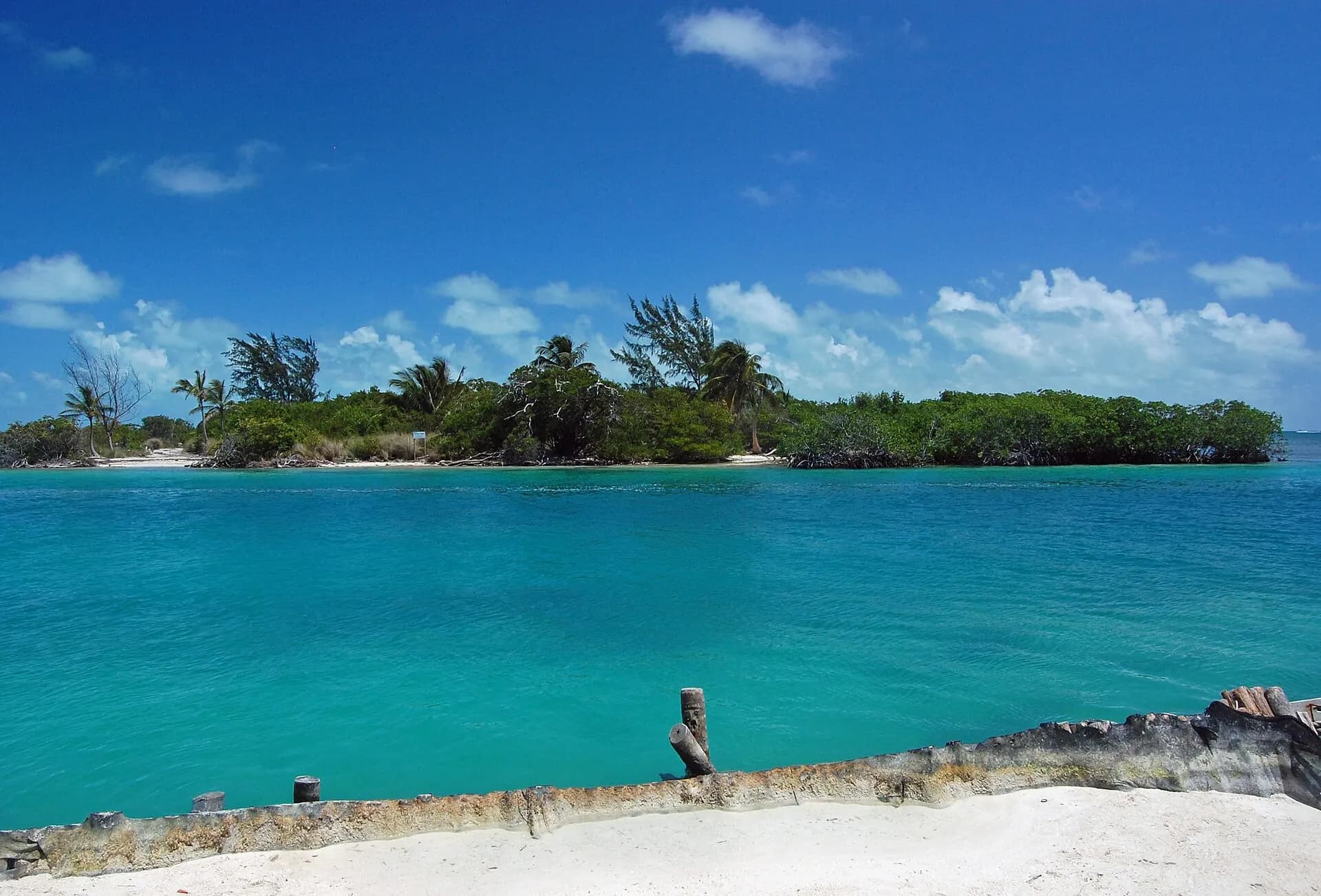
A short water-taxi ride south of San Pedro, Caye Caulker is the smaller, cheaper and more laid-back of the two main islands, with sandy lanes, brightly painted wooden houses and a "Go Slow" motto that people genuinely seem to live by. It is a favourite with backpackers and divers. At its northern end is the Split, a channel carved through the island by Hurricane Hattie in 1961, now the island's swimming spot and sunset bar. Day trips run to the reef, to Hol Chan and Shark Ray Alley, and to the manatees that feed in the waters nearby.
TipSailing trips that combine several snorkel stops are a Caye Caulker speciality, and some run all the way down to Placencia over several days, camping on small cayes.
- 8
Great Blue Hole
Photo: dronepicr, CC BY 2.0, via Wikimedia Commons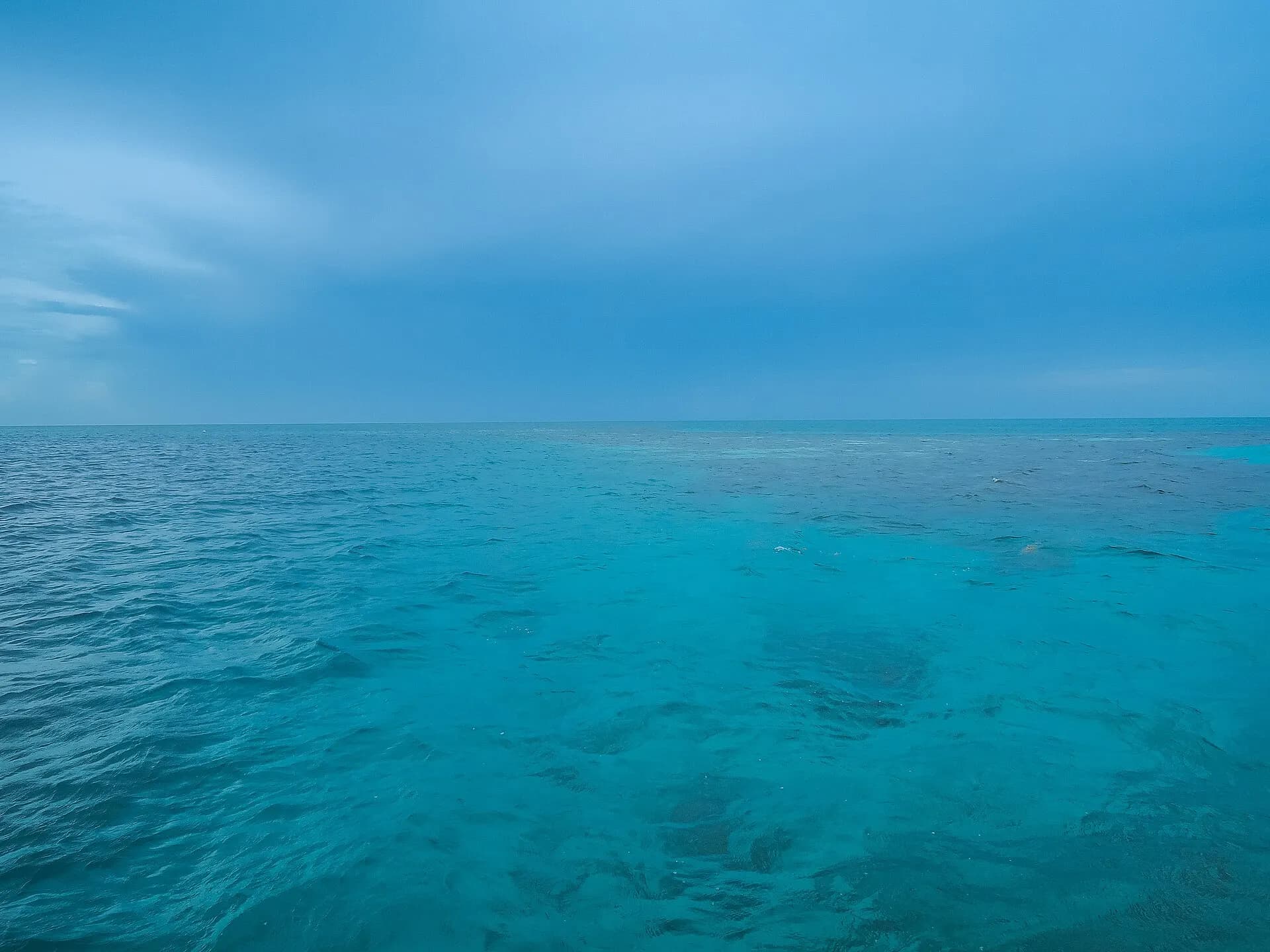
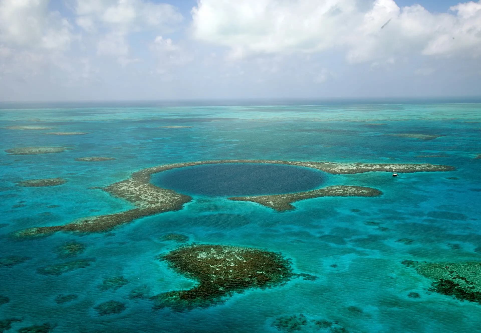
In the middle of Lighthouse Reef, the most remote of Belize's atolls, a near-perfect circle of deep blue, about 300 metres across and more than 120 metres deep, sits in the turquoise shallows of the lagoon. It is a sinkhole that formed on dry land during the last ice ages, when sea levels were far lower, and flooded as the oceans rose. Jacques Cousteau made it famous in the early 1970s. It's part of the Blue Hole Natural Monument, within the Belize Barrier Reef Reserve System World Heritage Site, managed by the Belize Audubon Society.
TipThe classic dive goes to about 40 metres to see stalactites under the overhanging wall, and is for experienced, certified divers only. The view is best from the air: scenic flights leave from San Pedro, Caye Caulker and Belize City. Day trips by boat take around two hours each way and can be cancelled in rough seas.
- 9
Half Moon Caye
Photo: dronepicr, CC BY 2.0, via Wikimedia Commons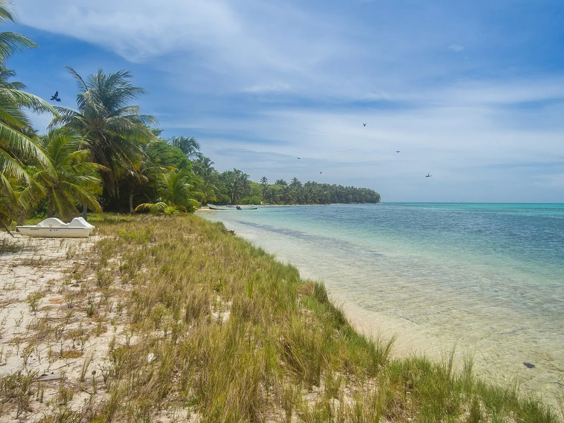
At the south-east corner of Lighthouse Reef, this small, palm-shaded island was declared a natural monument in 1982, one of Belize's earliest protected areas. Its littoral forest at the western end shelters a nesting colony of red-footed boobies, watched from a viewing platform among the treetops, alongside frigatebirds, iguanas and nesting hawksbill and loggerhead turtles on the beaches. The drop-off just offshore, the Half Moon Caye Wall, is among the best dives in the Caribbean, and Blue Hole day trips usually stop here for lunch and a walk.
TipOvernight stays are limited to a few basic camping and kayaking expeditions, which let you see the atoll after the day boats leave.
- 10
Belize Zoo
Photo: E.P. Mallory, CC BY-SA 2.0, via Wikimedia Commons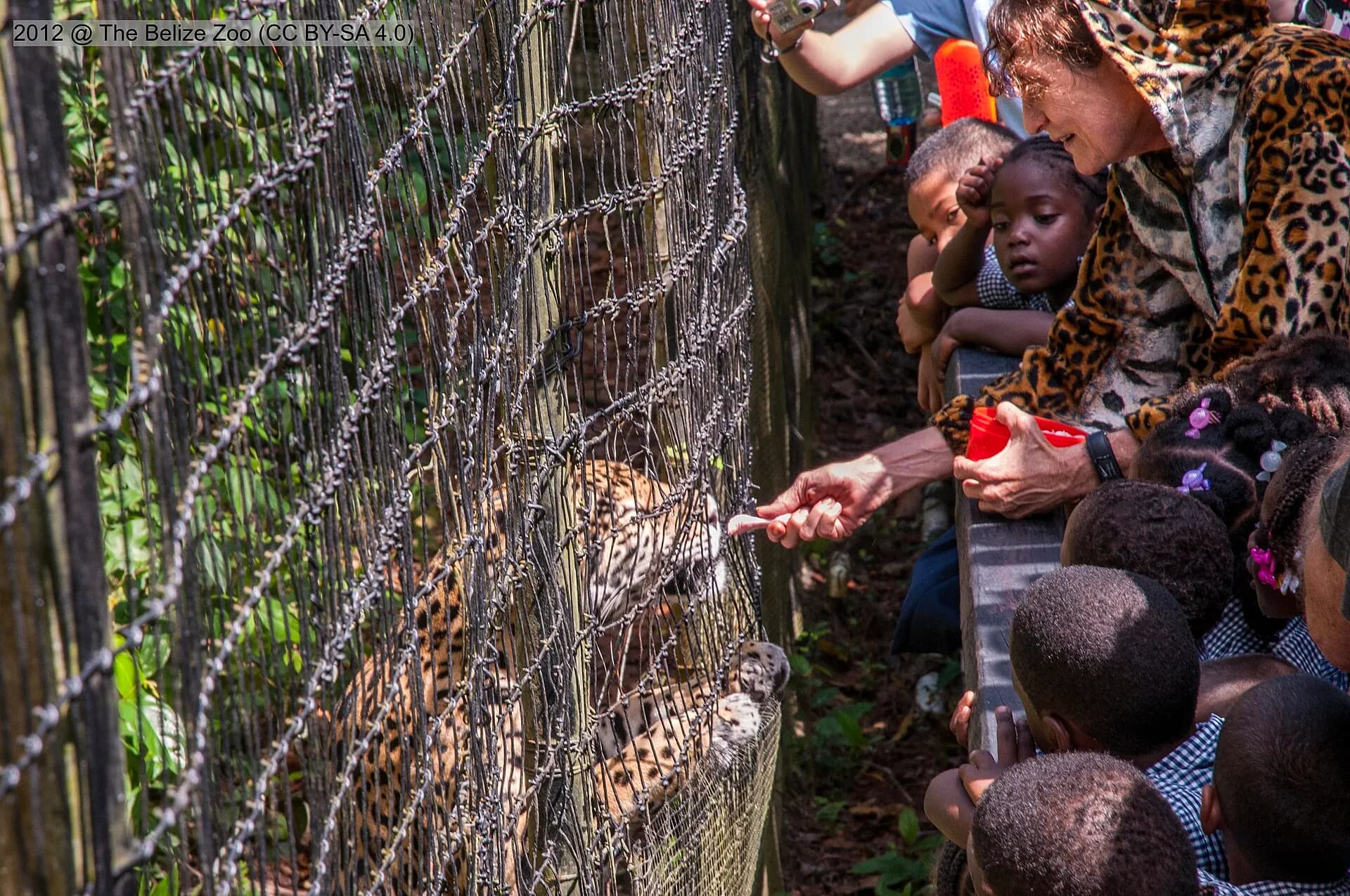
On the George Price Highway west of Belize City, this small zoo is different from most: it keeps only animals native to Belize, almost all of them orphaned, rescued, injured or born in captivity, in large enclosures set into the forest. It's the most reliable place to see the animals you're unlikely to spot in the wild, including jaguars, pumas, tapirs, the national animal, harpy eagles and the scarlet macaw. It makes a good break on the drive from the coast to Cayo.
- 11
Actun Tunichil Muknal
Photo: Antti T. Nissinen, CC BY 2.0, via Wikimedia Commons
For many visitors this cave, known as ATM, is the single most extraordinary thing in Belize. The day begins with a jungle walk across several river crossings, then a swim into the cave mouth, followed by an hour or more of wading, scrambling and squeezing through the river passage, by headlamp, before climbing up into a great dry chamber. There the Maya left offerings of pottery, and the remains of people who appear to have been sacrificed, some calcified into the floor. The most famous, a complete skeleton known as the Crystal Maiden, glitters with mineral deposits.
TipYou can only enter with a licensed guide, usually on a day trip from San Ignacio. Cameras and phones have been banned inside since 2012, after a visitor dropped a camera on a skull. In the upper chamber you walk in socks to protect the floor, so bring a pair. Expect to get completely wet, and know that the cave closes after heavy rain, when the river rises.
- 12
San Ignacio
Photo: Charles J. Sharp, CC BY-SA 4.0, via Wikimedia Commons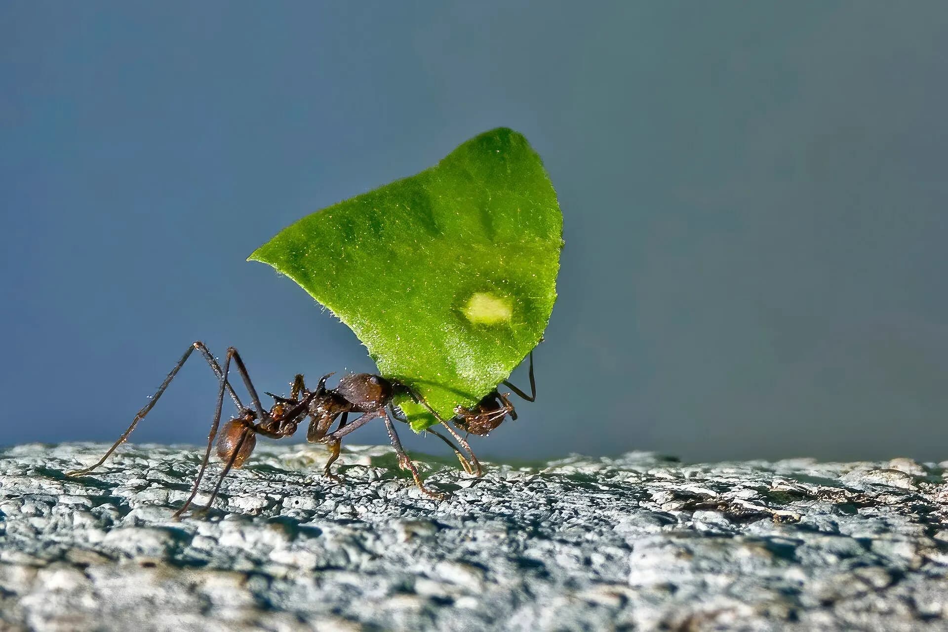
The main town of the Cayo District sits on hills above the Macal River, close to the Guatemalan border, and is the natural base for western Belize. It's a busy, friendly place with a Saturday market, good inexpensive restaurants and a choice of lodges in the forest around it. On a hilltop within walking distance of the centre, the small Maya site of Cahal Pech was an elite residence for centuries, with courtyards, temples and a ball court. Nearby, the Green Iguana Conservation Project and the medicinal plants of the Rainforest Medicine Trail are easy half-day visits.
TipFrom San Ignacio it's about two hours to the Guatemalan border town of Melchor and on to Tikal, which many visitors see on a long day trip or with an overnight stay.
- 13
Xunantunich
Photo: Denis Barthel, CC BY-SA 4.0, via Wikimedia Commons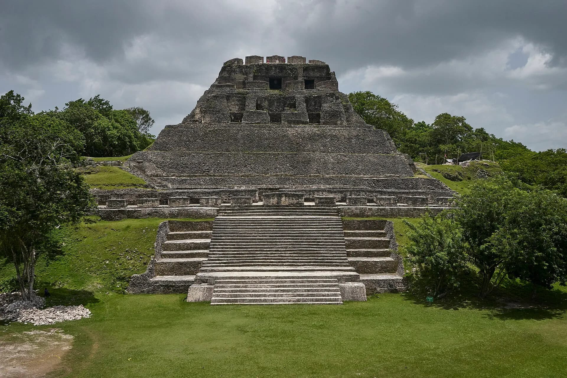
The approach is half the fun: a small hand-cranked ferry carries people and cars across the Mopan River at San José Succotz, a few kilometres from the border. On a ridge above stands Xunantunich, "stone woman" in Maya, named after a ghost said to haunt it. Its centrepiece, El Castillo, rises some 40 metres, with restored stucco friezes of masks and celestial symbols on its upper walls. From the top you can see across the forest into Guatemala.
TipGo early in the morning, when it's cooler and the howler monkeys are calling. The ferry is free, and buses between San Ignacio and the border stop at the landing.
- 14
Mountain Pine Ridge
Photo: Jriveragt, CC BY 4.0, via Wikimedia Commons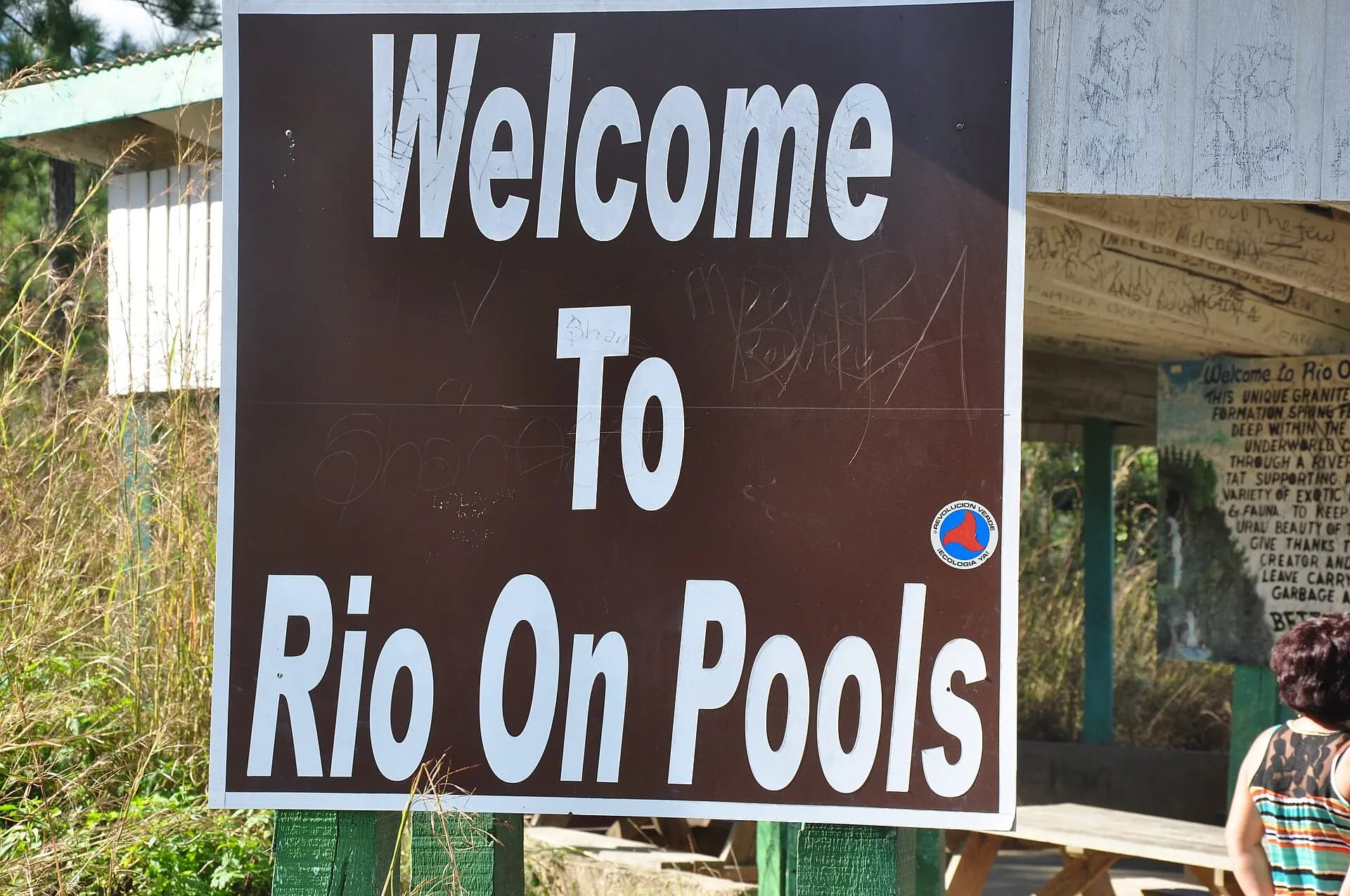
South of San Ignacio, the road climbs into a surprising landscape of Caribbean pines, red earth and granite outcrops, cooler than the lowlands and dotted with waterfalls and rivers. Rio On Pools is a series of granite rock pools and small cascades, perfect for a swim. Big Rock Falls drops into a deep, clear plunge pool, and the Thousand Foot Falls, which is in fact much taller, plunges down a cliff into the forest, best seen from a viewpoint across the valley. The Rio Frio Cave, a huge open tunnel the river passes through, is an easy walk from the road.
TipThe roads are mostly unpaved and rough, especially after rain; a high-clearance vehicle or a tour is best. Combine the area with Caracol.
- 15
Caracol
Photo: Dennis G. Jarvis, CC BY-SA 2.0, via Wikimedia Commons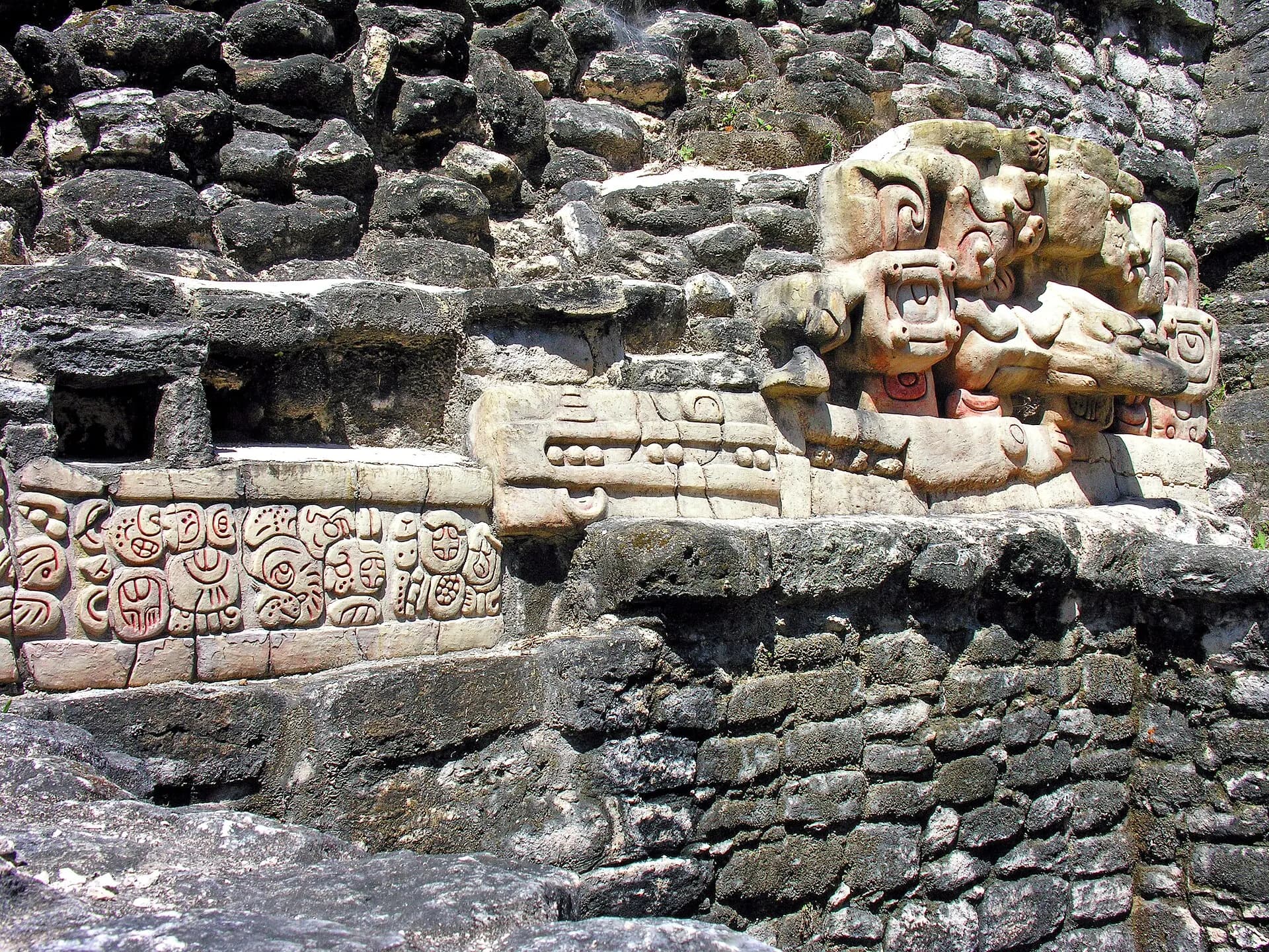
Deep in the Chiquibul Forest, a long, bumpy drive from San Ignacio, lie the ruins of the largest Maya city in Belize. At its height, around AD 650, Caracol is thought to have held well over 100,000 people, and it famously defeated mighty Tikal in war in 562. Laser surveys from the air revealed a vast network of farm terraces, reservoirs and causeways around the centre. Its great pyramid, Caana, the "sky palace", rises around 43 metres and is still the tallest building in the country. In 2025 archaeologists announced the discovery of the tomb of the city's founding ruler, Te K'ab Chaak.
TipIt's a full day from San Ignacio. Bring water and food, and check road conditions; tours have at times travelled in convoy with the security forces because of the remote border area.
- 16
Cockscomb Basin Wildlife Sanctuary
Photo: Cephas, CC BY-SA 4.0, via Wikimedia Commons
In the forested bowl beneath the Maya Mountains, Cockscomb was set up in the 1980s as the world's first protected area dedicated to the jaguar. The cats themselves are elusive and mostly nocturnal, so few visitors see one, but the sanctuary is a superb place for walking, with marked trails to waterfalls and swimming holes, river tubing, and chances to see tapir tracks, toucans, coatis and howler monkeys. Strong hikers can climb towards Victoria Peak, one of the highest summits in Belize, on a guided expedition of several days.
TipThe entrance is at Maya Centre on the Southern Highway, where women's cooperatives sell crafts. There are rustic cabins and camping at the headquarters for a night in the forest, when the chances of spotting wildlife are highest.
- 17
Hopkins
Photo: MusikAnimal, CC BY-SA 4.0, via Wikimedia Commons
This village on a long, quiet beach is one of the main centres of Garifuna culture in Belize. The Garifuna descend from West African and Indigenous Caribbean peoples who were exiled from St Vincent by the British in 1797 and settled along the Central American coast. In Hopkins you can take drumming lessons, try hudut, fish cooked in coconut broth with mashed plantain, and hear punta music at weekends. Settlement Day, on 19 November, celebrates the Garifuna arrival in Belize with re-enactments of the landing and drumming late into the night.
TipHopkins is a convenient base for Cockscomb, about half an hour inland, and for snorkelling and diving trips to the reef and South Water Caye.
- 18
Placencia
Photo: Jim McIntosh, CC0, via Wikimedia Commons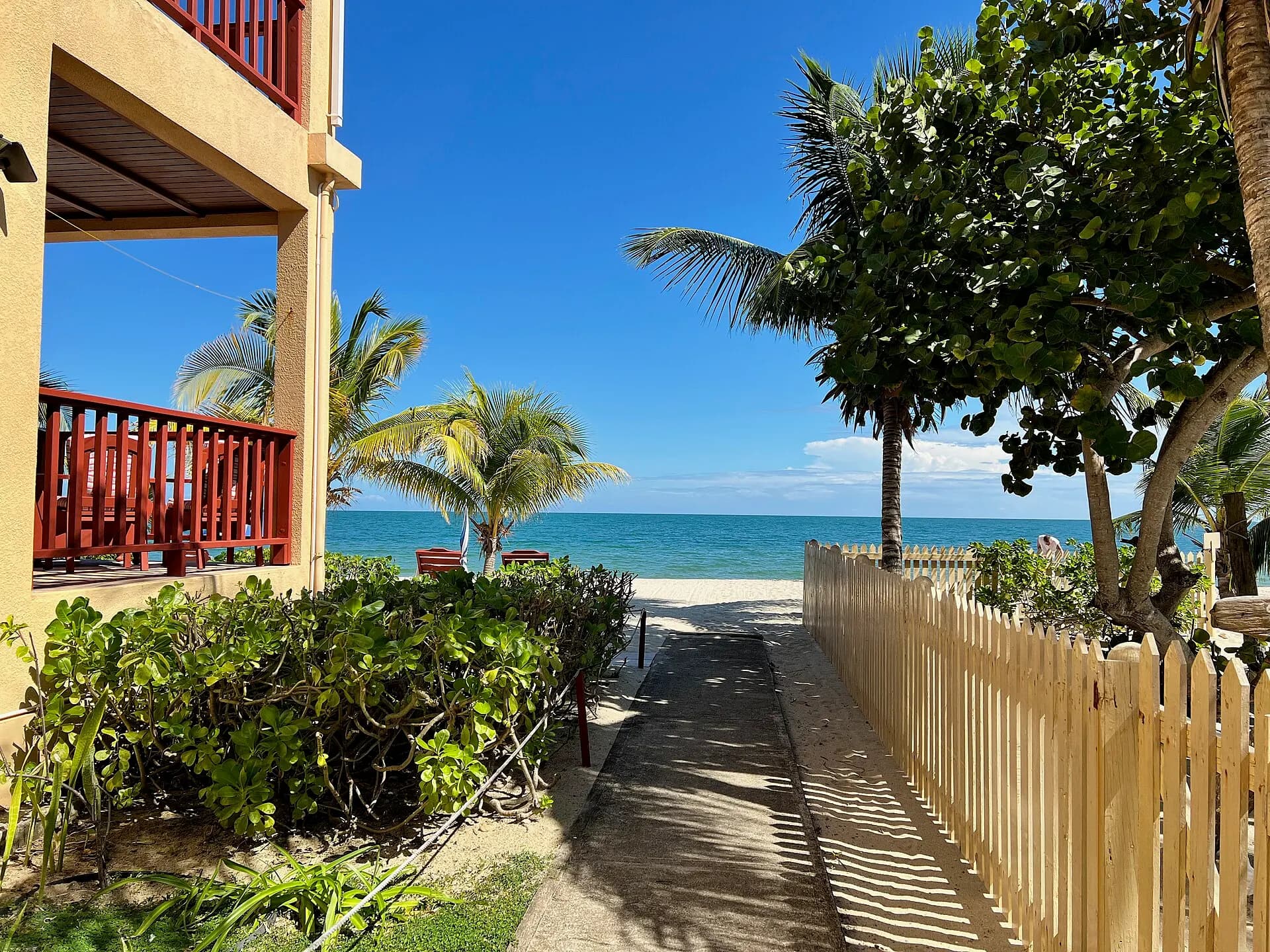
At the tip of a narrow, 25-kilometre peninsula with a lagoon on one side and the sea on the other, Placencia has some of the best sandy beaches on the Belize mainland. The village has a relaxed, small-town feel, with a narrow pedestrian sidewalk, once listed as among the world's narrowest main streets, running between the houses. Boats leave for the outer reef and cayes, for fishing trips and for the Monkey River, where howler monkeys and crocodiles are common.
TipFrom roughly March to June, around the full moon, whale sharks gather at Gladden Spit, a marine reserve off Placencia, to feed on the spawn of snappers. Trips are regulated, with limited numbers and licensed guides.
- 19
Laughing Bird Caye
Photo: Kaldari, CC0, via Wikimedia Commons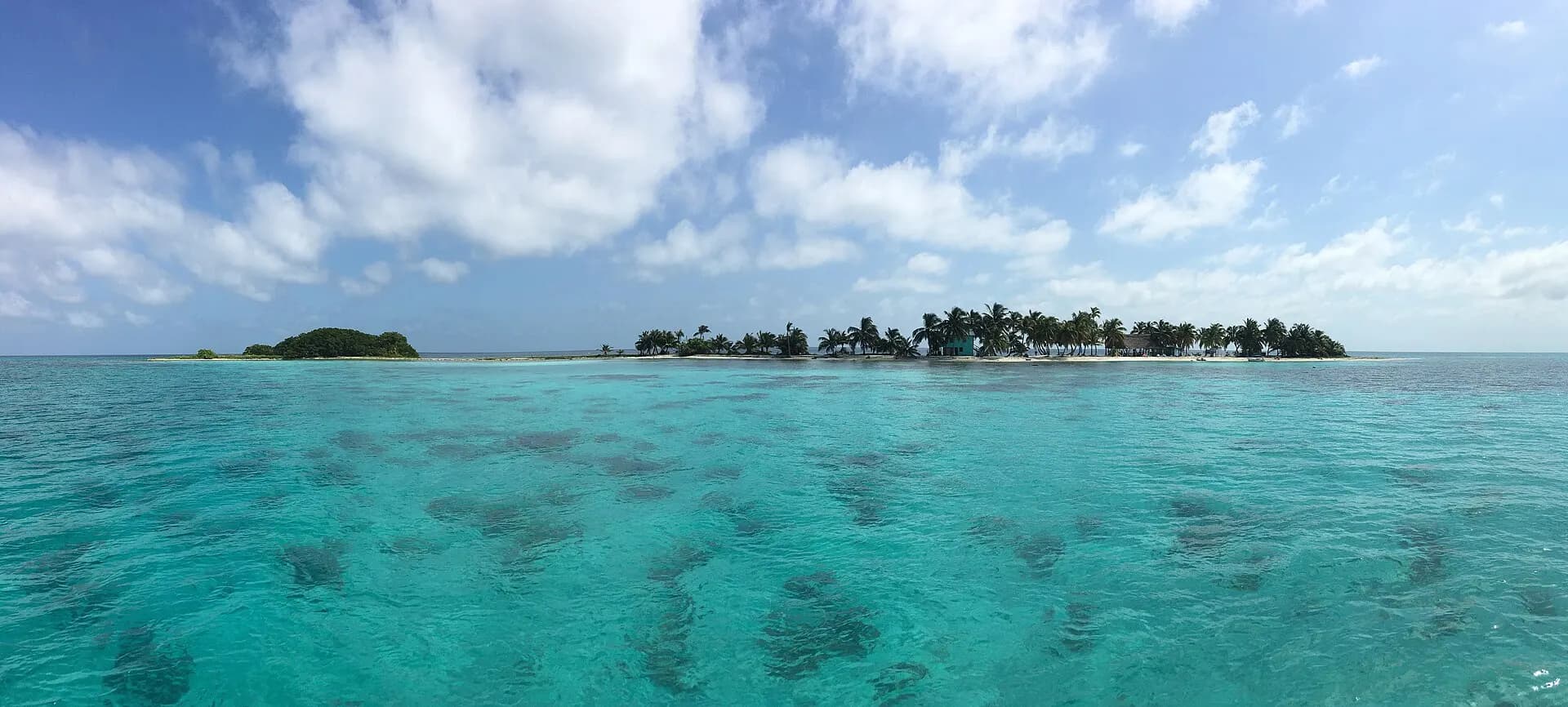
A tiny island of sand and palms on a reef formation known as a faro, about an hour's boat ride from Placencia, Laughing Bird Caye is a national park and one of the seven sites of the Belize Barrier Reef World Heritage Site. It is named after the laughing gulls that once nested here. The surrounding reef has some of the healthiest coral in the south, and the snorkelling straight from the beach is excellent, with reef fish, rays and turtles.
TipThere's a park fee, normally included in tour prices, and visitor numbers are managed; bring reef-safe sunscreen and pack out everything you bring.
The Belize Barrier Reef
The reef is the backbone of Belize's tourism and one of its great natural treasures. It runs almost the whole length of the coast, from the Mexican border to the Gulf of Honduras, with the three atolls of Turneffe, Lighthouse Reef and Glover's Reef beyond it. UNESCO listed seven protected areas within the system as a World Heritage Site in 1996, including Half Moon Caye, the Blue Hole and Laughing Bird Caye. It was added to the list of sites in danger in 2009, mainly because of mangrove clearing and plans for offshore oil, and removed in 2018 after Belize introduced a moratorium on oil exploration in its waters and tightened coastal protection.
Snorkellers can see a great deal close to San Pedro, Caye Caulker, South Water Caye and Placencia; divers have the walls of the atolls, the Blue Hole and the spring whale-shark season. The reef faces the same threats as reefs everywhere, especially bleaching in hot years, so choose operators who use moorings rather than anchors and keep visitor numbers sensible.
When to go
The dry season runs from about late November to April or May, with sunny days, lower humidity, calm seas and the best conditions for the reef, the Blue Hole crossing and travel on unpaved roads. This is also high season, with higher prices around Christmas, New Year and Easter. March to May is the hottest and driest stretch inland. The rainy season begins around June, usually with heavy afternoon showers rather than days of rain, and the forest turns intensely green; the south is much wetter than the north.
Hurricane season runs from June to November, with the greatest risk from August to October. Storms are not an annual event on this coast, but if you travel then, buy insurance that covers disruption and keep an eye on the forecasts from the US National Hurricane Center. September and October are the quietest months, and some island businesses close. Whale sharks visit Gladden Spit from roughly March to June, and the Garifuna Settlement Day falls on 19 November.
Getting around
Most international flights land at Philip S. W. Goldson International Airport, about 15 kilometres north of Belize City. Two domestic airlines, Tropic Air and Maya Island Air, fly small planes from there and from the municipal airstrip in Belize City to San Pedro, Caye Caulker, Dangriga, Placencia and Punta Gorda; the flights are short, scenic and handy if time is tight.
Water taxis link Belize City with Caye Caulker in about 45 minutes and San Pedro in roughly an hour and a half, with several departures a day, and boats run between the two islands. There are also boats between San Pedro and Chetumal in Mexico, which need to be booked ahead and involve border formalities. On land, Belize's main roads are paved: the Philip Goldson Highway north to Mexico, the George Price Highway west to Belmopan and San Ignacio, the Hummingbird Highway through the hills to Dangriga, and the Southern Highway to Placencia and Punta Gorda. Old school buses, many run by small private companies, cover these routes cheaply, if slowly. Renting a car gives most freedom, especially for Cayo and the south, but side roads can be rough and poorly signed. On the islands, people walk, cycle or use golf carts.
Local tips
- The Belize dollar is fixed at two to one US dollar, and US dollars in cash are accepted almost everywhere; check which currency a price is in, and expect change in Belize dollars.
- Cards work in hotels, larger restaurants and dive shops, but carry cash for buses, markets, small shops and village guesthouses. Cash machines can be scarce outside the towns.
- Many tours, dives and park visits are priced in US dollars and exclude reserve or park fees; ask exactly what's included.
- Tap water quality varies; many people drink filtered or bottled water. Carry a refillable bottle and refill it at hotels.
- Mosquitoes and sandflies can be fierce, especially at dusk and on the cayes after rain. Pack repellent and long sleeves.
- Tipping of about ten to fifteen per cent is customary in restaurants unless a service charge has been added, and guides and boat crews appreciate tips.
- Check the departure fees on your air ticket and the current land and sea border charges with the airline or operator before you travel, as they change from time to time.
Eat and drink
Belizean food is hearty and unfussy, built on rice and beans. The national dish is rice and beans cooked together in coconut milk, served with stewed chicken, a little potato salad and fried plantain; "beans and rice", by contrast, means the two served separately. Breakfast often brings fry jacks, puffy fried dough, with eggs and refried beans. Street stalls sell salbutes and panades, small fried tortillas and turnovers with a Maya and Mexican heritage, and tamales wrapped in banana leaf.
On the coast, try conch fritters and ceviche in season, and grilled lobster during the lobster season, which normally opens in mid-June; both lobster and conch have closed seasons to protect stocks, so don't order them out of season. Garifuna villages serve hudut and coconut-rich seafood stews. Marie Sharp's hot sauces, made from local habaneros, are on almost every table. To drink, there's Belikin beer, local rum, and fresh fruit juices from lime to watermelon and soursop.
Where to base yourself
Three bases cover the country well. For the reef, choose Caye Caulker for a cheaper, slower, more social stay, or Ambergris Caye for a wider range of resorts and restaurants. For the Maya sites, caves and waterfalls, San Ignacio has good-value guesthouses, while jungle lodges along the Macal and Mopan rivers and in Mountain Pine Ridge offer more seclusion and wildlife. In the south, Hopkins is quieter and good for Garifuna culture and Cockscomb, while Placencia has more beach, restaurants and boat trips. Dedicated divers might add a few nights on a remote island resort or liveaboard at one of the atolls. If you're combining Belize with Mexico, Cancún has many more flight connections, and the bus from the Riviera Maya to Belize City takes most of a day.
A short history
The Maya lived across what is now Belize for thousands of years, building cities like Caracol, Lamanai and Altun Ha; at its peak in the Classic period the region may have supported a population far larger than today's. Spanish conquistadors and missionaries made little headway here. From the seventeenth century, British buccaneers and loggers, known as Baymen, settled along the coast to cut logwood and later mahogany, using enslaved Africans as labour. In 1798 the settlers and their slaves fought off a Spanish fleet at the Battle of St George's Caye, still celebrated on 10 September. The territory became the colony of British Honduras in 1862, was renamed Belize in 1973, and became independent in 1981, though Guatemala's claim to its territory remains unresolved and was referred to the International Court of Justice. Today's population blends Kriol, Mestizo, Maya, Garifuna, Mennonite, East Indian and Chinese communities.
Responsible travel
Belize earns much of its living from nature, and visitors can help keep it intact. On the reef, never stand on or touch coral, use reef-safe sunscreen or cover up, and don't feed fish, sharks or rays. Choose licensed guides and operators who respect reserve rules and limits, particularly for manatee watching, whale sharks and the ATM cave. Don't buy souvenirs made from black coral, turtle shell or other wildlife, and avoid lobster and conch out of season. Inland, stay on trails at Maya sites and never take artefacts, which is illegal. Spending money with community-run businesses, such as the women's craft cooperatives at Maya Centre, Garifuna guesthouses and village homestays in the Toledo District in the far south, helps make sure tourism benefits Belizeans directly.