Palawan
A long, thin island of limestone cliffs, glassy lagoons and sunken warships, where the jungle runs straight down to some of Asia's clearest water.
- Best time to go
- December to May, the dry season; January to April has the calmest seas for island hopping, while June to October brings the southwest monsoon and cancelled boats
- Local time
- –
- Currency
- Philippine Peso (PHP)
- Reading time
- 16 min
- Language
- English and Tagalog / Filipino

Palawan is the Philippines' westernmost province, a sliver of land some 450 kilometres long that points from Mindoro down towards Borneo, with the South China Sea on one side and the Sulu Sea on the other. Most of it is still forest and mountain. What draws people, though, is the coastline: sheer black limestone karsts rising out of turquoise bays, lagoons you can only enter by kayak, reefs that are among the healthiest in the country, and, around Coron, a fleet of Japanese warships sunk in 1944 that now ranks among the world's great wreck dives. The province has long been called the country's "last frontier", and despite a boom in visitors over the past fifteen years, much of it still feels like one.
The classic trip links the three big names, Coron, El Nido and Puerto Princesa, in a line down the island, and the places below follow that order from north to south. Start in Coron (flying into Busuanga), take the fast ferry south to El Nido, then travel overland by van through Port Barton to the Underground River and Puerto Princesa, which has the main airport. The route also works in reverse. Allow at least ten days for all three; a week is enough for two. The far south, Balabac, is a separate expedition for those with extra time. For more limestone seascapes elsewhere in Asia, see our Krabi and Ha Long Bay guides; for another Southeast Asian island trip, Bali.
The top 18 in Palawan
- 1
Mount Tapyas
Photo: Patrickroque01, CC BY-SA 4.0, via Wikimedia Commons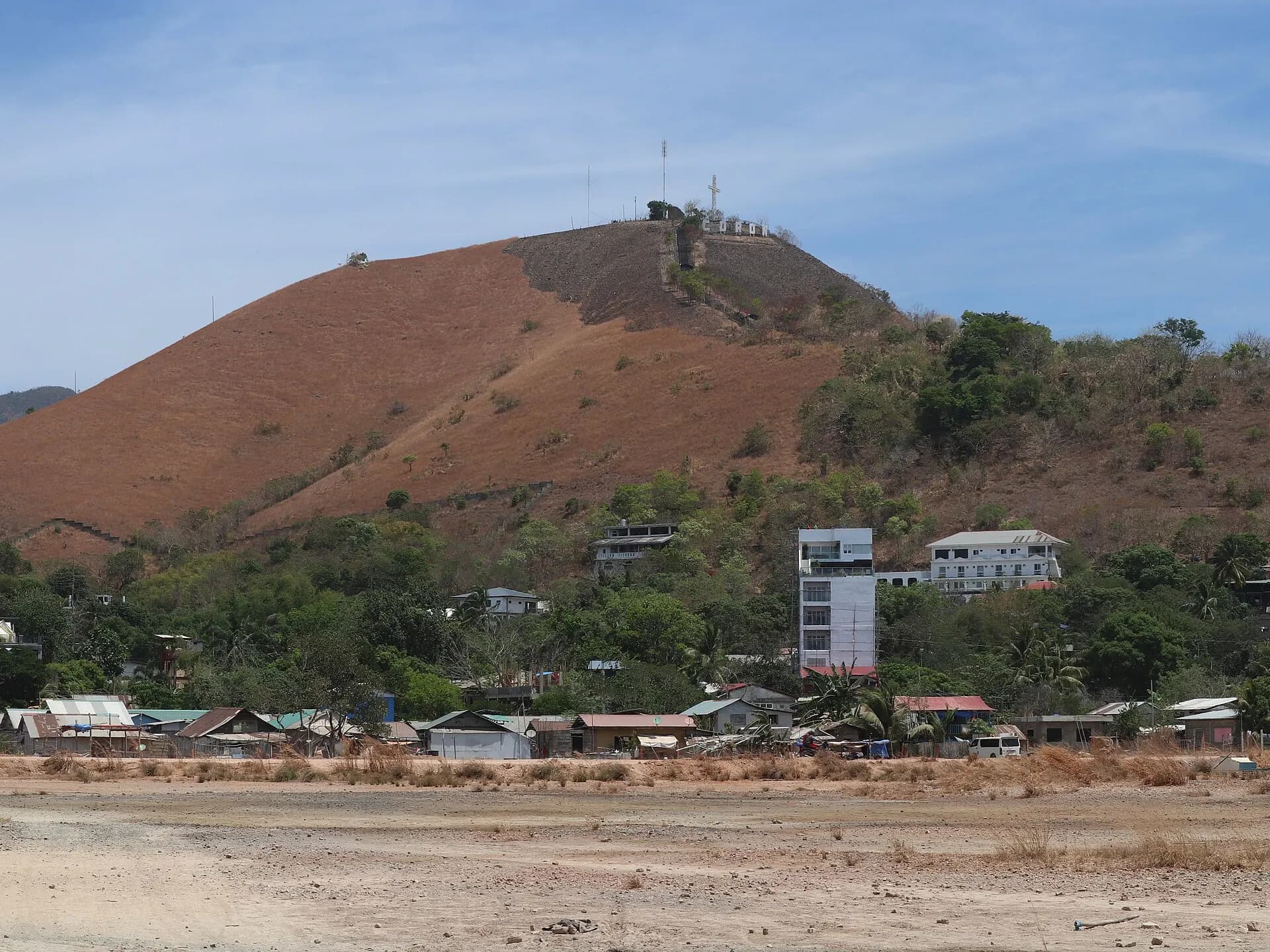
The hill that rises behind Coron town is the easiest way to understand the geography of the Calamian Islands. A concrete stairway of roughly 700 steps climbs to a viewpoint and a large white cross, and from the top you look over the town's tin roofs, the boat-filled harbour and the scattered islands of Coron Bay, with the jagged outline of Coron Island to the south. It is a steady climb rather than a hard one, with rest platforms along the way.
TipGo up an hour before sunset, when the heat has eased and the bay turns gold; take a torch for the walk down.
- 2
Maquinit Hot Springs
Photo: André Héroux, CC BY 3.0, via Wikimedia Commons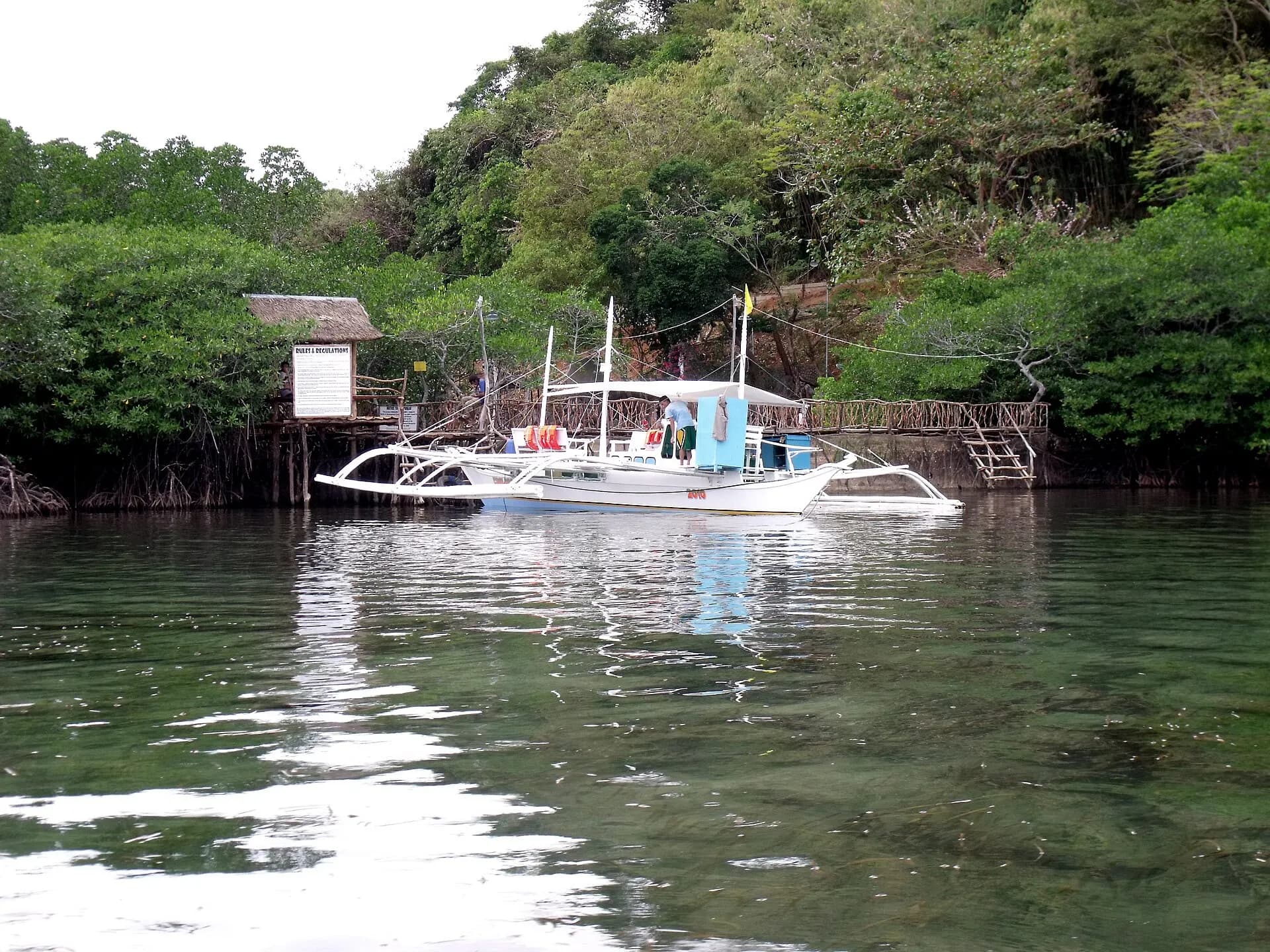
A short tricycle ride from town, Maquinit is a saltwater hot spring that feeds a pair of stone-edged pools set among mangroves by the sea. The water is genuinely hot, often close to 40°C, so most people last only a few minutes at a time before sitting on the edge. After a day of snorkelling it is a soothing way to finish, and it is at its best after dark, when the air has cooled.
TipBring cash for the small entrance fee and a towel; the pools close in the evening, so check the hours locally.
- 3
The Coron Bay wrecks
Photo: Ryan Sia, CC BY-SA 4.0, via Wikimedia Commons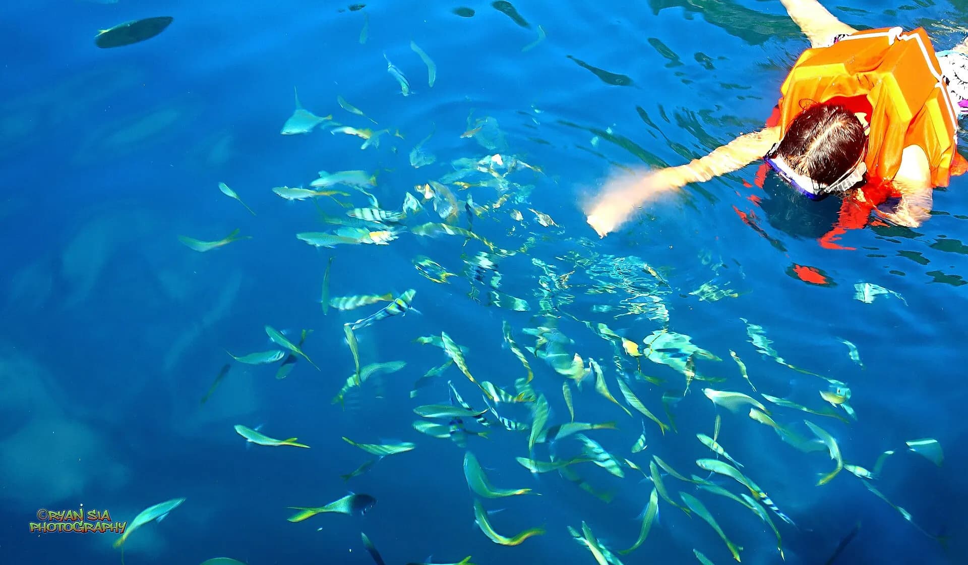
On 24 September 1944, American carrier aircraft attacked a Japanese supply fleet sheltering in the bays around Busuanga and Culion, sinking around a dozen ships in a single morning. They still lie where they went down, now coated in coral and sponges and patrolled by batfish and lionfish. The seaplane tender Akitsushima is the most famous, a large warship with its crane still visible; others, such as the Olympia Maru, Kogyo Maru and Irako, range from shallow hulks suitable for newer divers to deep penetrations for the technically qualified.
Non-divers can still see something of this history: the shallow Skeleton Wreck near Coron Island and the Lusong gunboat, whose stern almost breaks the surface at low tide, are both visible on snorkelling tours.
TipWreck penetration needs proper training; dive only with established, accredited shops and ask about the depth and condition of each site before you sign up.
- 4
Kayangan Lake
Photo: Lyndon Aguila, CC BY-SA 4.0, via Wikimedia Commons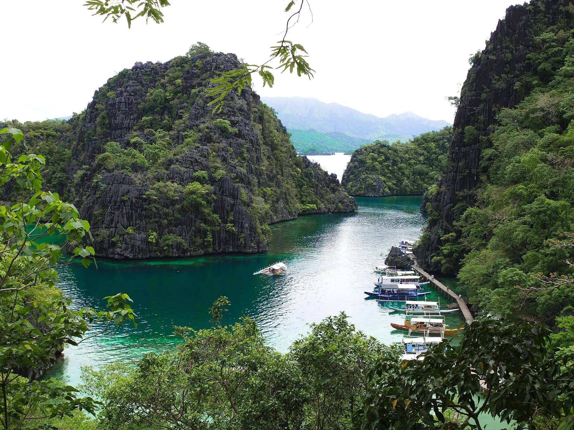
Coron Island is the ancestral domain of the Calamian Tagbanua, an indigenous community that manages access to its lakes and beaches and collects the entrance fees. Kayangan, a freshwater lake enclosed by limestone, is its best-known sight. A stepped path of a few hundred steps climbs over the ridge, passing a viewpoint over a cove studded with karst towers that has become one of the most photographed views in the Philippines, before dropping down to the lake itself. The water is startlingly clear, and boardwalks let you climb in and swim among underwater rock formations.
TipBoats from town arrive in waves mid-morning; leaving on an early private boat, or visiting in the late afternoon, makes a real difference here.
- 5
Barracuda Lake
Photo: Patrickroque01, CC BY-SA 4.0, via Wikimedia Commons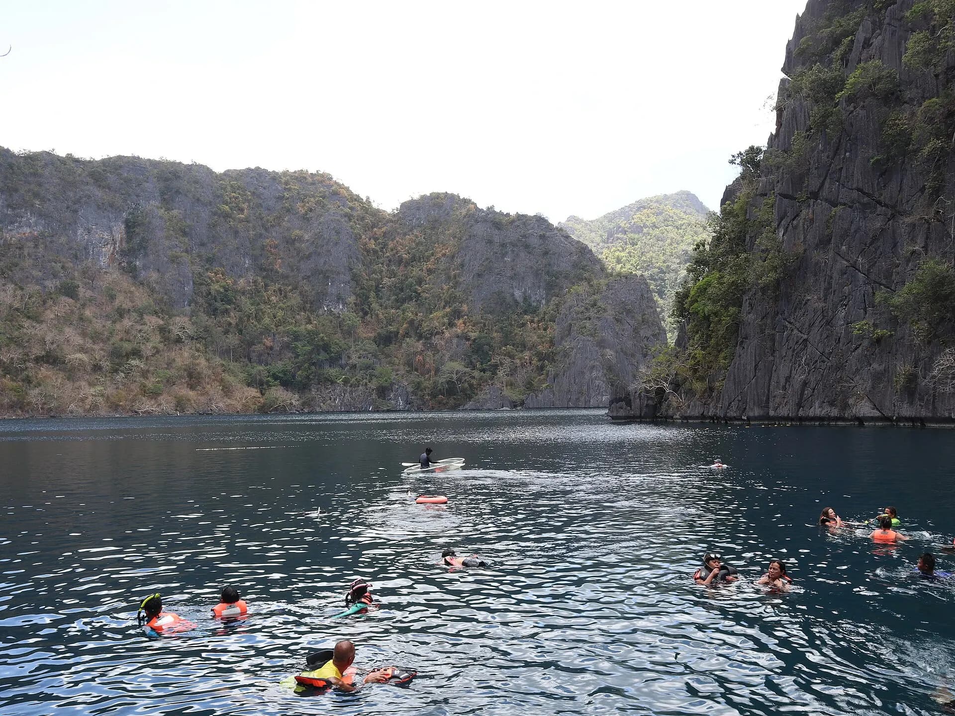
Barracuda Lake, also known by the Tagbanua name Luluyuwan, is a strange place: a lake of fresh water floating on a layer of sea water that seeps in through the rock, with a thermocline that makes the deeper water noticeably warm. Swimmers float above a drop of more than 30 metres between grey limestone walls that continue underwater as jagged ridges, and divers come for the eerie visibility and the shifts in temperature as they descend. Despite the name, barracuda are rarely seen.
TipWear a life vest even if you are a strong swimmer; fresh water is less buoyant than the sea and the lake is very deep.
- 6
Twin Lagoon
Photo: Franz C. Trinidad, CC BY-SA 4.0, via Wikimedia Commons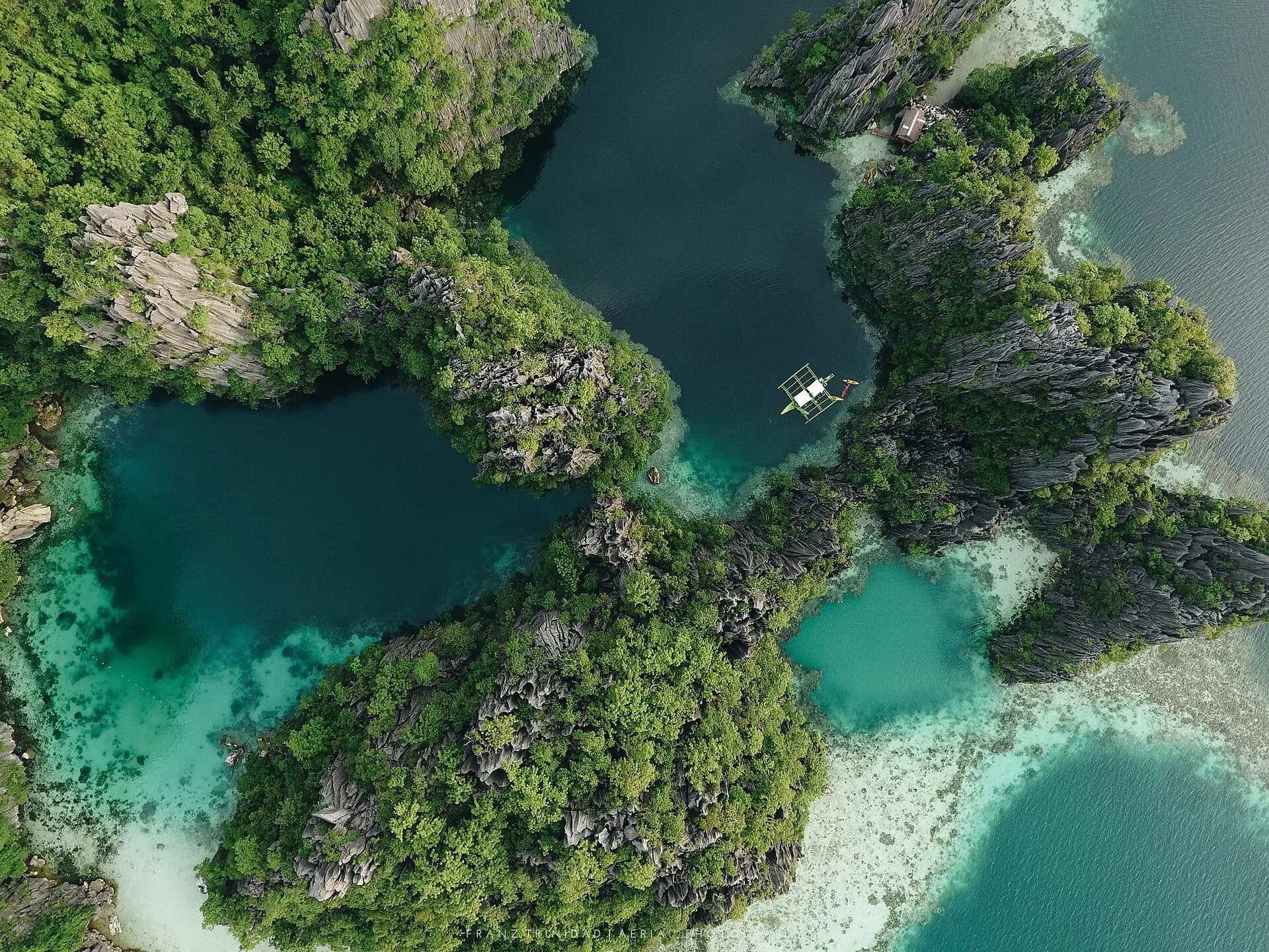
Two lagoons sit side by side on Coron Island's west coast, separated by a wall of limestone. Boats stop in the outer one, and at low tide you swim through a narrow gap under the rock into the inner lagoon; at high tide a wooden ladder takes you over the top instead. Fresh water from the island meets the sea here, creating a shimmering layer of different temperatures you can feel as you swim. Kayaks and bamboo rafts are usually available to rent.
TipTwin Lagoon, Kayangan Lake and Barracuda Lake are often combined on one boat day, usually sold as an "ultimate" or Coron Island tour.
- 7
Nacpan Beach
Photo: Micluna, CC BY-SA 4.0, via Wikimedia Commons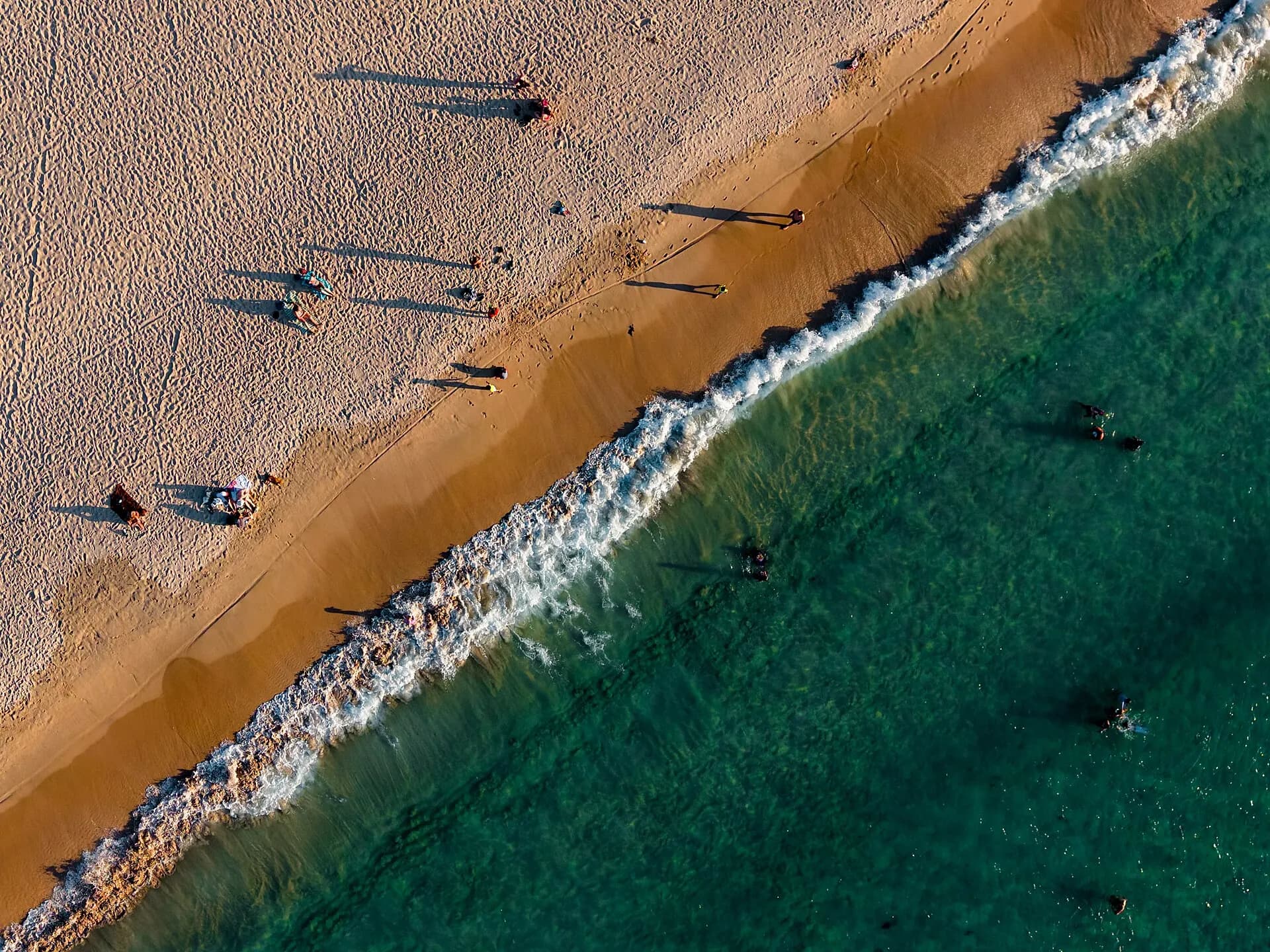
About an hour north of El Nido town by tricycle or scooter, Nacpan is a sweep of golden sand some four kilometres long, backed by coconut palms and almost entirely free of the karst cliffs that define the rest of the area. It feels quite different from the island tours: open, breezy and spacious, with a few beach bars and simple places to stay. A viewpoint at the southern end looks over Nacpan and its twin, Calitang, joined by a narrow neck of land.
TipThe road is now paved most of the way; rent a scooter only if you are an experienced rider, as the traffic and rain can be unforgiving.
- 9
Big Lagoon
Photo: Marciano Villavito, CC BY-SA 4.0, via Wikimedia Commons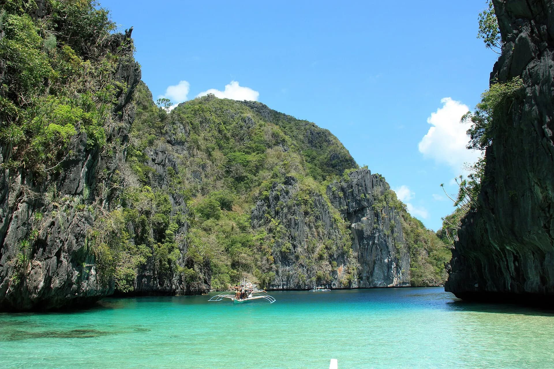
The Big Lagoon on Miniloc Island is the image that put El Nido on the map: a long channel of emerald water walled in by cliffs, opening into an enclosed basin where the only sounds are paddles and birds. Motorboats are not allowed inside, so visitors transfer to kayaks at the entrance and paddle in. It is the centrepiece of Tour A, which also includes the Secret Lagoon, Shimizu Island and Seven Commandos Beach. Visitor numbers are capped daily and access is booked through tour operators.
TipA two-person kayak costs extra and is shared between two; arrive early in the day for calmer, quieter water.
- 10
Small Lagoon
Next door to the Big Lagoon, the Small Lagoon is entered through a narrow gap in the cliffs, either by kayak or by swimming in with a life vest. Inside, a hidden pool opens up under overhanging rock, with a small cave to explore at the back. It now features on Tour D, a gentler loop that also includes Cadlao Lagoon and a series of quiet beaches close to town, and it is often less crowded than the Big Lagoon.
TipSmall Lagoon has its own access fee and daily cap, separate from the Big Lagoon, so check what your tour price includes.
- 11
Snake Island
Photo: Fabio Achilli from Milano, Italy, CC BY 2.0, via Wikimedia Commons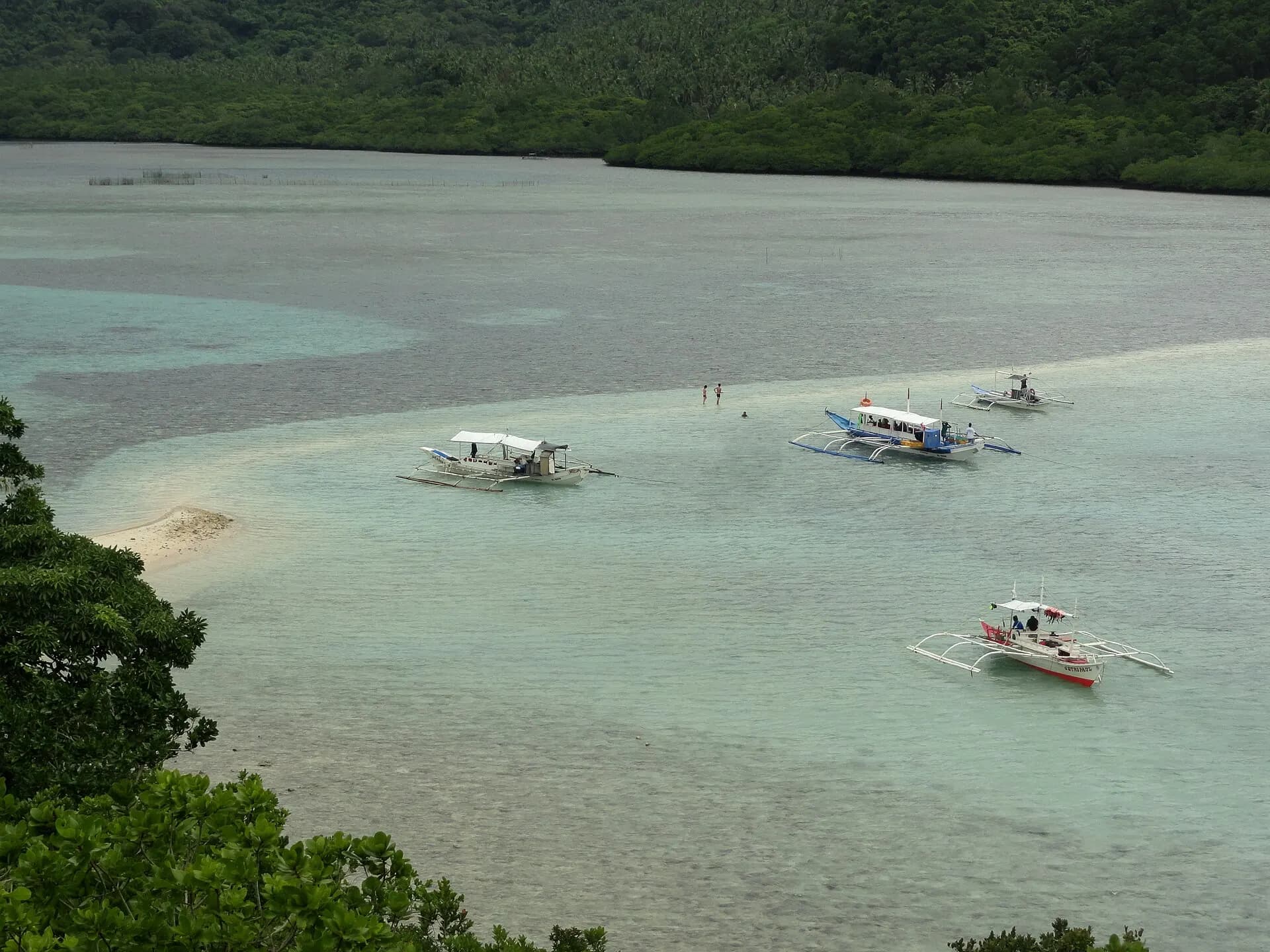
Tour B's highlight is a curving sandbar that snakes out from Vigan Island, visible in its full S-shape from a short hike to a viewpoint on the hill above. At low tide you can walk along it with water on both sides. The rest of the tour covers Cudugnon Cave, once used as a burial site and later a wartime hiding place, Cathedral Cave with its tall, church-like interior, and the beaches of Entalula and Pinagbuyutan islands.
TipTour B depends on the tide for the full sandbar effect; ask your operator which days line up with low tide.
- 12
Las Cabañas Beach
A short tricycle ride south of town, Las Cabañas is El Nido's sunset beach, a long strand facing west across Bacuit Bay towards the silhouettes of the islands. A zipline crosses from the mainland to a small island offshore, and a handful of beach bars set out beanbags as the light fades. It is the obvious end to a day spent on the water.
TipTricycles back to town can be scarce after dark; agree a return pick-up time with your driver.
- 13
Port Barton
Photo: Vyacheslav Argenberg, CC BY 4.0, via Wikimedia Commons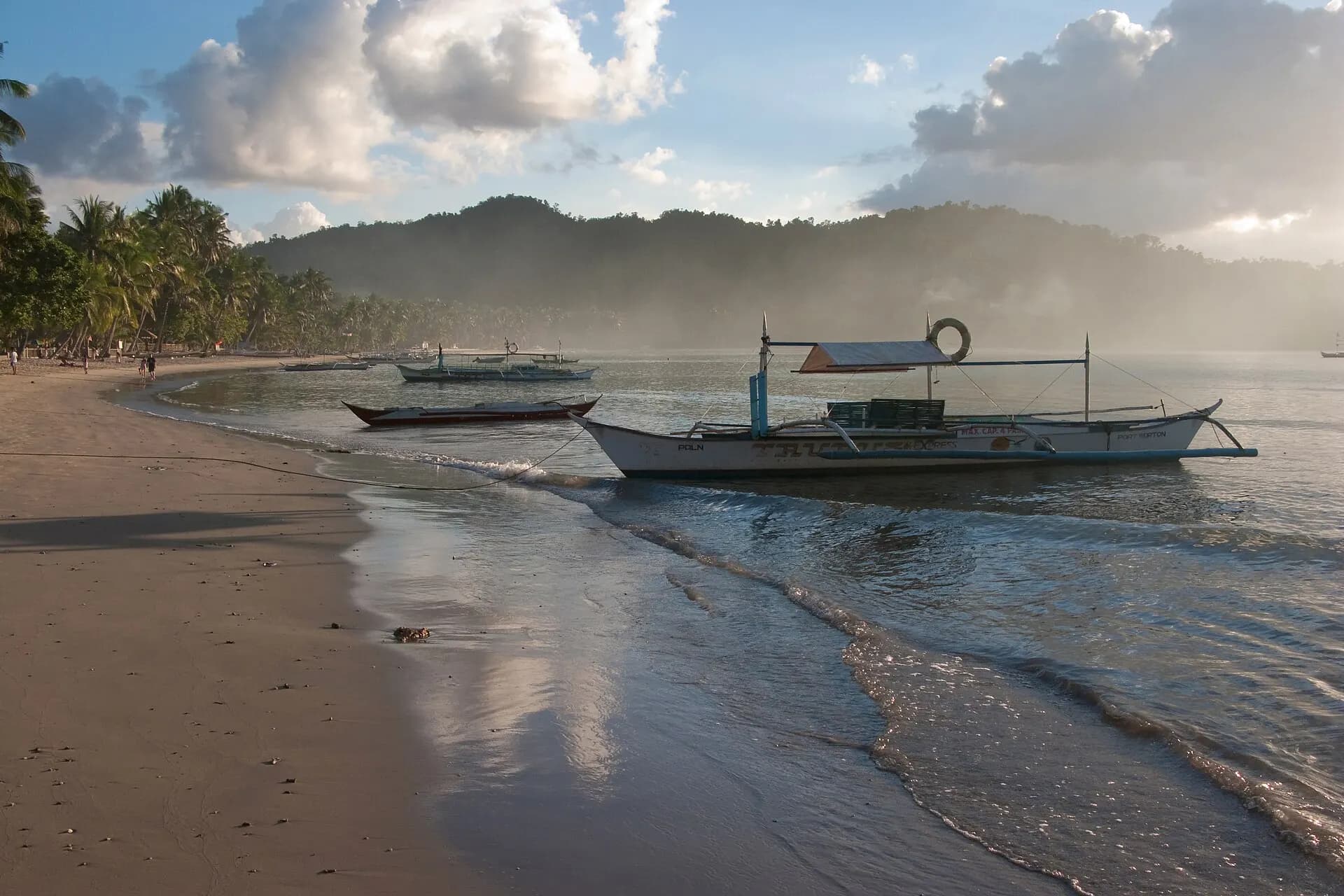
Halfway between El Nido and Puerto Princesa, Port Barton is a small fishing village on a bay in San Vicente municipality that offers a slower, cheaper version of the island-hopping experience. The village has no big resorts, the electricity supply can be patchy, and the beach doubles as the main street. Boat trips visit a string of islands and sandbars, including German Island and Starfish Island, with good snorkelling and turtles regularly sighted. Walking trails lead to quieter beaches and a small waterfall in the hills.
TipThere are few ATMs and they are not reliable; bring enough cash from Puerto Princesa or El Nido.
- 14
Puerto Princesa Underground River
Photo: Vyacheslav Argenberg, CC BY 4.0, via Wikimedia Commons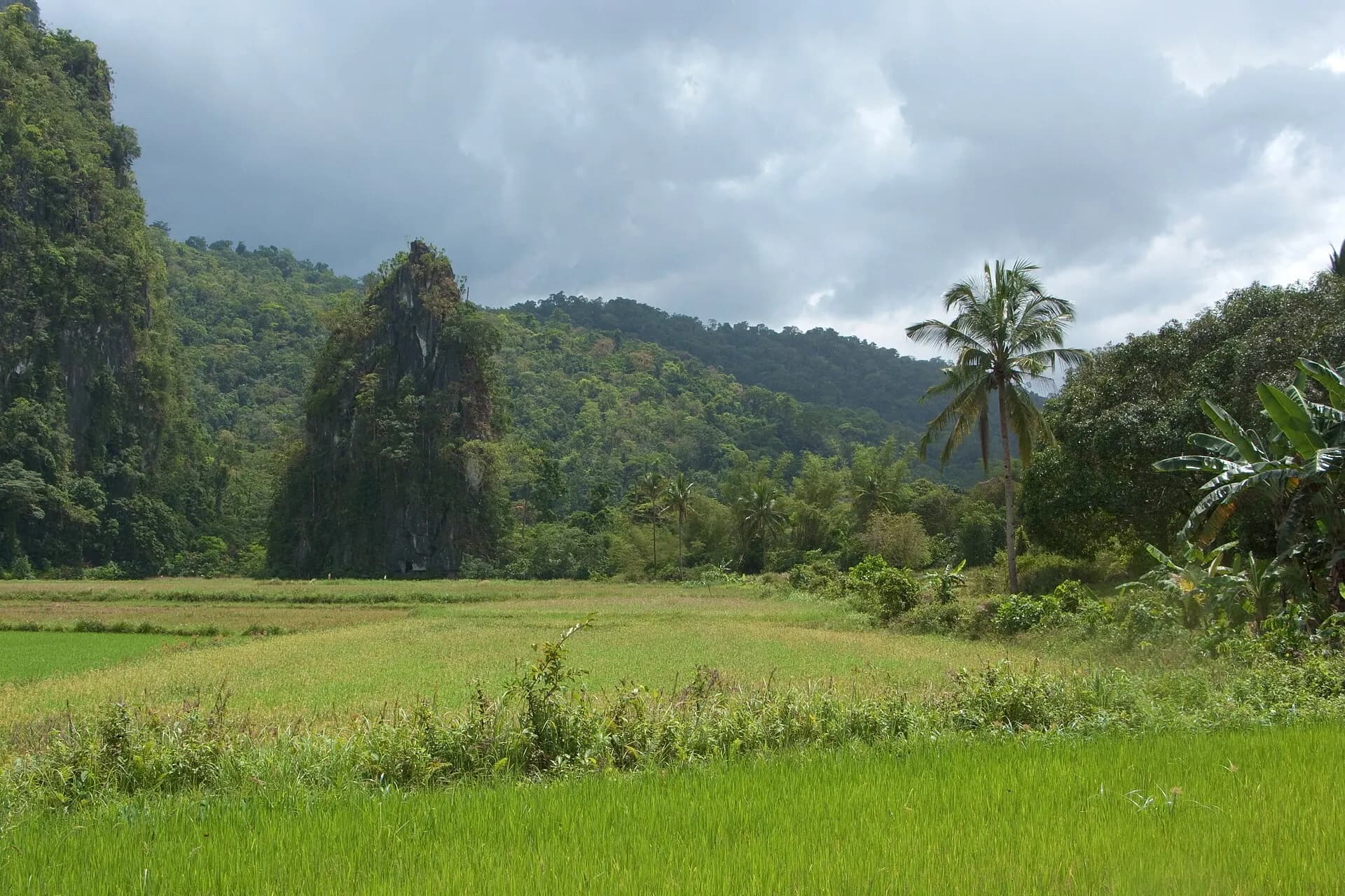
Inside a national park of forest and karst on the west coast, the Puerto Princesa Subterranean River flows for more than eight kilometres through a cave before emerging into the sea. It is a UNESCO World Heritage Site, inscribed for its full mountain-to-sea ecosystem, and one of the longest navigable underground rivers in the world. Paddle boats with a guide and an audio commentary take visitors around a kilometre or so into the dark, where torchlight picks out vast chambers, stalactites, swiftlets and thousands of bats.
Access is strictly controlled. The park enforces a "no permit, no entry" rule and a daily visitor cap, currently 900 people, and every visitor must register individually with valid ID. Permits are issued through the Underground River booking office in Puerto Princesa or through accredited tour operators, and they sell out ahead of time in peak season. From the village of Sabang, a 20-minute boat ride brings you to the cave entrance.
TipBook your permit, or a tour that includes it, several days ahead, or weeks ahead for Easter and the March to May peak; keep your mouth closed when looking up in the cave, for obvious reasons.
- 15
Ugong Rock
Photo: Robertmarrel, CC BY-SA 4.0, via Wikimedia Commons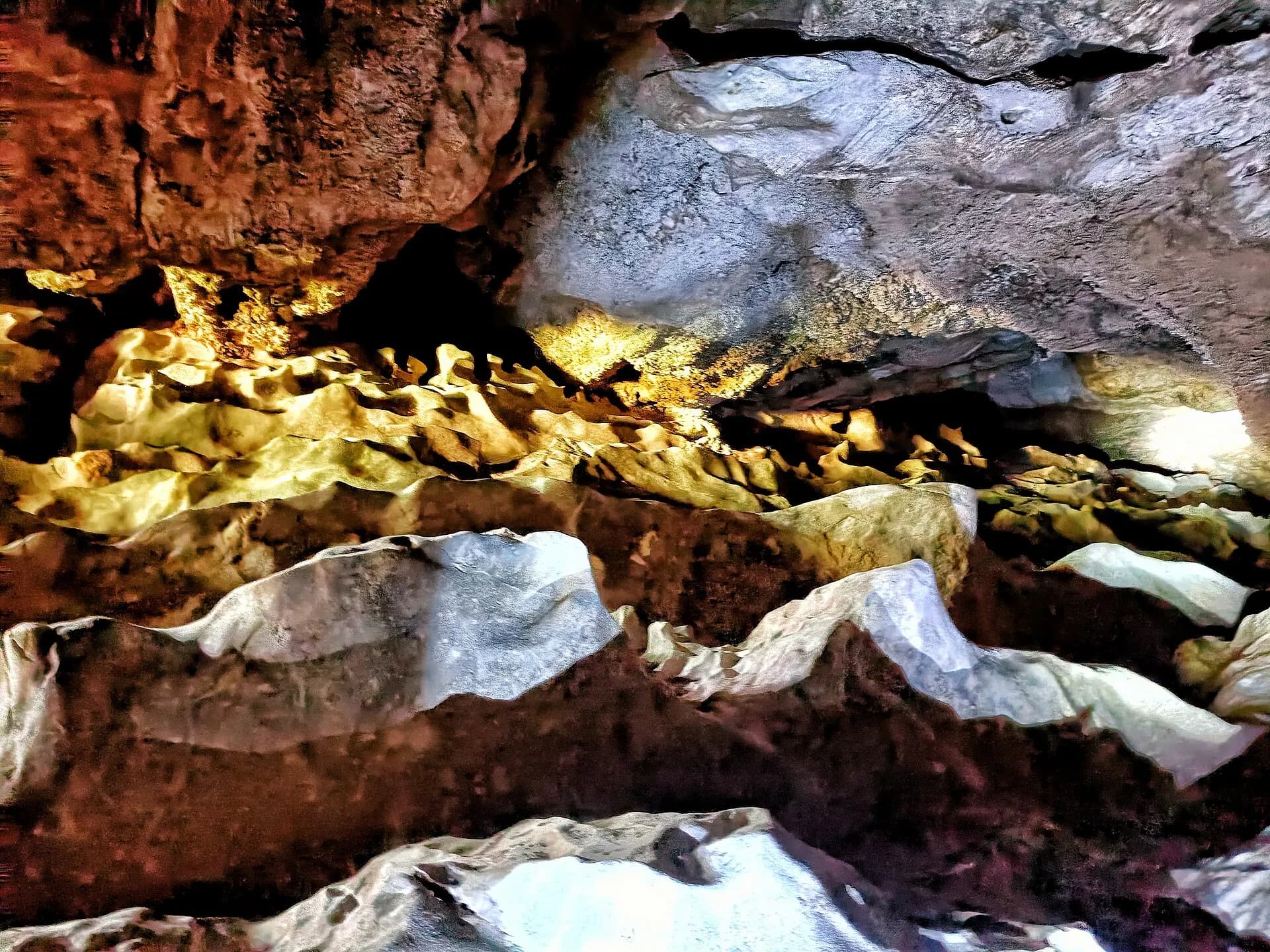
On the road between Puerto Princesa and Sabang, Ugong Rock is a limestone outcrop that a local community has turned into a small adventure park. Guides lead visitors up through narrow crevices and caves to the top, where a view opens across rice fields to the mountains, and the quick way down is by zipline. The rock gets its name from the hollow, ringing sound some of its formations make when tapped.
TipWear shoes with grip; the climb involves squeezing through passages and using ropes.
- 16
Honda Bay
Photo: mendhak, CC BY-SA 2.0, via Wikimedia Commons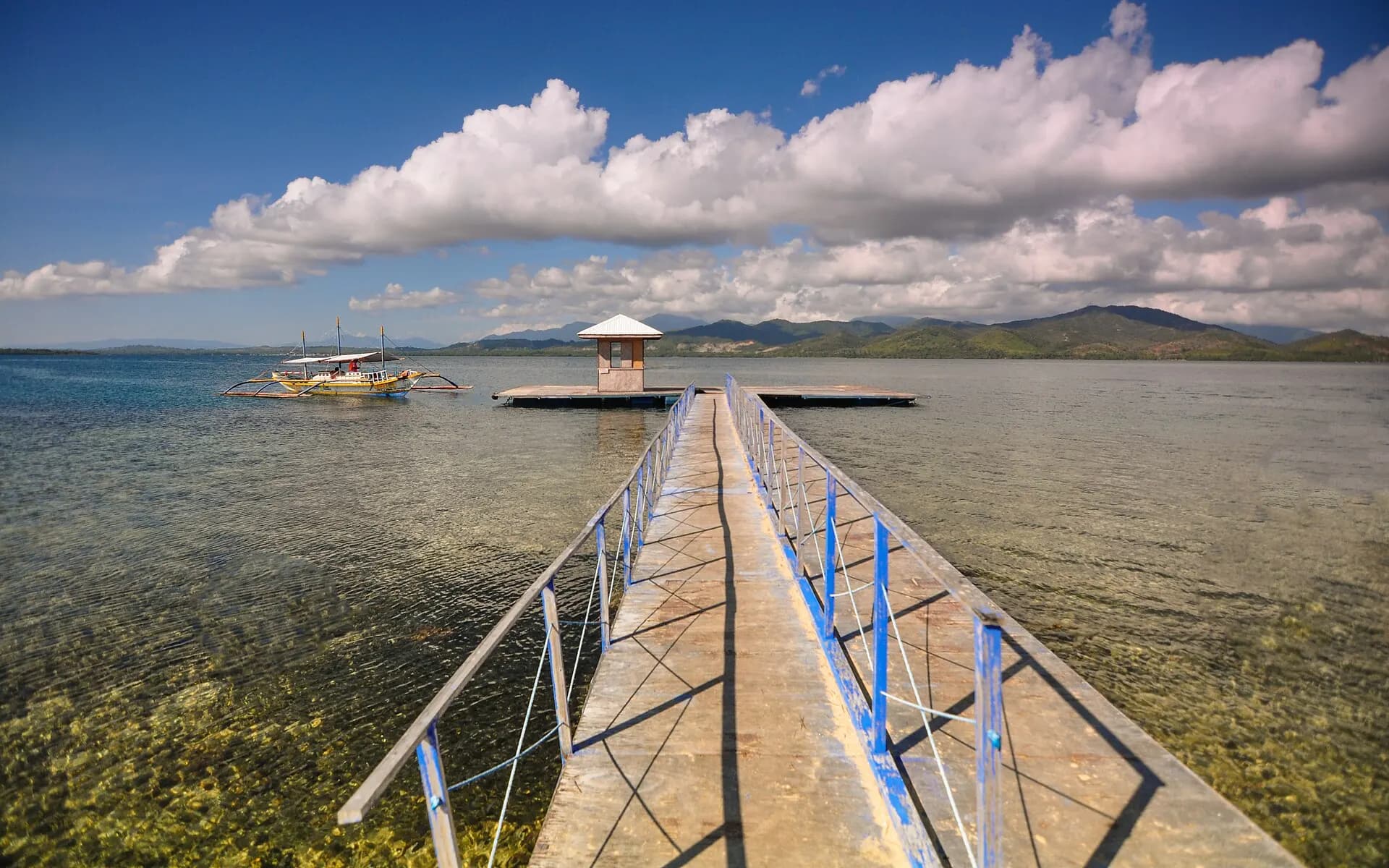
Just north of Puerto Princesa, Honda Bay is the city's day-trip playground: a shallow bay dotted with small islands and sandbars that boats visit in a lazy loop. Cowrie Island has a beach and bar shaded by palms, Starfish Island lives up to its name in the shallows, and Pambato Reef has a floating platform for snorkelling over fish-filled coral. It is far less dramatic than Bacuit Bay but easy, relaxed and good for families.
TipBoats leave from the wharf at Santa Lourdes; go on a weekday, as the bay fills with local groups at weekends.
- 17
Plaza Cuartel
Photo: DarwinNaredo, CC BY-SA 4.0, via Wikimedia Commons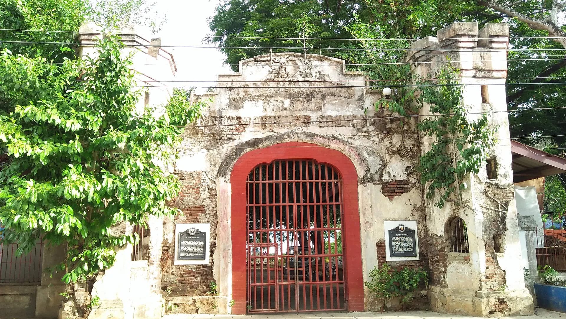
Puerto Princesa itself is a pleasant, low-key provincial capital, and its most affecting sight is this small park beside the cathedral. During the Second World War the site held American prisoners of war, and in December 1944, fearing an Allied landing, Japanese guards herded them into air-raid trenches and set them alight; only a handful escaped. Memorials and the remains of the tunnels tell the story, a sobering counterpoint to the beaches elsewhere on the island.
TipCombine it with the nearby Immaculate Conception Cathedral and the waterfront baywalk at sunset.
- 18
Balabac
Photo: Ervin Malicdem, CC BY-SA 4.0, via Wikimedia Commons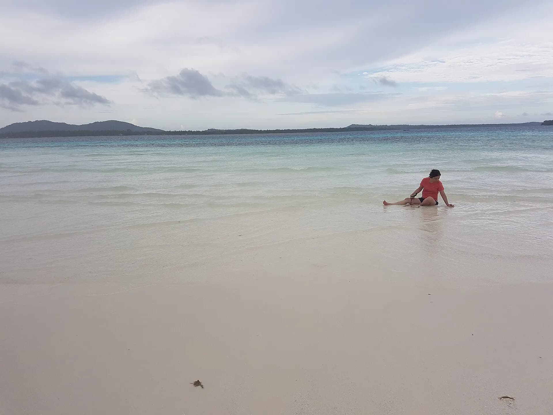
At the island's southern tip, the Balabac group of islands sits closer to Borneo than to Manila. Islands such as Onok, Candaraman and Punta Sebaring have powder-white sand, very clear shallow water and coral gardens, with almost no infrastructure: no towns to speak of beyond Balabac itself, few shops, and accommodation that is mostly camping or rustic huts. It is also home to the tiny Philippine mouse-deer, a protected species found only in this corner of Palawan.
Getting there is a commitment. Most visitors join a multi-day organised trip that drives from Puerto Princesa to the port of Buliluyan in Bataraza, a long journey usually begun before dawn, followed by a boat crossing to the islands.
TipGo only with an established tour operator, travel in the dry season, and check your own government's travel advice for the far south of Palawan before you book.

When to go
Palawan has two broad seasons. The dry season runs from roughly December to May: the northeast monsoon (amihan) brings breezy, comfortable weather from December to February, and March to May is hot, very sunny and calm, with the best visibility for snorkelling and diving. This is peak season, especially over Christmas, the New Year, Chinese New Year and Holy Week, when rooms, ferries and Underground River permits book out.
From June to October the southwest monsoon (habagat) brings heavy showers and rough seas on the west-facing coasts, which can cancel island tours, close Tour C in El Nido and halt the El Nido to Coron ferries for days at a time. Typhoons are more likely from July to November, and the northern Calamian Islands around Coron are more exposed to them than the south of the province. That said, the wet season also means fewer people and lower prices, and many days are a mix of sun and short downpours. Follow PAGASA bulletins if you travel in these months, and leave slack in your plans.
Getting around
Flying in. Most visitors arrive by air. Puerto Princesa International Airport has the most connections, with frequent flights from Manila and Cebu and some international services. Coron is served by Busuanga's Francisco B. Reyes Airport, about 40 minutes by van from town. El Nido has a small private airport at Lio, a few minutes from town, with turboprop flights operated by AirSWIFT that are pricier and have strict baggage limits. Some northern Palawan flights now leave from Clark rather than Manila's NAIA, so check your departure airport carefully.
Between Coron and El Nido. Fast ferries link the two towns in roughly four to five hours, run by several companies including Montenegro Lines, Atienza and Jomalia, typically with one or two morning departures each way. Fares are noticeably higher than most Philippine ferries. Timetables change often and sailings are cancelled in bad weather, so book a few days ahead, confirm the day before, and avoid scheduling a flight on the same day. In very rough weather the only alternative is to fly, either directly between Busuanga and Lio or via Manila or Clark.
Overland down the island. A single road runs the length of Palawan. Air-conditioned shared vans link El Nido and Puerto Princesa in around five to six hours, with services also to Port Barton (around three to four hours from Puerto Princesa, via a turn-off at Roxas or San Vicente) and to Sabang for the Underground River. Vans collect from hotels if you book through your accommodation. Buses are cheaper and slower.
Locally. Tricycles (motorbikes with a sidecar) are the standard short-hop transport in every town; agree the fare first. Scooters can be rented in El Nido, Coron and Port Barton. On the water, island tours use outrigger boats called bangkas, either on a shared "joiner" basis or privately chartered.
Local tips
- Cash is king. ATMs exist in Puerto Princesa, El Nido and Coron but run out or go offline, especially at weekends; Port Barton and Balabac have little or nothing. Carry plenty of pesos.
- Budget for fees. El Nido charges an Eco-Tourism Development Fee to visitors, valid for ten days, and individual sites such as the Big and Small Lagoons, Matinloc Shrine and the Coron Island lakes have their own entrance or user fees. These are often not included in tour prices, so ask before you pay.
- Joiner or private? Shared tours are cheap and sociable but follow the same timings as everyone else. A private bangka costs more but lets you start early and reach the lagoons before the crowds.
- Power and internet can be intermittent outside Puerto Princesa. Brownouts happen, so a power bank and a torch are useful.
- Protect your feet. Water shoes make the rocky entrances, coral beaches and karst scrambles much more pleasant.
- Dress and manners. Swimwear is fine on the beach and boats but cover up in town and in churches. A smile and a little Tagalog, such as salamat (thank you), go a long way.
- Leave buffers. Weather can cancel boats for days. Do not schedule a ferry and an onward flight on the same day.
Eat and drink
Palawan cooking leans heavily on seafood: grilled fish and squid, prawns, crab, and kinilaw, raw fish cured in vinegar or calamansi with ginger, onion and chilli. The boat lunches on island tours, usually grilled fish, pork, rice and fruit cooked by the crew on a beach, are often a highlight. In Puerto Princesa, look out for chao long, a noodle soup of Vietnamese origin that recalls the city's former refugee camp for Vietnamese boat people, and for tamilok, the woodworm harvested from mangrove timber and eaten raw with vinegar by the adventurous. The province is also known for its cashews, sold roasted or sugared everywhere. Puerto Princesa has the widest choice of restaurants, from simple grills to stylish places using local produce, while El Nido's town centre has plenty of international options aimed at visitors. San Miguel beer and a fresh coconut are never far away.
Where to stay
Coron town is the base for the Calamian Islands, with guesthouses and mid-range hotels close to the harbour; quieter resorts sit on outlying islands. In El Nido, the town itself is lively, noisy and convenient for tours, while Corong Corong, just south, has calmer resorts with sunset views, and a few private-island resorts in Bacuit Bay offer seclusion at a price. Nacpan and Duli in the north suit people who want empty beaches over convenience. Port Barton has simple bungalows and beachfront guesthouses. Puerto Princesa has the widest range, including resorts on the bay, and Sabang has a handful of hotels near the Underground River for those who want to visit the cave first thing.
A short history
People have lived on Palawan for tens of thousands of years: the Tabon Caves in the south have yielded human remains among the oldest known in the Philippines. The island lay on trading routes linking China, Borneo and the Sulu Sultanate, and its south came under Sulu influence before Spanish colonisation spread from the north in the seventeenth and eighteenth centuries. Puerto Princesa was founded as a Spanish naval station in 1872. The Second World War left its mark in the wrecks of Coron Bay and the massacre at Plaza Cuartel. For decades afterwards, Palawan was remote and lightly visited; tourism took off only in the 2000s, and today the province is trying to balance its popularity with protecting the ecosystems that made it famous. Indigenous peoples, including the Tagbanua, Pala'wan and Batak, still live on the island, and some, like the Tagbanua of Coron Island, hold legal title to their ancestral lands and waters.
Responsible travel
Palawan is a UNESCO Man and the Biosphere Reserve, and the province has its own environmental planning law, the Strategic Environmental Plan, overseen by the Palawan Council for Sustainable Development. Visitor caps at the Big and Small Lagoons and the Underground River exist for good reason, and the fees you pay help fund waste management and conservation in towns where rapid growth has strained water and sewage systems.
You can help: use reef-safe sunscreen or cover up with a rash guard, never stand on or touch coral, and do not feed fish or collect shells or starfish. Carry a refillable water bottle, as plastic waste is a serious problem and El Nido has restricted single-use plastics. On Coron Island, remember you are a guest on Tagbanua land: follow the community's rules and stick to the areas open to visitors. Choose accredited boat operators and dive shops, and avoid any tour that offers wildlife handling or close encounters with protected animals.